Last Updated: April 16, 2020

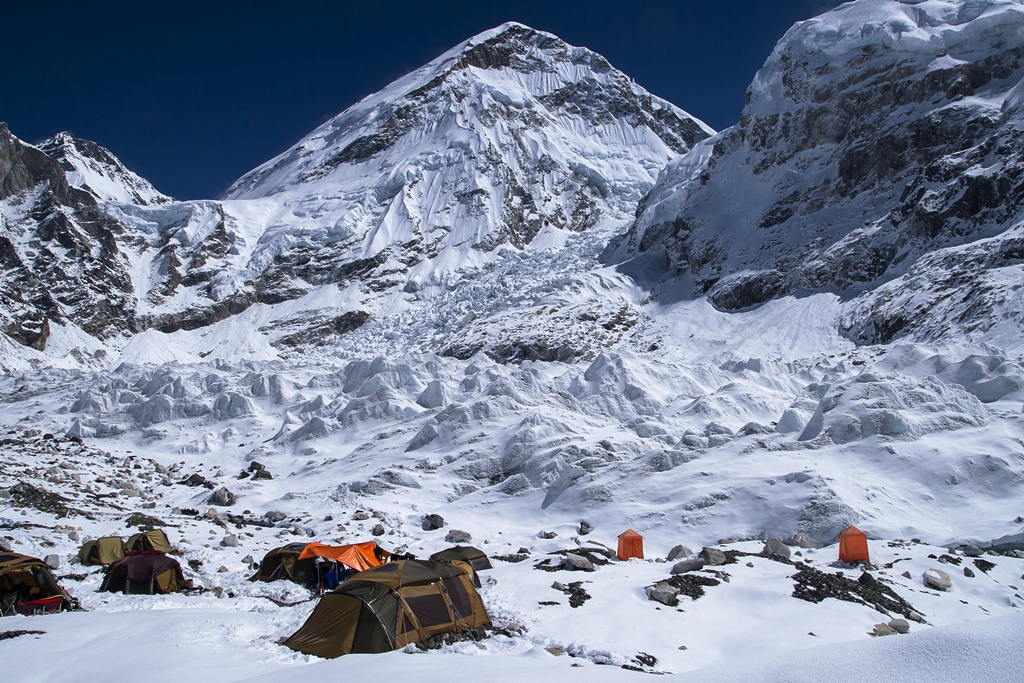
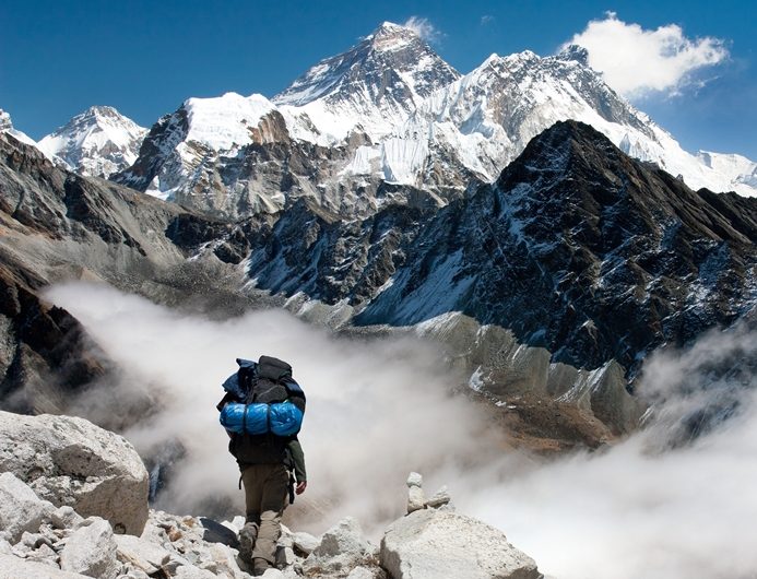
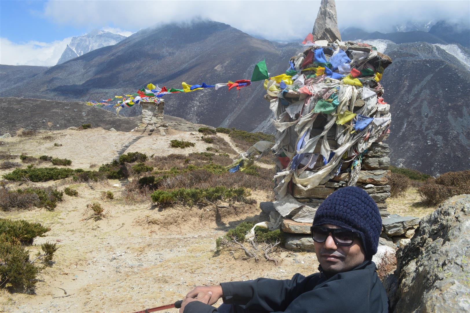
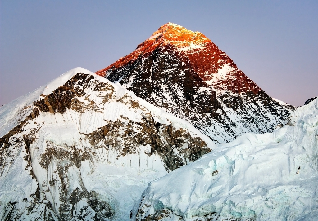
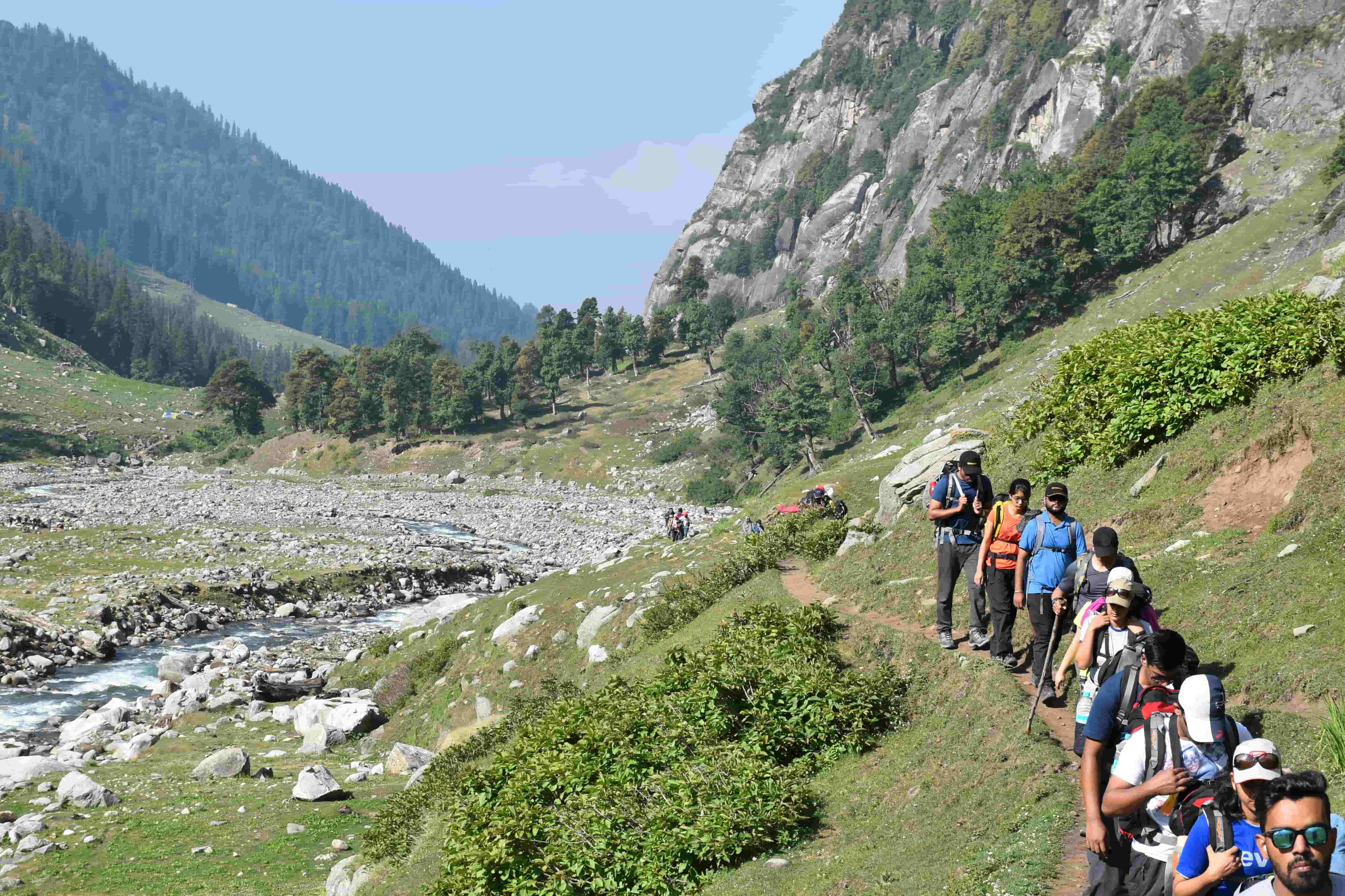
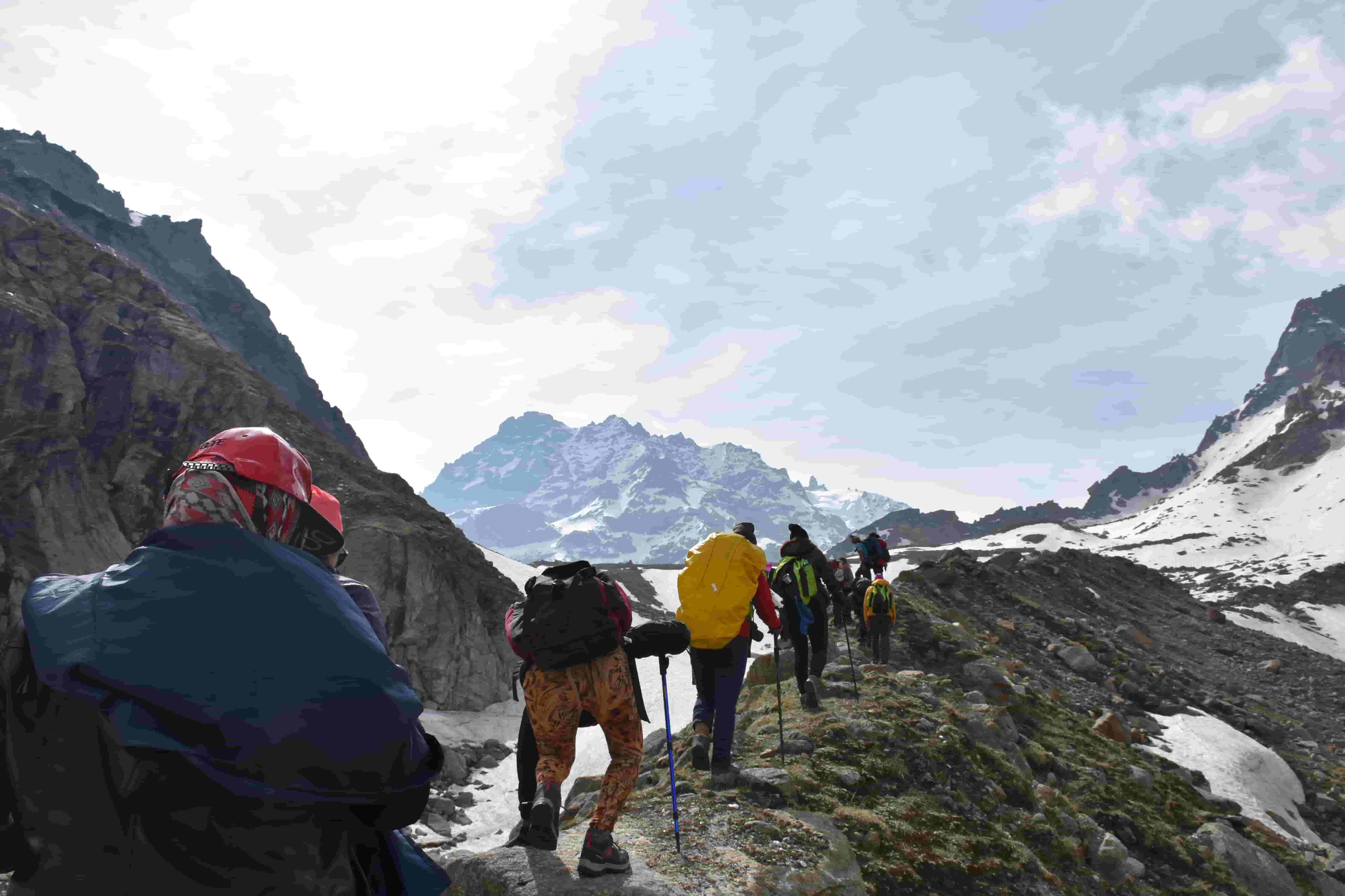
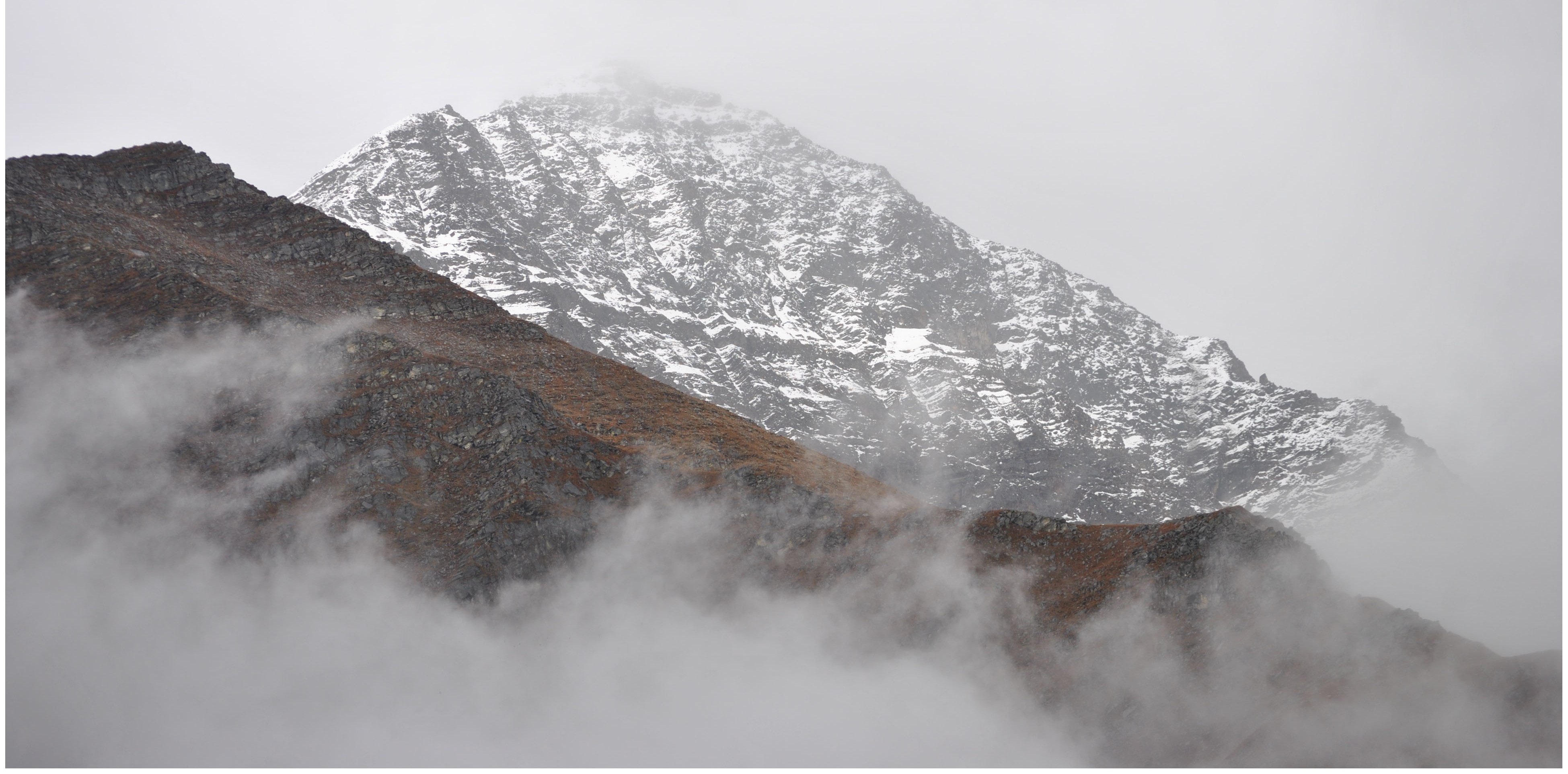
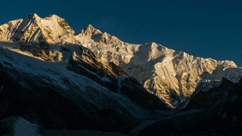
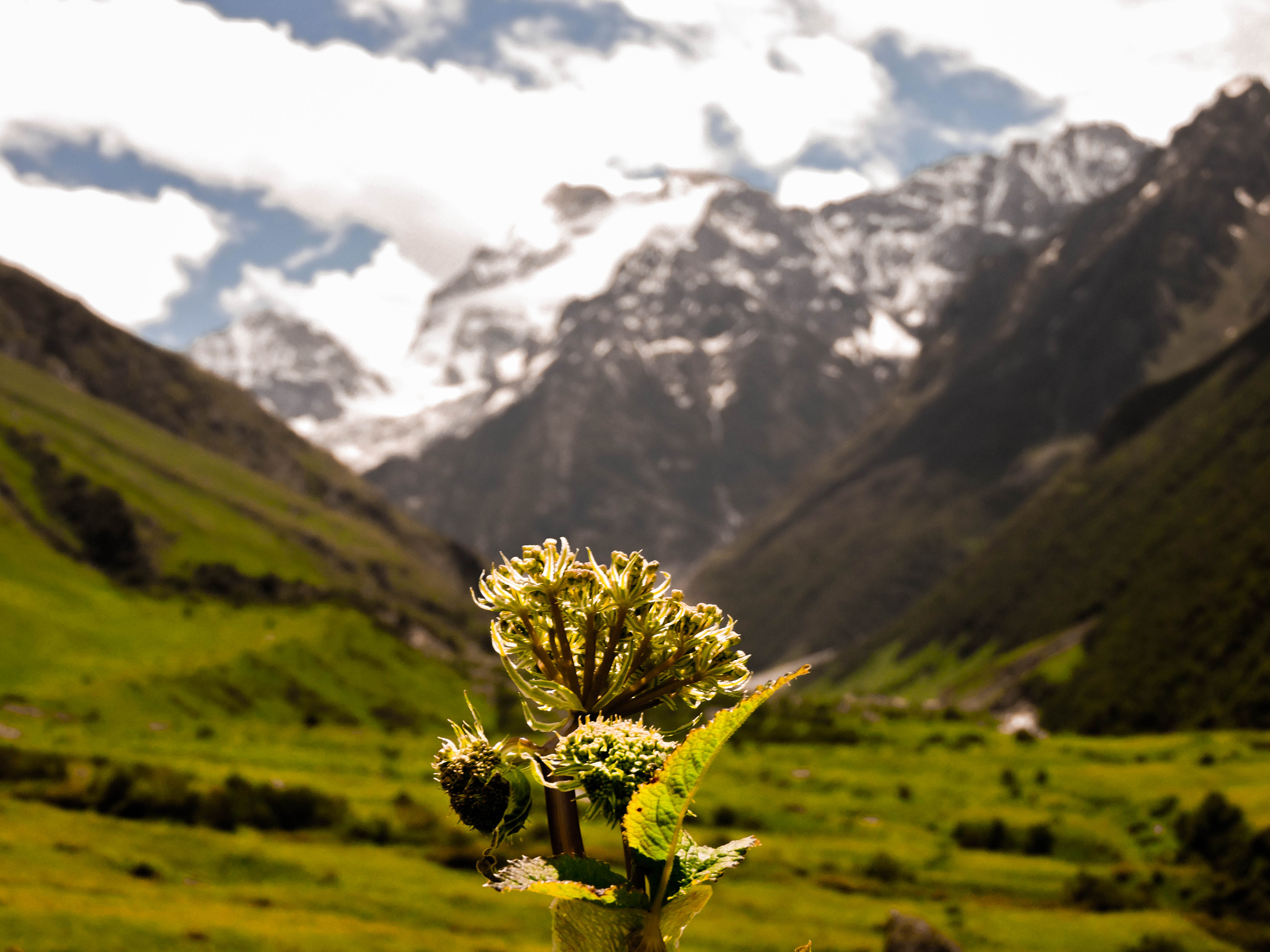
Almost all mountaineers wish to scale the mighty Everest on some lucky day of their hiking career. And why not? The feeling of touching the roof of the world, world’s highest mountain-the magnificent Mt. Everest (8,848 m), the sheer magnitude of which makes everything else feel puny and irrelevant: the feeling of having accomplished a feat like this is an ultimate life goal for trekkers worldwide. Many mountaineers prepare all their lives for it and yet a small percentage really ever makes it. Isn’t that alone so chilling to comprehend? EBC or Everest Base Camp trek is a stepping stone for many trekkers that wish to someday conquer this ginormous mountain.

everest-base-camp

For some trekkers, EBC trek alone is a huge travel goal! Rigorous training, honing patience levels, developing sustainable trekking stratagem, investing in reliable trekking gear are the many tasks on the to-do list when you are planning for an EBC trek. Add to that, the project of finding qualified trekking outfitters and trusting the uncertain weather. Discussing with professionals and booking early will take away half of those troubles and yet a few loopholes will still remain.

Must Read: 15 Tips and Tricks to Reach Everest Base Camp

Naturally, when the achievement is so humongous, the stakes are higher. Sometimes, life-threatening even. You can do best by putting some faith in your luck and winging it or you can know what to do if you face some serious problem on your EBC trek, the possibility of which remains significant. Here’s a complete guide to knowing what to do when things don’t go as planned on your EBC trek: 

mount-everest-climbing

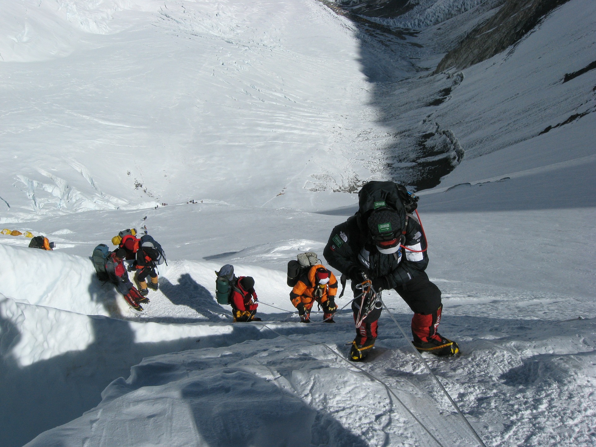
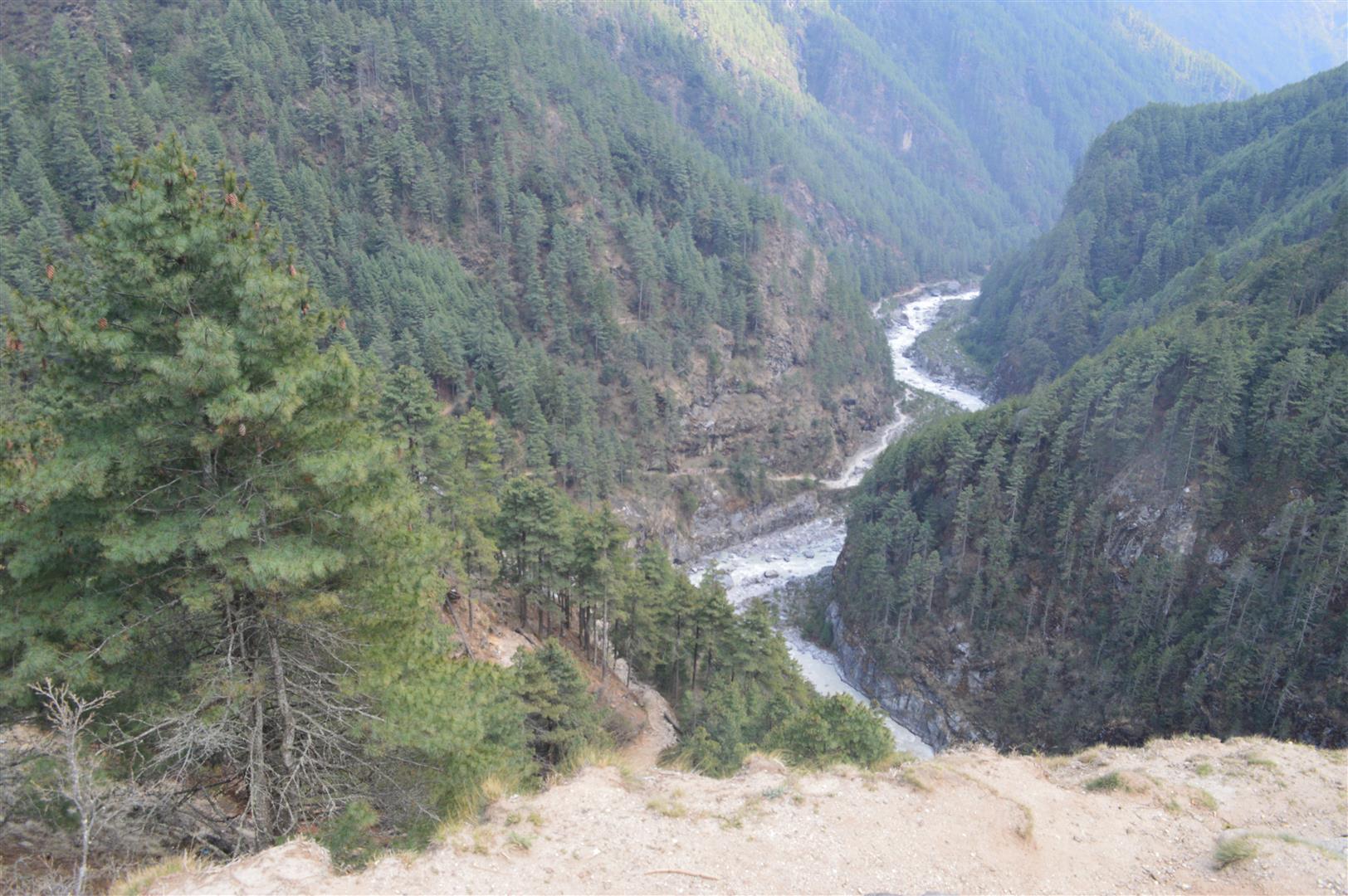
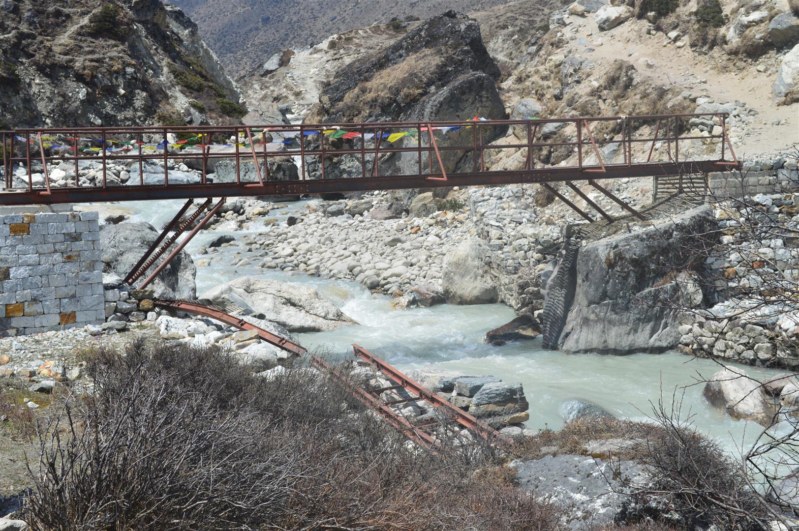
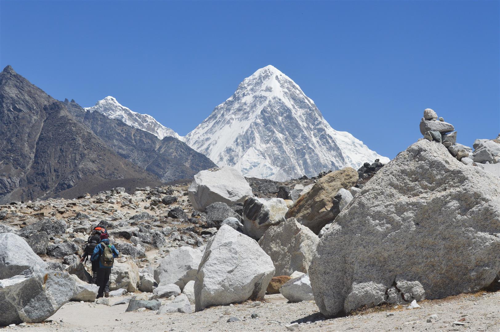
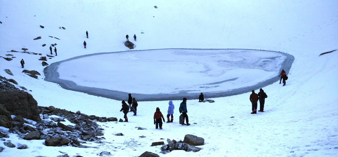
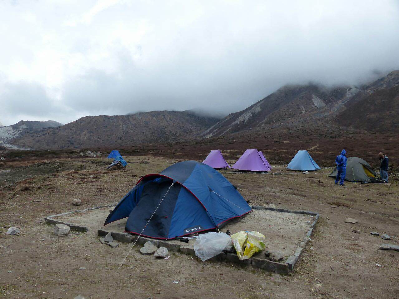
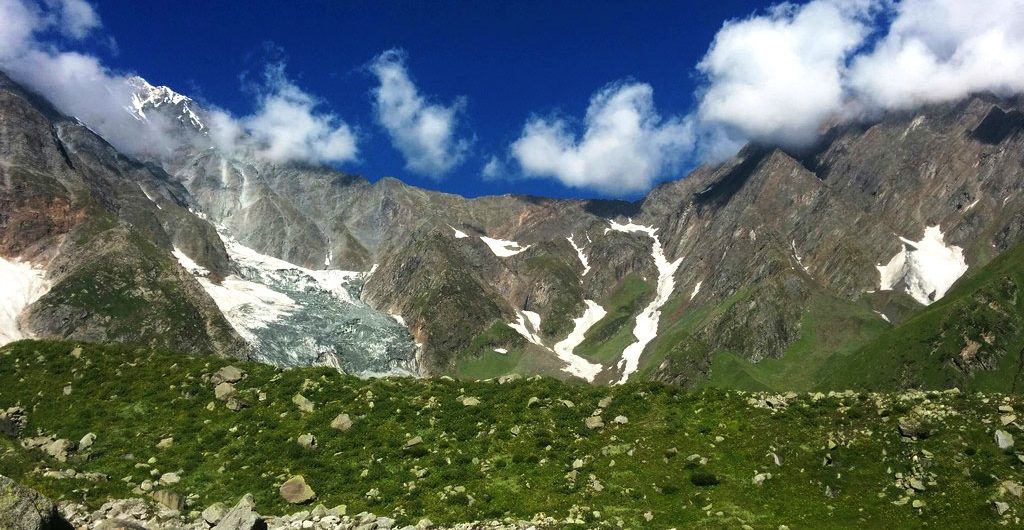
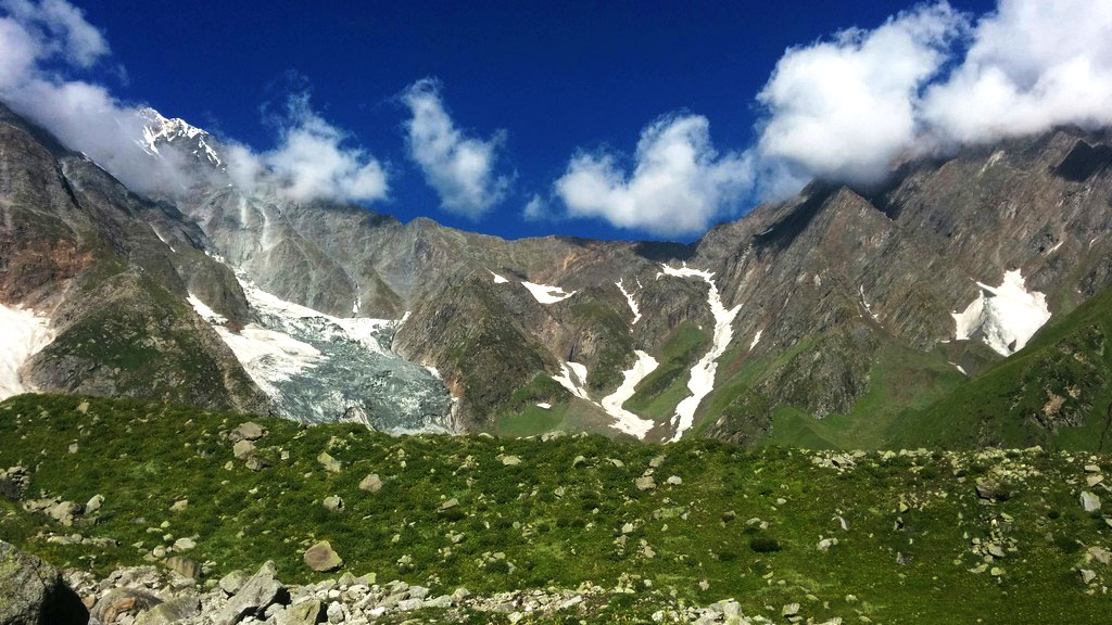
Mt. Everest is in a very remote region and at a very high altitude doubles the risk factor. However, the chances of getting medical aid get scarcer as we go up. A mishap like a simple leg injury; life-threatening high altitude sickness like AMS (Acute Motion Sickness), HAPE (High Altitude Pulmonary Edema) or HACE (High Altitude Cerebral Edema); natural disasters like earthquakes, avalanches, and rock-falls can prove fatal. At such an altitude, one has to be rescued with the help of a helicopter and escorted to the nearest medical facility. An emergency evacuation via helicopter could cost more than US$10,000!

Next, never self-diagnose!

  • The symptoms of altitude sickness can vary with each body type. One should never self-diagnose, chances are you will be wrong and will worsen your condition further. Medicine delayed is medicine denied.
  • Update your guide regularly. Believe you, they have been doing it for years and know this like the back of the hand. Trusting their advice is not only recommended, but it is also necessary.
  • Eating garlic, drinking plenty of water, and sufficient rest can reduce the symptoms but ultimately descending is the only cure.
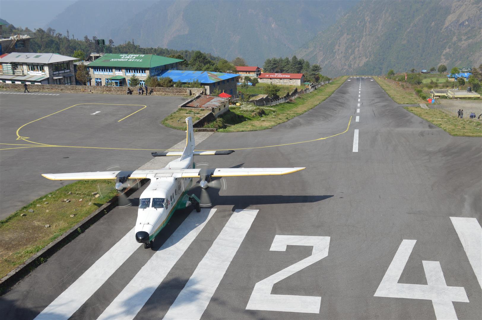
Reaching Lukla

Lukla is a small airfield with a very short landing strip. It is considered to be one of the most dangerous airfields in the world. Being a small airfield, only small aircraft like Dornier 228 having short take-off and landing capabilities, are operated. These aircraft do not have the ability to operate in bad weather and very low visibility. That means it can get cancelled or delayed for safety reasons if there is a bad weather condition. Always take a few grace days after your return to Kathmandu so that this does not affect your flight back home. In case you reach Kathmandu on time as per your schedule you can spend the free days to explore this colorful city of Kathmandu for its rich culture.

All flights to Lukla leave from Ramechhap Airport, which is about 140 KMS and 4 and half hours drive from Kathmandu, since September 2019. In a way, it is better, as Kathmandu Airport had congested air traffic causing flight delays, really not a good thing for the mountain flights which have to leave early mornings to get a good weather window.

Tenzing-Hillary Airport or Lukla Airport

Different alternate options you can choose from, in case your Lukla flights get cancelled are:

1. Wait and try again the next day
When we wait we are be given the last priority as others have already booked for the scheduled date. Therefore, when flight gets cancelled, we reschedule it for the next day. And this means that sometimes we don’t get them at the earliest. However, we try our best.

2. Pay for an expensive helicopter to get in or out
There are choppers available for this very case. But the catch is that they offer expensive rides to get into Lukla or return back to Kathmandu. This is totally not in our hand. Sometimes they offer less and sometimes the price they offer is really high. There aren’t any fixed prices for the choppers so far and is totally dependent upon the situation. Chopper to Kathmandu is an option. Another option is a chopper to Phaplu from Lukla which may cost USD 800 (per chopper). Note: A chopper can carry 6 people. Add to that, 12 hours sharing jeep drive to Kathmandu.

helicopter viewed on the way to helicopter

3. Hike to Phaplu + Drive to Kathmandu(Cheaper Alternative)
It is a 2 days hike to reach Phaplu from Lukla and then it takes 12 hours sharing jeep to Kathmandu. This is a way cheaper option for getting out to Kathmandu in the worst-case scenario. Meant for those who do not want to pay for an expensive helicopter or cannot wait for next day’s regular flights.

Must Read – Everest Region: There’s More to it than Everest!

WATER RESOURCES-Staying hydrated is essential!
There are many natural sources of water all along the trail. It is advised to carry some water purification tablets and a good reusable wide mouth water bottle. You can get bottled water all the way till EBC but it gets more and more expensive as it gets closer to the EBC. Also, bottled water is NOT a good idea as every other bottle means more and more garbage is created.

Responsible eco-tourism means one is not encouraged to leave behind anything other than their footprints. 

trekking to EBC

REMEMBER, REMEMBER

  • There aren’t any ATMs located on the EBC trail. Remember to carry cash from Kathmandu itself. Currency exchanges on the trail offer especially inflated rates so it is advised to keep enough local currency with you i.e., Nepali Rupees.
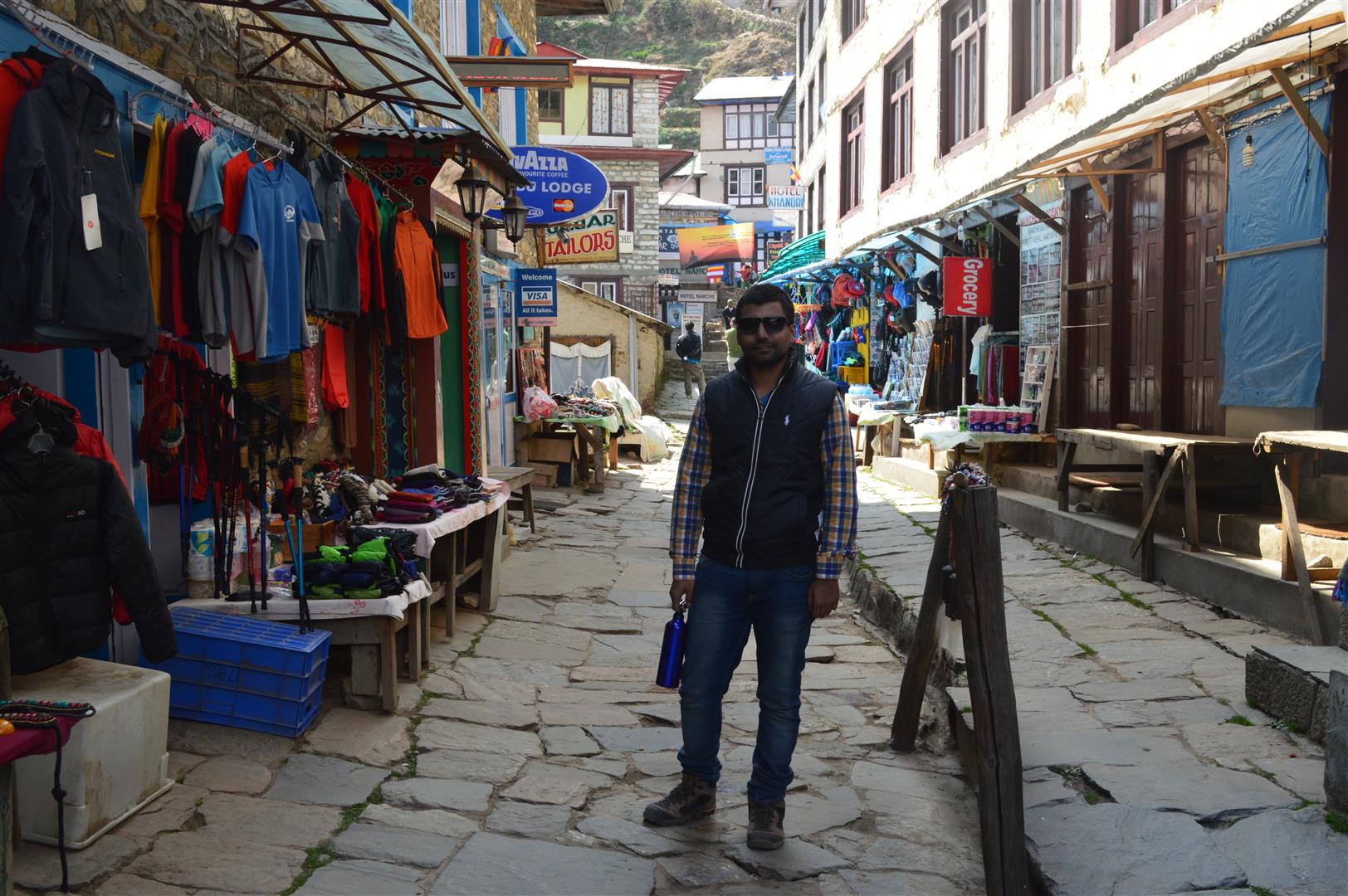
  • Do not worry about food at all. Plenty of tea houses line up the trail and typically, all kinds of nutritious or sugary food is available all the way right to the top. Dal-Bhat(dal and rice), chowmein and spaghetti are easy finds.
  • You will get sufficient data if you are in possession of a local sim. Most lodges will offer Everest Link and you can buy a Wi-Fi data pack to go with it. The wi-fi is slow, generally. You are likely to remain unavailable to your friends and family.
  • Even though helicopters are constantly hurrying up and down this vast network of mountains, it is extremely costly to be used for supplying materials. This is exactly why you will find everything priced pretty heavily, the further up you trek.

Must Read – Why ‘One Is Not Enough’ For Mount Everest Base Camp: A Detailed Account of the EBC Trek

INSURANCE is a must in a trek like Everest Base Camp. Any insurance you go for should at least cover the following:

  1. Altitude cap should be at least 5,700 m
  2. Emergency evacuation by air in case of an accident, illness or natural disaster.
  3. Trip cancellation and delays
  4. Flight cancellations and delays including the internal flights to Lukla
  5. Baggage Loss
  6. All the countries you intend to visit during the trip
  7. All the adventure activity one intends to do during the course of the trip

Perched at an altitude of 3,500 m, Kheerganga is nestled deep in Parvati Valley in Himachal Pradesh.  It is believed that Lord Shiva’s son Kartikeya meditated here for thousands of years. On the Kasol to Kheerganga trek, you can experience a rare combination as you will take a bath in the hot spring while the surroundings are chilled and covered by snow.

Moreover, stunning views of mountains, waterfalls, mountain animals, and oak and deodar trees are a much-needed feast for the trekker’s eyes. The trail unveils a few of the most fascinating destinations such as Rudra Nag Waterfall and Shiv Temple.

A Serene Visit to Kheerganga
Trekking to the magical Parvati Valley still seems like a dream. It was a place which I wished would remain a secret as I couldn’t stop myself imagining about those majestic valleys, mountain goats, green lush mountains and peaceful oak forests.   

webp-net-compress-image-9

My journey to Kheerganga began when I boarded a taxi from Delhi’s Paharganj to Kasol with my younger sister. After 12 hours of tiresome journey and covering 550 km, we finally reached Kasol. Kasol is one of the most beloved destinations among youth though, we preferred to move to Tosh, the nearby village.

In Tosh
In Tosh

We had Aaloo parathas at Sasi Restaurant and then we kept moving ahead. The trail had no roads and we walked through green land and reached the beautiful village of Tosh. 

On the first day, we wanted to take rest as much as possible. In the evening we visited local bazaars, enjoyed local delicacies and coffee in a nearby Amsterdam’s coffee shop. We played badminton with the local girls, gave them chocolates and clicked several pictures with them. At Tosh, villagers sit together after a long day of work and smoke chillums.

kasol_to_kheerganga__cpozp

Next day, the thrill of Kheerganga trek began from Barshaini, which is enveloped by lush green trees. Also, it is a confluence point of Rivers Parvati and Tosh. We reached the base camp at 10 am. We had delicious breakfast at Prem Cafe. From there, we walked through the splendid landscape and enjoyed magnificent sights of nature. While trekking, we passed a few wooden bridges, waterfalls and hamlets.

Camping on the trek from Kasol to Kheerganga

We both captured some amazing pictures in our DSLR. After two hours of moderate trek, we arrived at Rudra Nag and stopped there for a while to admire the beauty of nature. This dazzling serpent-shaped waterfall is considered as one of the main tourist attractions in the Parvati Valley. Here we met a local who told us that there are other villages as well, like, Kalga, Pulga and Tulga. He said that thousands of years ago, there was a very powerful demon, Tadkasura, who defeated Devas. The Devas  then visited Brahma, who told them to worship Mahadevi. It was Mahadevi who told them-‘I would soon reincarnate and get married to Lord Shiva, and the offspring would defeat the demon’.

Later, we kept climbing for 3 hours. We followed the marks imprinted on trees; the trail was quite an arduous climb. My sister asked me the same question for at least five times, “How far do we need to climb in one day?” Surprisingly, before she asked the same thing for one more time, we suddenly came across a sign saying “Welcome to Kheerganga”.

The green meadow of Kheerganga was right in front of us. There was nothing to wait for, we kept our bags in the tents and took a refreshing dip in the hot springs. It simply washed away the weariness of the trip. This pool was divided into sections one for men and the other for women.

Later, we visited Kartikeya Cave and offered prayers to Lord Kartikeya. Amazing weather, sights of mighty peaks, green forests, friendly locals and the therapeutic water of the hot springs made our journey worth. We spent a night at our campsite at Kheerganga.

Next morning, we woke up to a wonderful view of the sunrise. After taking a bath in the divine hot water pool again, we descended towards Kasol through the same route that we followed to reach Kheerganga. For me, it was mystery-packed trek which involved lots of excitement and thrill.

img_0840

Best Time to Visit
One can visit Kheerganga from Kasol from March to June or October to November. This place experiences soothing climate throughout the year. The weather remains pleasant and in summers, the temperature varies from 15 – 22 degrees Celsius while in winters, it varies from 3 to 10 degrees Celsius.

Must Carry Essentials

  • Sunglasses and Sunscreen
  • Trekking shoes and trekking pole
  • Camera and torch
  • Mosquito repellent
  • Warm clothes and rain coat
  • First aid kit

In the backdrop of the mystery hidden in the majestic Parvati Valley in Himachal Pradesh, it would be really exciting to unravel these untold tales on your own. Moreover, the beautiful views of the meadows and dense oak forests make Kasol-Kheerganga trek a must-do for every avid trekker. 

Everest is one of the most popular destinations in Nepal which is known for its majestic mountains and magnificent hills and peak. A trek to Everest Base Camp is a journey where dreams and expectations of an adventure lover turn into reality. Every step of the journey takes you to the most breathtaking mountain region and it also gives you an opportunity to get acquainted with the unique Himalayan culture and mountain climbers known as Sherpas. Moreover, while trekking to an altitude of 18,513 ft., you will be challenged by tricky slopes and curves, rough terrains and slippery path.

everest-base-camp-trek_1439798387

My Meeting with Himalayas: A Journey That Changed Me Forever
There would hardly be anyone who doesn’t admire the stunning beauty of the mountains. The Himalayas have always intrigued me and I had never dreamt that it would ever be so accessible! While watching a video on YouTube, I learnt about the Everest Base Camp trek, and I was so fascinated by it that I decided to look more into it. After contacting a travel agent and planning a thorough itinerary of the trek, I began my prep in the rundown for this expedition and started working on my fitness level and physique.

Three weeks passed, and now it was time to board a flight to Kathmandu. I was welcomed by my guide at the airport and later we both headed towards our hotel. On Day 1, the guide held a pre-trek meeting where we were briefed about the trek and introduced to our fellow trekkers. Later, we visited world’s three UNESCO heritage sites i.e Bhaktapur Durbar Square, Boudhanath Stupa and Pashupatinath Temple.

Tenzing-Hillary Airport or Lukla Airport

Next day, we had an early morning flight from Kathmandu Airport to Tensing Hillary Airport at Lukla which is said to be the gateway to Everest. The landing at Lukla alone gave me an adrenaline rush as it is called the world’s most dangerous airport. Our porters were already waiting for us there. After breakfast and a brief stay in the tents, we descended towards Dudh Koshi River.

Dudh Kosi River
Dudh Kosi River

Our eyes were stunned by the beauty of the river. We clicked several pictures there and then moved towards Phakding. That day, the walking was quite easy and it took almost three hours to reach Phakding where the guide had arranged a night stay for us. We slept early that day as we were told that next day trek would be quite challenging.

dsc_2619

Our trek started at 8 am and we continued to walk along the bank of Dudh Koshi River. Crossing several suspension bridges, we entered Sagarmatha National Park which is a home to rare species like the snow leopard, musk deer and red panda. We met several Sherpas here and they shared their inspiring mountain climbing experiences with us.

everest From there, the trail climbs up steeply until we reached Namche Bazaar which is the largest village in the region. We were amazed to see quality restaurants, shops, hotels, bakeries and internet cafes at such height. Also, there were two banks and one ATM.

Namche Bazaar from the top

On Day 5, our guide told us that there were two acclimatization stops and after 5 hours of trekking, we reached Hotel Everest View, which is one of the highest perched hotels in the world. While sipping a coffee and gobbling a cup of Maggie, we enjoyed a beautiful sight of Himalayan ranges. On the way, we also visited Sherpa Museum where we saw photographs of mountain expedition of the greatest climbers i.e. Edmund Hillary and Tenzing Norgay. The trail to the hotel offered spectacular panoramic views and luckily the weather was clear that day so we got a chance to see a magnificent view of Mount Everest and Ama Dablam. Another morning, the trek continued along the glacial river of Dudh Koshi. After 4 hours of trek, we reached Tengboche and visited local monasteries. It is believed that Tenzing Norgay spotted this monastery from the summit of Everest. The trail continued for one more hour until we reached Mong La, where we had lunch.

dsc_2699

Next morning, we walked through dense rhododendron forests and steep slopes. From the forests, we reached meadows and small grasslands. From there, we saw Cho Oyu, which is said to be the world’s sixth highest mountain. The trail took us to Inja Khola and then climbed up to Pangboche where we had our lunch. We captured mesmerizing views of Mount Ama Dablam and after 2 hours of trek we reached Pheriche and proceeded to the Imja Valley. Here, we passed through River Lobuche and went on a steep hike to Dingboche for overnight stay.

everest

Day 7 was an acclimatization day. As we didn’t want to lose this opportunity, we walked to a Nankan Sa Peak situated at 4,900 m. From here we got to see the world’s top three mountain peaks – Mount Cho, Mount Lhotse and Mount Makalu.

everest

Next day, we went from Dingboche to Dughla, the trail offered some of the best views so far as we enjoyed the sight of magnificent mount Pumori (7,138 m) and a glacial lake.

On Day 9, we climbed to Lobuche which is positioned next to the Khumbu glacier. We crossed Dughla Pass/ Thukla Pass.

Day 10 was the moderate trek of around 6 hours. It was an absolute glacier course which took us to Gorakshep (5,170 m) and it eventually proceeded to the Everest Base Camp (5,364 m). This part of hiking made me feel like I’m stepping towards heaven amidst the glaciers. It was the most important and difficult day of the whole trip. We continued walking on the side of Kumbhu glacier; it took 3 hours to reach the base camp where we saw colorful tents of mountaineers who were attempting to climb the gigantic Mt. Everest. We stayed here for a brief period and celebrated our accomplishment like winners. We clicked as many pictures as we could. Two hours later we found ourselves in the lodge at Gorakshep where we spent the night.

Mt. Everest in all its glory

Next morning, with the support of the headlight, we hiked to Kala Patthar at around 4 am where we saw the most magnificent view of Mt. Everest. After breakfast, we descended to Loubouche for lunch and finally Pheriche which was an end to the wide Himalayan valley. Next day, we climbed down to Namche Bazaar and there we bought souvenirs. On day 13, we hiked to Lukla and on day 14, we proceeded to Kathmandu.

Take a Note!
Maximum Height: 18,513 ft
Difficulty Level: Strenuous
Nearest Airport: Kathmandu, Nepal
ATM: Namche Bazaar has two banks and one ATM point
Trek Time: 14 Days

Best Months to Visit
Except for January, July and August, all other months are suitable for the trek.

Trek Itinerary
Kathmandu – Lukla – Namche Bazar – Tengboche – Lobuche – Gorak Shep – Everest Base Camp – Kala Patthar – Namche Bazaar – Lukla – Kathmandu

What level of fitness is required?
A trekker has to hike at altitudes higher than 12,000 ft and that too for 6-7 hours daily. Also, due to lack of oxygen,  breathing issues are a problem. Thus, both mental and physical fitness are required for this trek.

Believe me, a meeting with the jewels hidden in the snow-capped mountains of Everest gave me an array of experiences and memories that one should definitely experience at least once in a lifetime.

Hampta is a dream come true for trekking enthusiasts who are constantly on the look out for an unforgettable experience in the scenic valleys of Kullu and Lahaul in Himachal Pradesh. Why, you ask? Hampta Pass Trek is literally a paradise filled with eye-catching views and ever modifying scenery that captivates travelers in a lasting trance. Every turn of the trail is an immensely rewarding experience as it reveals nature’s hidden treasures. The rare sights of alpine forests, glaciers, and Himalayan flora and fauna make this expedition truly spellbinding.

Hampta Pass Trek – A Newbie’s Pleasure chi_4114
It’s a moderate trek that goes to magnificent foothills of the Pir Panjal Range and the great Himalayas. As you gain altitude, the trail offers different shades of nature, from green pine forests to the awe inspiring view of Indrasan and Deo Tibba mountains.

A Quick Overview of Elevation Points
The adventure began from Manali, situated at 2,050 meters. This is the point from where you will head towards Jobri by road, taking you to Chika at 3,100 meters. You will trek from here to your base camp – Balu Ka Ghera Hampta Pass at 3,600 meters. Also known as the ‘Heaps of Sand’, it is said that brown bears hibernate at Balu ka Ghera in the winters. The place offers the breath-taking sight of the magnificent Dauladhar Ranges.

Trekking will continue to an elevation of 4,000 metres at Shia Ghoru. The next stop will be Chatru and later you will arrive at the crystal clear Chandratal Lake at 4,270 metres. Moreover, steadily flowing streams, the long wavy bridges and a range of vibrant flowers offer great delight and peace.

chi_4251

Measuring the Trek
Region: Himachal
Duration: 6 Days
Grade: Easy to moderate
Max Altitude: 14,100 ft.
Trekking Distance: 26 Km

The Friendly Locals: Living in the beautiful Himalayan region of Himachal Pradesh, the locals are quite reserved about their traditions and living customs. The socio-cultural lifestyle of farmers and artisans is reflected in their conventional heritage. They are ardent lovers of nature and its creation. Uniquely designed handicrafts and paintings can be discovered in the markets. People share a great bond of togetherness and brotherhood. They will surely help you whenever you ask them about the route and even if you’re lucky enough, some may offer you scrumptious traditional delicacies at a reasonable price or free of cost.

A Way to trek
Hampta Pass trek originates from the places like Manali, Naggar and Dharamshala. Manali is accessible by rail, road and air and well connected to cities like New Delhi and Chandigarh. The nearest airport is Bhuntar Airport, which is located 52 km from Manali.

Joginder Nagar Railway Station is situated at the distance of 166 km from Manali. Volvos and taxis are considered to be more convenient to reach the scenic destination.

An Amazing Experience of 14, 100 ft.
Actually, the story started on a boring Sunday when on the spur of the moment I decided to gift a solo trip to myself. While doing my research, I came to know about an exciting trek to Hampta Pass. I flew from Mumbai to Delhi and then boarded a Volvo AC bus to Manali. As it was going to be my first solo journey, I was very cynical about taking a long bus ride without any familiar faces. Surprisingly, the solo trip ended right in the bus, as a Korean woman sitting next to me was going for the Hampta Pass trek. This is the fun part of solo trips that you move all alone but come back home making several friends. While sharing some wonderful travel stories, Alena told me that it was the 4th time she had visited India.

After reaching Manali, we both rushed to Rambaug Circle on Manali Mall Road where we met our other group members and guide. We stayed at our booked hotel that day.

Capture
Get, set, ready to capture the most scenic of views on this breathtaking trail

The next day we were headed towards the base camp – Manali to Chika via Jobra. We drove to a certain point and from there we started trekking. When we began, it started raining. Thankfully, we were carrying umbrellas. We climbed through the forest and lush green meadows. As it was just the first day of hiking, I was literally gasping for breath. At that point, I felt like I should have better trained myself for a month before saying yes to the adventure. However, the enchanting sight of a wide range of deodar and oak trees on the way can make you feel refreshed. The slope seemed to be very easy for my Korean friend who was constantly smiling as she was amazed to see such a pristine beauty of nature!

chika
After a span of 3 hours, we reached Chika which was the perfect site to relax amidst the serene surroundings.

In the evening, our trek leader briefed us about the program and handed out a route map. In the evening, I captured some beautiful views in my DSLR camera which was recently gifted by my father. Later, we enjoyed dinner at the camp.

sun

We woke to a stunning view of sunrise and after having Chai and Parathas, we were all set to go on a long trek. Though the trek was very challenging, the sights of the valley, rivers and meadows made it all easier. You know what? I did pretty well on the steep trail which was covered with snow. We reached Balu Ka Ghera. The camp was organised at an elevation of 11,900 ft with a stream on one side and river flowing on the other.

Balu ka Ghera
Balu ka Ghera, the most beautiful campsite ever!

Day 3 was the final day! The most challenging yet the most exciting one, we were going to conquer Hampta today! Many of us were excited and nervous. We wore our snow spike shoes, took out our trekking pole and hiked towards the destined end. I was playing safe as I was mostly trekking in the middle troupe. The green valley made our way to the icy mountains and glaciers.

Yoga at Shia Goru
Yoga at Shia Goru

We finally reached Hampta. It was very foggy there so we were supposed to move forward as early as possible. We stayed there for 20 minutes and descended to Shea Goru. It was a slippery route and many group members rolled down when they fell on the ground. And then we couldn’t control our laughter. We created a warm corner of memories by clicking a plethora of pictures that I couldn’t even count. When we reached the spot, we saw that our guides had arranged a bonfire night at our camp. So, we sang and danced together that night!

On day 5, we moved towards Chatru and this was the place that gave us an opportunity to capture the most stunning views we only ever dreamt of. The valleys of Lahaul-Spiti and Pir Panjal Ranges added a charm to the beauty of the place. Notably, Chatru is the base point for three locations namely Spiti Valley, Hampta Pass and Rohtang Pass. We spent the night at Chatru.

The glorious Chandratal lake

Next morning, we had to say goodbyes to some really nice people that we met on the trek. After taking selfies and exchanging some warm hugs, I boarded a cab that took me to magnificent Chandratal Lake, which is said to be a jewel of the mountains. It is believed that the lake was the home to one of Pandavas – Yudhisthira, the eldest son of Kunti. After witnessing the purest form of nature, I hit the road back to Manali.

Facts|Figures

Know About Mobile Connectivity and ATM Facility
You should withdraw money from ATM at Manali or Prini. No ATM service is available after Prini. So, if there are chances of falling short of money, it’s better to take some from here.

Mobile connectivity is quite good till Prini but beyond that, you don’t get such facility. You should make sure that all your important calls are made.

Take Note on Temperature and Trekking Time
The best time to go for Hampta Pass is from June to August and September to October. The harsh climatic conditions vary at high altitudes, thus, it is important to choose the right time to get acclimatized. There are chances that you witness heavy snowfall and rain during the monsoon season.
June to August: The temperature ranges from 20 °C to 15 °C during the day time and 7 °C to -2 °C at night.
September to October: The temperature ranges from 15 °C to 10 °C during the day time and 5 °C to -5 °C at night. During this period, trekkers can enjoy the clear views of snow-capped mountains.

Things to Carry

  • Sweaters, warm jackets, caps and gloves
  • Trekking shoes, 6-7 pair of socks
  • Trekking pole, power bank
  • Sunscreen lotion
  • Water bottles, backpack, energy bars and drinks
  • A pair of sunglasses, camera
  • Basic toiletries, bed sheets
  • Flash light (with spare batteries)
  • Insect repellent, emergency medical kit
  • First-aid kit, binoculars, sleeping bag

Got some time? Check out these nearby attractions!

  • Siyali Mahadev Temple
  • Gadhan Thekchhokling Gompa Monastery
  • Museum of Himachal Culture & Folk Art
  • Rahala Waterfall and Jogini waterfall
  • Beas Kund
  • Tripura Sundari Temple
  • Solang Valley
  • Rohtang Pass

Don’t Forget to Carry Your Documents
You are required to carry your ID cards and photocopies of your driving license or voter ID or passport (along with visa for non-Indian travelers). Passport size photo is a must. When it comes to your fitness for the trek, you may need to show a medical certificate signed from your doctor.

hampta pass

Hampta Pass has been the best experience of my life so far! It came as a confidence booster to me as it had cleared all my hesitation for a solo trip. The natural landscape, amazing trek group and friendly locals gave me a bundle of beautiful memories that will remain entrenched in my heart forever.

Interested in knowing more about trekking in Himachal Pradesh? Read some of our other blogs!

Triund Trekhttp://www.adventurenation.com/blog/triund-trek-unraveling-himachal-pradeshs-treasure-trove/

Kasol-Kheerganga Trekhttp://www.adventurenation.com/blog/kheerganga-where-the-mountains-meet-the-moon-kasol-to-kheerganga-trek/

Sar Pass Trekhttp://www.adventurenation.com/blog/sar-pass-trek-a-little-heaven-in-parvati-valley/

Magical! Yes, it’s the one word that comes to mind whenever I think about the Roopkund trek. The fact that it has consistently been one of the most booked trekking destinations in North India owes to the snow-capped mountains, lush green forests, picturesque views and tricky routes. It challenges and thrills, puts your trekking potential to test and rewards you greatly, equally so. 

So, if you want to breathe amidst the striking icy glaciers of Nanda Ghunti and Mount Trishul, this is an ideal place to be!

Beautiful Views

Situated in the lapse of Chamoli District of Uttarakhand, Roopkund trek paves the way to Roopkund Lake which lies serenely at an altitude of 5,029 m. The biggest highlight for the trek though has to be the ‘Skeleton Lake,’ Roopkund Lake that supposedly consists of over 500 human skeletons. Spooky, right? [Legend: It is said that an ancient army who came on an unscheduled pilgrimage had faced the wrath of the Weather God as they travelled without his permission.]

The mythological mystery around Roopkund Trek; Nanda Devi Raj Jat Yatra
The ‘Nanda Devi Raj Jat Yatra’ is among the biggest religious yatras in the ‘Land of Gods’, Uttakhand.  The hill folks of Uttarakhand organize the yatra in every 12 years to honor Goddess Nanda Devi. It is said that people take her to Lord Shiva’s home which is located in the icy folds of the Himalayas. The three-week-long grand procession begins from Nauti village near Karanpraayg and ends at Homkund near Roopkund. Despite the harsh climatic conditions, the devotees remain barefoot throughout the yatra.

Where does it all begin?
Wan is the base camp of the trek and it is accessible from Kathgodam (210km) or Rishikesh (270 km). A trekker can take a bus from any of these two places. The bus will likely drop you at Deval which is 27 km away from Wan.

When should I start packing?
There are two phases during which a visit can be made safely:
May to June: The temperature ranges from 15 °C to 20 °C during the day time and 7 °C to -2 °C at night.
September to October: The temperature ranges from 10 °C to 15 °C during the day time and 5 °C to -5 °C at night. At this time, you can enjoy the clear view of snow-clad mountains.

Nearby Attractions
The Roopkund trekking experience is not meant for beginners. So, if you don’t qualify for the same or are simply not in the mood to explore the mystique of Roopkund, following are the places you can check out instead:
Brahma Tal and Bekhal Tal: These are two most stunning lakes situated near Hemkund.

Bedni Bugyals: One can witness the raw beauty of nature at Bedni Bugyal – a green pastures. It is also a stopover on the Yatra of Nanda Raj Jaat.

Hemkund Sahib and Hemkund Lake: It is the holiest place for Sikhs and Hindus. The glaciers from the peak of Hathi and Saptrishi feed the Hemkund Lake.

Facts and numbers for Roopkund trek
Duration: 7 days
Max Altitude: 15,696 ft
Trekking Distance: 53 Km
Grade: Moderate to difficult

Here is a shorter version of the itinerary…
Day 1: Driving from Kathgodam to Lohajung (2130m)
Day 2: Lohajung to Didana (2550m)
Day 3Didana to Bedni Bugyal (3350m)
Day 4: Bedni Bugyal to Bhagubasa (4100m)
Day 5: Bhagubasa to Roopkund and Junargalli(4750m) to Patal Nauchaniya (3850m)
Day 6: Patal Nauchaniya to Bedni Bugyal (3350m) to Wan (2550m) – Lohajung
Day 7:  Lohajung – Kathgodam

Roopkund Trek: A high dose of adventure filled with natural splendor all along 
To escape from the mundane city life, I decided to go on a trek to experience the serene beauty. The expedition was an opportunity to discover a wide variety of flora and fauna and the giant mountains that I had only ever previously dreamt of.

Kathgodam
Lohagunj– a fantastic starting point for your Roopkund trek

The journey began one morning with one of my closest friends from Delhi. We hired a cab that dropped us to Kathgodam – a town in the Uttarakhand’s Nainital district. From there, we both moved to Lohajung which was the base point of our trek. Even after a tiring journey, the excitement didn’t let us sleep on the bus. Travelling through a scenic route, we arrived at the destined place after 7 hours. The purest form of nature, Lohajung is replete with rich biodiversity. The beautiful surroundings of evergreen alpine forests were so captivating that we thought to not move further!

Next day, we walked through a pictorial forest lined with Himalayan cedar and oak trees. Crossing an old bridge over the River Neel Ganga, we reached Ruan Bagad after 2 hours of easy trek. Our guide told us that people also take a road route from here that goes to Wan Village. Despite the uneven terrain, the hike from Ruan Bagad to Didna village took just around 2 hours. The night was spent in a camp.

Meadows on the way to Roopkund
Green meadows that stretch as far as eyes go fill your initial trek

On day 3, the trail moved ahead to the village of Ali Bugyal which is one of the highest inhabited locations in India. Since I’m not a regular trekker, I opted for the easier route and it took almost 6 hours to reach the Ali Bugyal. To keep the pace with other trekkers and to reach on time, we were advised to consume dry fruits and energy bars. It really gave us energy throughout the expedition.  

Day 4 of Roppkund trek

Thankfully, we reached bang on time! We arrived at Ali Bugyal by noon where we enjoyed magnificent views of Nanda Ghunti and Trishul peaks. And it was right there that I couldn’t control my emotions and took around 170 pictures in just 15 minutes. Fun times! Later, we moved towards Bedni Bugyal – a campsite for our overnight stay.

Next morning, we woke up to the beautiful views of the sunrise. Our guide briefed us about the program and then, we all were ready to move towards Bhagubasa. A trail first entered to the coniferous forest that took us to an area of high altitude. After crossing a zigzag path, we reached the temple of Lord Ganesha ‘Kalu Vinayak’ which is constructed with irregular pebbles and bricks. We stayed there for about 20 minutes and we prayed for 5 minutes. After receiving much needed blessings from the Lord, we hiked further.

After 1 hour we reached a spot where we got an opportunity to capture the astonishing views of Chaukhamba, Neelkanth and Hathi peaks in our cameras. Though the distance was short, the slippery path made it a bit challenging for us. We reached our beautiful campsite at the hilltop of Bhagubasa after 1 hour.

Skeletal Lake; visit at a time when its not completely frozen to spot the skeletal remains buried in the ground

It was day 5, our guide had set a goal for us and according to that, we were supposed to reach the lake in about 2-3 hours. The mysterious Roopkund Lake gave me an adrenaline rush. Our guide was carefully watching our steps around the lake as we were walking around the tricky terrain. It was quite a moment, as we viewed the human skeletons and bones. We all were so happy that there were tears of joy in our eyes. After hugging each other, some of our group mates moved towards Junargali ridge. However, I spend time in capturing gorgeous views of the mountains. After staying up there for an hour, we later headed back to Patal Nauchaniya. It was a long walk down and we stopped at two spots for rest along the way. After reaching the camp, we realized that it was time to celebrate our victory! We organized a bonfire, played cards and finally, clicked a lot of group photos.

Day 6,7 : The way back to Kathgodam
We woke up at 5 am and after grabbing toasts from the camp we tramped down to the forest of pine, rhododendron and oak to reach Wan village. We had a scrumptious lunch at a Garhwali restaurant which served us traditionally style Thali filled with local food. We went back to Lohagunj and spent the night in tents at the campsite. After saying goodbye to each other, we moved to Kathgodam.

Mobile connectivity and ATM facility
One can find ATM machines in two places i.e. Kathgodam and Dewal. Notably, there is no ATM after crossing Dewal as the trek begins from here.
Most of the mobile networks work at Lohajung. There is hardly any connectivity in the mountains which means all important calls should be made at Lohajung.

Things to carry

  • Trekking pole, trekking shoes, 6-7 pair of socks, power bank
  • Sweaters, warm jackets, caps and gloves
  • Sunscreen lotion
  • Water bottles, backpack, energy bars and drinks
  • A pair of sunglasses, camera
  • Basic toiletries, bed sheets
  • Flash light (with spare batteries) and Swiss knife
  • Insect repellent, emergency medical kit
  • First-aid kit, binoculars, sleeping bag

And with that, the dreamy journey of 7 days came to an end. What I brought back with me was a box full of beautiful memories.

The Divine beauty of Sikkim – Goecha La (16207.35 ft)

Situated in the Himalayan range of North-East Mountains, Goecha La is a tiny yet unforgettable place for thousands of adventure lovers across the world. Perched amidst striking hills and multi-colored flora and fauna, Goecha La trek takes you toward the astonishing beauty called Kanchenjunga National Park. It is not just the third-highest mountain in the world, Kanchenjunga, that makes the Goecha La trek such a great pleasure but also the other big summits that can be clearly seen from here around the year. You can also spot the splendor of various mountains like Talung, Kabru, Pandim and Simvo during the trek.

Mt. Kanchenjunga
Mt. Kanchenjunga; it is said that when government officials first witnessed the view of majestic Kanchenjunga from Goecha La, they were so impressed by the scenic sight that they thought to feature it on the Rs.100 note!

Get going to Goecha La

One should visit Goecha La from September to November as during this period you can see the snow-clad mountains clearly. Trekking in the cold climate would be a bit tough but if you’re aspired to scale the mountain, you will notice that you’re easily tackling both the rough and slippery paths. Moreover, you can also start your trek anytime between April and June.

Temperature Tally 

April to June: The temperature ranges from 15 °C to 22 °C during the day time and 7°C to -1 °C at night.
September to November: The temperature ranges from 10 °C to 15 °C during a day time and 5 °C to -5 °C at night.

Facts about Goecha La you need to know before you visit 

Trekking Distance: 90 Km
Maximum Altitude: 16207.35 ft (approx)
Duration: 11 Nights and 12 Days
Grade: Moderate to Challenging

Are you ready for a challenge? Beware: Goecha la is not for beginners!

Exploring the charm of Goecha La; a step-by-step guide 

The adventure began from Bagdogra Airport to Jalpaiguri, West Bengal. I boarded a vehicle to reach a hamlet called Yuksom which is located in the West District of Sikkim. On my way, I witnessed the amazing sight of striking mountains, lush green valleys, misty clouds and locals who were dressed beautifully in their traditional
dresses. The one thing that actually put me at ease immediately was how the locals, especially kids, greeted me with a heartfelt smile.

Once I reached the hotel, I gorged on some hot snacks and a cup of delightful coffee. I didn’t want to waste any time, so, in the evening, I visited Tashiding Monastery and Khecheopalri Lake with one of my trek companions whom I had met in the hotel. Next morning, we woke up to the beautiful views of the sunrise. Our guide briefed us about the program and then, we all were ready to move towards Sachen. We arrived at the destined place after crossing the valley of the river called Rathong, a trail that entered to the coniferous forest, several villages filled with mud houses; Pha Khola – a suspension bridge over a stream; a stunning waterfall, and Mentongang River.

bridge
Crossing Sachen, one step after another

We started our trek to Tshoka the very next day. While trekking to this sublime beauty, we passed through a bridge over Perk Chu stream, the off-beat trail, isolated hamlets, and Bakhim – a place surrounded by diverse species of flora and fauna. At Bakhim, we stopped by a food stall that served scrumptious momos and Maggi. Here, we got an opportunity to call our family members or friends as the networks of BSNL and Airtel were working quite well at this place. We spent a night at this charming campsite that completely won our heart!

The way to Dzongri via Phedang is quite beautiful, it is an easy climb and I found myself up there just after 1 hour of trekking. Frankly, I was a bit scared because a few people warned us beforehand that it would be an 80-degree steep climb.  However, setting up camps and staying at Dzongri while being surrounded by mountains from all sides was absolutely heartwarming.

Don’t forget to take a good number of pictures and group selfies after reaching Dzongri!

Camping on the Goecha La trek

We arrived at Thansing via Kokchurang – an uneven slope with a river flowing beside it and evergreen coniferous vegetation. Thansing was a place where I felt like I was walking in the clouds, with crystal clear views of Mt. Kanchenjunga and Mt. Pandim. The clouds turned dark and the valley echoed with the sound of thundering. Though the views were splendid, the joy and excitement stopped right there, as we were freezing. By god’s grace, we woke up to clear skies and sunny weather the next day.

We wore our headphones and enjoyed the 2 hour trek to Lamuney. Before ending the journey for that day, we spent some time at Samiti Lake where we got an opportunity to see wild blue deer, a natural rarity. In the end, it was quite a lucky day for us as it was a full moon night and we enjoyed a glimpse of Mt. Kanchenjunga in the shadow of stars and moonlight.

Climbing to Goecha La was the toughest part of the whole expedition as trekkers are not only required to scale the heights of Goecha La but also supposed to pave their way back to Kokchurang. We woke up at 3 am. We hiked to the mountain and reached the plateau of Zemathang glacier that was covered by a thick layer of snow. Around 5.30 am, we witnessed the sunrise over the Kanchenjunga Range. We reached Goecha La pass in another 2 hours. It is said to be the highest point of the trek which acts as the base camp for the mountaineers who take a challenge to scale Mount Kanchenjunga.

After capturing picturesque views of mountains and group pictures in our cameras, we began our trek down to Kokchurang. That day, we erected the tents for ourselves to spend a night by the riverside.

The ending of a journey: Kokchurang to Tshoka – Tshoka to Yuksom – Drive back to NJP

We started our downward journey to Tshoka via Phedang. As there was no elevation, we quickly covered a distance of around 10 km within 4 hours. We rested for a while in Phedang and then started our journey towards Tshoka that took around 3 hours. Here we met some locals who served us lip-smacking traditional foods such as Dhindo, Thukpa and Sha phaley.

Yuksom; get a cultural fix on the trek as you get to interact closely with the locals

Next day for Yuksom, we followed the same route that we used to reach Golcha via Bhakim and Sachen. The night was spent there in a lodge. The last day, it took us around 6 hours to be back at New Jalpaiguri.

Essential Trek Gear You Need To Get For Goecha La

  • Sweaters, warm jackets, caps and gloves
  • Trekking shoes, 6-7 pair of socks, trekking pole
  • Power bank
  • Sunscreen lotion
  • Water bottles, backpack, energy bars and drinks
  • A pair of sunglasses, camera
  • Basic toiletries, bed sheets
  • Flash light (with spare batteries), Swiss knife
  • Insect repellent and an emergency medical kit

What You Need To Do (and don’t)

  • One needs to work on the fitness levels for trek at least two months before.
  • Prior research is must!
  • Don’t try to compete with fellow trekkers, just set your own pace.
  • Don’t take off your clothes just after reaching the camp as this drastically cools down your body.
  • Greet the locals well and talk to them to grab more information about the place.
  • Respect mountains, fellow trekkers and trekking staff.
  • Last but not the least, take out your camera at the right time to capture as many memories as possible!

Presenting a delightful mix of adventure, pleasure and self-fulfilment, trekking has been close to the heart of fun-lovers. And what better place to fulfil this desire then trekking in the lap of the mighty Himalayas?

Sikkim is a hidden treat for many people, and the scenic beauty it has to offer is yet to be fully explored. For me, the Goecha La trek was a journey of self-realization, the steps that took me to the raw beauty of the natural world. And, if you are willing to take up the challenge, mark my words – it is going to be the most thrilling discovery nestled in the abode of nature!

Read more about Himalayan Treks that can get your blood pumping on our blog!

Situated at an altitude of 3,700 m, Beas Kund is an alpine lake which is said to be the original source of Beas River. Set in the backdrop of several peaks such as the Shitidhar Peak, Friendship Peak and others, Beas Kund has a unique way of making people fall in love with nature. Home to some of the most pictorial views of the region, it allows trekkers to embrace the beauty of fascinating lands, majestic peaks, hospitable locals and cascading waters. So, do not miss the chance to experience the respite and magnificence of the Himalayas with Beas Kund trek.

What draws the attention of the masses? 

There are several treks to enjoy your journey to the mighty Himalayas. However, Beas Kund trek is an ideal trek for those who have a desire to witness isolated miracles of nature away from the proximity of urban settlements. The natural splendor of Beas Kund that extends from the giant ski slopes of the Solang Valley to the meadows of Dhundi and Bakarthach is beyond comparison. Being a trek for everyone, it is convenient as well as easily accessible. Without any age restrictions and prior experience, it is a trek that appeals all equally.

Meadows and mountains on the Beas Kund Trek

A quick glimpse into my illuminating trekking expedition to Beas Kund: At times, it becomes difficult to deal with the curve balls that life throws. When the desire to do something new and different starts awakening, it’s time to paint it with colours of spirit. In my case, trekking to Beas Kund helped me to rekindle that fire.

Somebody has rightly said that it is better to see something than hear about it a thousand times. Many of my friends had been singing praises of their experiences, and I finally decided to embark on the journey. I packed my bags and left home with a desire to give voice to those unruly and wild screams which the din and noise of human settlements had pacified. With that welcoming hope in my heart, I reached the first leg of my trek, Dhundi. While driving with other group members from the Solang valley up to the Dhundi road, there were several views that left us awe-struck.

Following river Beas, witnessing the best skiing slopes of India and crossing the stream from one side to the other was a lifetime kind of experience. Surrounded by wildflowers and their scenic beauty, Dhundi served as a perfect site to set up camp for overnight stay.

Meadows of Beas Kund
Expansive meadows and exotic flora and fauna; let yourself loose!

The next day, we proceeded from the 9,000 ft tall quaint little mountain helmet, Dhundi, to Bakartach. Situated at 10, 800 ft, Bakartach is a high-altitude meadow which literally translates as ‘shepherd’s field’. The guide told us that these sun and windswept meadows are very popular pastures for a hardy nomadic tribe of shepherds, Gaddis. The sight of sheep grazing in this pastoral idyll gave us a pause, as we gazed upon the picture perfect scene.

The almost flat walk from Bakartach’s meadows gave gradual way to moraines and stray boulders that made the climb little steeper. It was little difficult to climb from boulder to boulder until we crossed the river that took us to the ridge which was marked by systematically placed cairns. At this point of time, we all were feeling tired and needed rest. To sleep in the lap of nature amidst its music and rhythm was a dream-like adventure. Our endless talks, excitement and the desire to explore more of the area kept us awake all night.

Beautiful verdant mountains as you make your way on the Beas Kund Trek

An early start the next day and a short climb up the ridge through Bhoj Patr got us to our final destination. When we reached here, the guide enlightened us about the historical and mythological importance of Beas Kund. He told us that it is believed that the author of the great epic of Mahabharata, Sage Vyas, had meditated here. Protected by an igloo-like stone structure, the Kund is a site of great religious importance to devotees across the country, especially Hindus. Besides being regarded as sacred, it is home to spectacular views of the nearby located Shitidhar, Ladakhi, Friendship and Hanuman Tibba peaks that can leave anyone numb for a while.

Beas Kund River Crossing
Waterfalls and rivulets galore; the trek is a retreat into nature

The best part of the journey was to locate the valley amidst the numerous streams and waterfalls. After discovering this lake nestled at an altitude of 3,700 metres, we decided to capture the splendid views that it offers. It was reflecting the pristine and untamed beauty of nature which was worth-experiencing after this long and tiresome journey. Before heading back, we decided to rest here for some time. 

Let not routes puzzle your mind: 

There are several modes of transportation to reach the first location of the trekking expedition to Beas Kund. People can travel by air, rail and road as per their own convenience. However, the most convenient way to reach Manali is by bus. The view offered by the window serves as a microcosm of the entire journey that you wish to undertake in the lap of nature and in a desire of adventure.

As there is no airport in Manali, Bhuntar airport serves as the nearest airport. It is located at a distance of 50km from Manali and 10km from Kullu. Chandigarh Airport is 300 km away from Manali and runs scheduled flights from major cities likes New Delhi, Mumbai, Chennai, Kolkata, Hyderabad and Bangalore.

The nearest railway station to Manali is Joginder Nagar railway station. Situated at a distance of 166 km, it is known for connecting several important cities of the country. Chandigarh and Pathankot are the other convenient railheads.

Being well connected to major North Indian cities such as Delhi, Ambala, Chandigarh, Dehradun, Haridwar, Shimla, Dharamsala and Chamba/Dalhousie, Manali provides regular bus service that makes it convenient to ply between these stations. 

Flowers on the trek to Beas Kund

Do not let the wrong time spoil the fun:

The best time for Beas Kund Trek is from mid-May to mid-October. During this period, the weather remains quite salubrious and is suitable to explore the beauty of the place. 

Beas Kund Trekking Tour Highlights: 

  • Witnessing the stunning views of Indrasan, Hanuman Tibba and Deo Tibba Peak
  • Enjoying the calm and solace offered by Solang Nallah and the Manu Temple
  • An opportunity to seek information about the simple yet fascinating life of the inhabitants of picturesque villages such as Goshal, Sannag and Burua
  • Camping under the open sky, amidst the scenic landscape and to recall your own childhood.

Load your bags with some essentials:

  • Trekking shoes
  • Trekking Pole
  • Warm clothes
  • Trekking pants
  • Moisturizer
  • Torch
  • Synthetic hand gloves
  • Emergency Medical Kit
  • Required Documentation:
  • Original and photocopy of identity card
  • Medical certificate 

To sum up – it is not under our control to live longer but we can make efforts to live deeper. It is important to rediscover those impulses that fill one’s life with fun, excitement, thrill and tonnes of happiness.


Traveling is as much about the experience you gather while on the trip and the pleasure you take when sharing it while after the journey ends. One such place, a favorite among the most adventurous travel enthusiasts, is Hampta Pass and its better half, Chandra Tal Lake.

Read further why you need to go on this trek to make the best memories and tell the craziest stories later.

What’s so unique about this

Hampta Pass is not just splendid in its charm but a rare spectacle at that. It is a narrow pass that climbs out of the Kullu valley and overlooks Lahaul valley’s long, desertous and scenic stretches. There is a vast difference in landscapes that this trek packs.

Traverse through alpine forests, huge rock formations and exotic flora-fauna to reach the glistening Moon Lake, a mythicized beacon of nature. Not only does this trek offer Lahaul’s vegetation and cold deserts, it provides the best views of Dhauladhar ranges. What’s more is that you get to closely observe the culture of the inhabitants of nature’s high altitude marvels. Why travel? Experience.

What’s the trail like

Camping at Chikka
Camping at Chikka

Chikka: You will begin your journey from Hampta Dam. Trek to Chikka, close to Manali, after spending a day acclimatizing at the base camp in Manali.

Balu ka Ghera
Balu ka Ghera

Balu Ka Ghera: This location is basically a heap of sand (“balu ka ghera”) right below the Hampta Pass. This is one of the best campsites in the entirety of your trek. The whole view is picturesque. It is a lush, expansive plain ground on the bank of a river. Marvel at the surrounding Dhauladhar ranges, the outer Himalayan peaks.

Hampta Pass Trek is one with a vast difference in landscapes throughout the trek

Hampta Pass via Shia Goru: From Balu ka Ghera, you will trek further to Hampta Pass (4270 m) via Shia Goru. Gaze at the desertous Lahaul valley in a panoramic view. Notice the vast change in landscapes this trek has to offer. Descend back to Shia Goru for a star-studded overnight stay.

Chatru and moving on to Chandra Tal Lake – 

Chandratal Lake or “Moon Lake”; why it’s the best addition to your Hampta Pass Trek

The glorious Chandratal lake

The cherry on the top (quite literally, since it sits atop the Hampta Pass) is this high altitude glacial lake called Chandra Taal (Moon Lake). In mythology, this is the point where from Yudhisthra (in Mahabharata) ascended to heaven. Surely, the feeling of just standing by its side and holding its reflection in admiration is nothing short of heavenly in itself.

Likely on your last day of the trek before you descend, you will visit the lake. Set out on a early morning and trek to Pir Panjal ranges and to Chandratal from there. Descend back to Chatru, the point where Spiti valley, Rohtang Pass and Hampta Pass meet – for your overnight stay.

hamptapass-trek-himachal

So what is the best time to make your way to Hampta Pass and Chandratal Lake?

Best time to take a getaway and spend a charming week in Hampta Pass is from June to late September. Within this time frame, most people visit in June or the next month. It is clad with snow, perfectly and all over. What a breathtaking view!  

Hampta Pass, the starting point of your tryst with Himachal Pradesh

Hampta Pass in Himachal Pradesh is a favorite among trekker’s who are not too advanced but have some prior experience. These trekkers love an escape into the beatific Himachal which offers unparalleled views of the Himalayan peaks and is home to some of the most exotic Himalayan scenery and flora-fauna.

Once here, you will forever cherish and long for another visit. Most people go on to trek to other places in Himachal Pradesh after they get back from Hampta Pass. You are likely to continue being on a long and rewarding journey with nature after this one.

Perched at an altitude of 14,400 ft, Valley of Flowers is home to the pristine beauty of nature which most of us get a chance to admire only in books. Replete with rich biodiversity and breathtaking surroundings, Valley of Flowers is popular for drawing the attention of several tourists across the world. Located in the ‘Abode of God’, Uttarakhand, it is a striking UNESCO World Heritage Site. To step into the bed of flowers on this beautiful journey into wilderness is an experience in itself.

What sways the mind of millions?

Renowned for its meadows of endemic alpine flowers, Valley of Flowers National Park is a picturesque park that graces the beauty of the Western Himalayas. Hemkund Sahib is one of the major attractions of the Valley of Flowers trek. An abode of faith and devotion, Hemkund Sahib is known for receiving huge tourist traffic round the year. The trekking expedition to Valley of Flowers and Hemkund Sahib presents a unique combination of rustic beauty and spiritual grandeur. Abandoned areas, isolated hamlets and an off-beat trail makes the level of adventure and excitement shoot up!

uttarakhand_valley_of_flowers_trek

A quick glimpse of my trekking expedition:

It is often said that, ‘Nature is the friend of silence and peace’. And I met this friend when I trekked to the Valley of Flowers. To be honest, nothing was pre-planned. When it became a little difficult for me to go with the mundane flow of things, I decided to take a short break. Nature often comes to the rescue when survival becomes stressful and draining. And my case is no exception!

So I left the city and my troubles behind, and reached the first location of my trekking expedition, Haridwar. On the way from Haridwar to Govindghat, the best moment was to witness the holy confluence of Bhagirathi and Alaknanda Rivers forming the River Ganges. The long journey to this place did tire me, but the fascinating paths and religious enshrine kept my spirits alive. Despite the longing of exploring more of the place, I decided to rest in the hotel for some time.

Next morning, it was time to move from Govindghat to Ghangria.  With a short 14 km gradual ascent, I started the trek with a fresh and clear mind. On the way, I met several other people who joined me. While we were walking through the forest area, we came across a number of waterfalls and beautiful greenscapes that left us amazed. In a state of awe, we were trying to comprehend the mesmerizing beauty that was right in front of us. The thought of capturing that hypnotizing moment suddenly slipped into my mind. A lot of selfies and photos got clicked by all of us. Also, do not miss the chance to visit one of the most famous Sikh shrines, Hemkund Sahib. Being the world’s highest Gurudwara, it tops the list of the trekkers’ itinerary.

trek_uttarakhand_valley_of_flowers

And then, arrived the much-awaited moment!  After scaling a height of 3,858 m, we finally reached our destination, Valley of Flowers. Vibrating with hues of unique color codes, the sight was casting an enchanting spell. The balsam flowers flaunting light bright pink, blue and orange colors were lending a majestic appeal to the valley. The beauty of such exotic flowers took us on a flight of imagination where the valley seemed to be a dreamlike adventure. Stretched over a wide expanse of 87.50 km, the sight of a variety of flowers, including Himalayan Slender Tape Vine, Meadow Rue, Dwarf Globe Flower, and Marsh Marigold, was invigorating our senses.

Glazed by such a fantastic spectacle, I decided to pen down the experience deep in my mind. While all were celebrating their victory, I was silent and trying to give voice to my experience which changed my perspective towards life. Life is beautiful; however, it’s up to us to design it beautifully.

At last, it was time to climb down and to experience several other soulful moments waiting for us on the reverse journey.

webp-net-compress-image-10

A part of the journey which was a spiritual surprise:

While trekking through numerous waterfalls, dense forests and astounding views of Himalayas, we were unaware of the surprise that was awaiting us! The view of Sri Hemkund Sahib  was enough to leave us in a state of spiritual ecstasy. The picturesque natural settings of the place replenished our soul and relieved us from all our worldly tensions.

Being an important pilgrimage site, Sri Hemkund Sahib is nestled amid the Himalayan ranges. Lying in the backdrop of snow-clad mountains, this holy place offers peace and tranquility away from the din and noise of the city. Adorned with beautiful and exquisite tapestry, the walls of Hemkund Sahib have pictures of various Sikh gurus who have inspired humankind with their morals and principles. Hemkund Sahib is not only a site of religious relevance, it also stands as a testimony to the sacrifice of those people in history who have fought for the welfare of the society.

Hemkund Sahib was one of the highlights of our trek. When every ounce of energy drained up, it served as a site that refreshed our mind and nourished us within a fraction of seconds. The guide told us that it is believed that Hemkund Sahib is home to seven snow peaks where Guru Gobind Singh meditated in his previous birth. The religious importance and spiritual joy attract a myriad of devotees every year. As it is considered that a dip into the holy water can purify our soul, we also felt that our souls were rejuvenated!

Load your bag with few essentials:

  • Walking stick
  • Trekking shoes
  • Head Torch
  • Moisturiser
  • Emergency Medical Kit
  • Insect Repellants

Amidst the noise and restlessness of my mind, I found something precious on this expedition. To sum up the experience in one line is to recall poet John Keats’s words, “A thing of beauty is a joy forever”.

So you have finally given in to adrenaline’s demands and decided to go on a motorbike expedition all the way to Ladakh. Or maybe you are still in the process of finding out how thrilling an adventure it is.
Maybe you dare to make this journey all by yourself or maybe this is an extended bachelor’s party or a ‘girls gone wild’ trip which is actually going to be something that will be talked about for years to come instead of a night out or a vacation. Or you are someone who is down for some fierce, life-changing experience just for the sake of how valuable an experience like this one is.

For all of you, this is a beginner’s guide to exploring how you could have this heck of an experience and take the high road as you embark on your Ladakh Motorbike Expedition, in the land of high passes with all its hauntingly beautiful, snow-clad peaks, rugged and challenging routes that will make sure you have the time of your life.

Explore the Popular Motorbike Tours in India

Feel the rage of the winds in Ladakh

Ride In The Right Season
The preferred season for Ladakh motorbike expeditions is from the months of June,July to September, October. This is the best time to minimise potential dangers and deal breaker weather. Some people choose to do this in winter too. The worst weather to do this is definitely the rainy season so plan accordingly.

How many days of work leave do I need to complete this?
You need at least 15 days to comfortably complete a the Ladakh motorbike trip and visit all the places that you should while you have the opportunity.

What’s the route like?
From Delhi, there are two possible routes that get you to Ladakh. Choose on the basis of three factors: a) how much time you have, b) what all you want to cover and c) what level of danger you desire.

  • Delhi-Jalandhar-Jammu-Srinagar-Kargil-Leh-Karu-Sarchu-Manali-Delhi

    You will be covering almost 2,300 kms. Best weather and road conditions. Round trip.  
  • Delhi-Manali-Sarchu-Leh-Khardung La-Nubra Valley-Kargil-Srinagar-DelhiYou will be covering almost 2,600 kms. More distance, more challenging routes and rough roads. Covers picturesque Ladakhi locations.

Petrol: On a mileage of 35 kms per litre, you will be needing close to 100 litres of petrol. (Rounded off) 

Manali to Ladakh- a ride of a lifetime 

I do not have a bike. Where do I find one?
If you do not already have a bike that can be your partner in exploration then you will have to rent one. Delhi’s Karol Bagh is one rental hub where from you can rent a bike at a cost as minimal as a thousand bucks per day.
If you are starting from Manali instead, you can find bikes there a bit on the costlier side. They range from a thousand to fifteen hundred INR per day.
Keep in mind the security deposit and the valid ID proofs that need to be submitted to rent these bikes.

As a general rule, make sure to test drive before you finalise anything. Also, get it duly serviced before you begin your long tryst with the high roads.

Undoubtedly, the beauty along the way is unparalleled but you need that eye wear to really appreciate it

Biking Gear Tips
If you were thinking you only need a bike to do this, you were wrong. There’s a ton of other things that are easily available everywhere but that you definitely need to make this ride a successful expedition:

  • The best full face helmet you can get(you can rent this too); a pair of eye goggles of supreme quality; a pair of solid gloves
  • One or two leather jackets to protect you from the biting winds when they glaze through you; you are going to be mostly covered so sunscreen might not seem that obvious a gear essential to you but having some will not hurt you
  • Clothes that suit the weather; wisely pack enough some warm clothes that will last 15 days of use
  • At least two pairs of trekking shoes are important. One will get dirty after some time, trust us
  • A first-aid kit is absolutely necessary for the rider. And for the bike, a tool kit
  • MAPS! Make sure you have physical maps as well as GPS readily available to you
  • Camping materials such as tents, sleeping bags and essential toiletries as per your need
  • Swiss knife, torch, matchsticks are important for any potential dangers  


A camera to capture beautiful and exotic landscapes is also an essential for many. Do not forget chargers, power banks for your phones.

Apart from this, not part of the biking gear, but equally if not more important, are the valid ID proofs (including the driving license) you are going to need for the ride to go hassle-free!

What to do while in Ladakh  
If half of the success of your bike trip is dependent on the bike itself, the other half is the beautiful locations you’re going to be visiting. So, decide beforehand which ones you are sure to visit and plan routes accordingly. Here’s a list of all the Ladakh highlights:
Please note that these are the most popular sites. You can very well choose less popular or even off-beat locations to explore.

The many colors of Pangong Tso

Pangong Tso Lake
130 kms of stretch of water that extends from India to China. Camp overnight by the sides of deep azure waters. If you visit off season, you are bound to find it completely frozen.

Nubra Valley
Be ready to be mesmerized by far reaching cold mountain deserts. The mountainous air here is everything. This is another beautiful campsite.

Magnetic Hill
The mystery of Magnetic Hill is such that it is an uphill ride on the Srinagar-Leh highway yet if you were to completely shut your engine down, the vehicle will still keep moving. Test it for yourself!

Indus Zanskar Confluence, Ladakh
Indus zanskar Confluence Ladakh


Zanksar Valley

Long stretches of brown surrounded by snow-white peaks. The beauty of Zanskar is a heartening sight.

Lamayuru Monastery
On the Srinagar-Leh highway, this Tibetan Buddhist monastery is a must-visit. It is situated at a height of whopping 3,510 m. A masked dance festival is performed here annually.

Shanti Stupa
Overlooking all of Leh, this marvel atop a hill (4,267 m) is the perfect stop to witness a beautiful sunset.  

Khardung La Pass
World’s highest motorable pass called Khardung La at 18,490 feet. Accomplishing this feat is obviously a pass for show-off later. 

Drass Valley
Drass, the second coldest place on earth. Climb up to the Tiger Hill Peak and then restart your road journey. En route, cross Zoji La pass and enter the breathtaking valley of Sonamarg, which is a famous ski resort.

Camping by the lake side

Health Tips
Do not forget that you are going to deal with high altitude so make sure you don’t fall prey to altitude sickness. Carry important medicines to deal with that if need be. Hydrate as many times as you can. It is very important and a very easy thing to pull off. Half of your traveling sickness will go away if you hydrate adequately.

Ladakh Bike Tour
Take care of your partner-in-adventure, your dearest bike
Make sure you take the bike for a test drive if you are renting one. Check the lights, the tyres and let the mirrors be. Fill the tank before you set out.

Extra information it wouldn’t hurt to know

  • From Manali to Leh, there are only two petrol pumps you will find on your way. However, Srinagar-Leh has plenty of pumps.
  • You will find mechanics on the way. Don’t worry if you get a flat tyre. But it is advised to take all precautions.
  • Carry enough cash with you for meals and accomodation. You are not likely to find many ATMs on your way.
  • Only a few mobile network services work in this area. Check with the concerned authorities before you are stranded without network.

Plan a whole day’s route before you set off. And try and set out with sunrise and come to a halt with the sunrise. Riding in the dark is not that safe, still make sure all your lights work.

This is your life. What will you make of it? A Ladakh Motorbike adventure is an experience worth having at least once in a lifetime.

What’s expansive, majestic and home to the highest peaks on the planet? Of course, the Great Himalayas! An enigma in itself, the Himalayan Range lures travelers with its arresting landscape of snow-laden mountains, glaciers and plunging river valleys, along with the ever-so-colossal Mount Everest sitting at a whopping elevation of 8,848 meters above sea level.

But there is more to the Great Himalayan range than just natural grandeur…

Stok Kangri in the Himalayas
Stok Kangri, Himalayas

India’s prime outdoor adventure refuge- Himalayas- house some of the most prominent winter-sports destinations like Gulmarg, Auli, Leh, Manali and Narkanda. While Kashmir offers some of the world’s highest, tough-to-tread but blissfully unexplored ski slopes, just right for extreme snow sport enthusiasts, the gentle slopes of Himachal Pradesh provide a perfect base for novices.

Whizzing past jagged and raw terrains, plunging from great heights will fill you with a sense of exhilaration and make you want to immerse yourself in the unparalleled beauty of the surroundings. All this at a fraction of the cost in contrast to famous European resorts! Well, does that make you want to go on a snow-sporting vacation right away? If you are still not convinced, here are our top reasons to go skiing and snowboarding in the Great Himalayas:

Tanglang-La
Escaping the well-trod path; explore Himalayas in the most action-packed way

You Don’t Get To Do This Every Day!

Winter sports in India are not that prevalent. You do not get to experience such activities every day. That makes the Himalayan resort towns even more special. But if you wish to experience uncharted and unique snow challenges, then the Himalayan Range is your eternal playground. Forget the jam-packed and well trimmed Alpine slopes, the Himalayas offer next-level skiing and snowboarding experiences, adding a whole new meaning to the phrase ‘going-off-piste’!

skiing in gulmarg
Discover Hidden Treasures of Gulmarg

Adventure tourism is on the rise with Kashmir’s Gulmarg leading the pack! Often touted as the Mecca for skiers, Gulmarg has one of the highest ski lifts in the world and it is certainly not just another alpine escapade. While the naturally smooth gradient of Kongdoori Peak makes it an ideal spot for novice skiers to get a hang of the activity, it is the Mountain Apharwat that steals the show! Strictly meant for advanced skiers, it offers an once-in-a-lifetime experience. Here, you will find the world’s highest gondola- The Gulmarg Gondola that takes fearless skiers to the world’s most uncharted slopes at a vertigo-inducing altitude of 13,400 feet- almost reaching the peak of Mount Apharwat.

Advanced skiers feeling a little frisky can really push their boundaries in these elevated terrains. How about exploring the hoary playground filled with firs and pines by taking on the mountains from dizzying heights where the Gondolas do not reach? Picture taking a helicopter ride to the most untouched and dramatic mountaintops of the world and get ready for a flabbergasting Heli-skiing experience amid the mystical wilderness of Gulmarg. Those who cannot imagine a skiing holiday without the comforts of gourmet dishes can look forward to an authentic experience with Kashmiri offerings like soothing mint teas, flavored curries, and some warm conversation.

Lose yourself in the picturesque Garhwal slopes of Uttaranchal..
The lesser-known cousin of Gulmarg, Garhwal woos adventure enthusiasts with its intoxicating natural splendor and is just as generous in terms of thrill!

Auli
Auli, a pristine stimulation

Auli– Enveloped by the mighty Himalayan range, Auli has some of the gentlest slopes covered in just the right amount of snow. The ski-worthy slopes range somewhere between 2000-3000 meters, making it an ideal playground for both amateur and skilled skiers. To enhance the thrill, an 800 meters long cable car runs between Auli and Joshimath offering magnificent views of the Dronagiri, Kamet and Nanda Devi peaks. On top of the mountain peaks, there is a government operated ski resort equipped with amenities and guide which also features a 500-m long ski-lift.

Dayara Bugyal– With multiple trails, gorgeous scenery and an awe-inspiring ambiance, this Himalayan hamlet has skiing slopes extended about 28 square kilometers in area that brings back skiers for more. The magnificent snow covered slopes are a dream to ski and the enchanting views of the Tal and Barnala lakes add further charm to the site.

Mundali– Another entrancing winter-sports destination in Uttarakhand, Mundali offers sublime views and the perfect snowy slopes for skiing adventures. The powdery snow-draped slopes work as a magnet for both amateur and expert skiers. Getting to the hill station is a thrill in itself. Expect to fight through a tough terrain, unmetalled roads and steep treks to reach this unspoiled paradise.

The Thrill of Mystical Slopes of Manali in Himachal Pradesh

Himachal Pradesh
Himachal Pradesh is a calling for the venturous souls

Manali has evolved from being a quaint holiday destination to a promising base for thrilling winter-sports like skiing, heli-skiing and snowboarding. Covered with miles of glaciers and surrounded by snow-clad peaks, skiing trails in Manali takes one through cedar-birch forests and jaw-dropping ridgelines that is sure to raise your adrenalin levels.

Apart from the above mentioned places, the other Himalayan towns that offer memorable and thrilling skiing experience include Pahalgam, Kufri, Narkanda, Solang Valley, Tawang, Yumthang Valley, among others.
Have you been to the Great Himalayas for skiing or snowboarding? Tell us about your experience in the comments below!