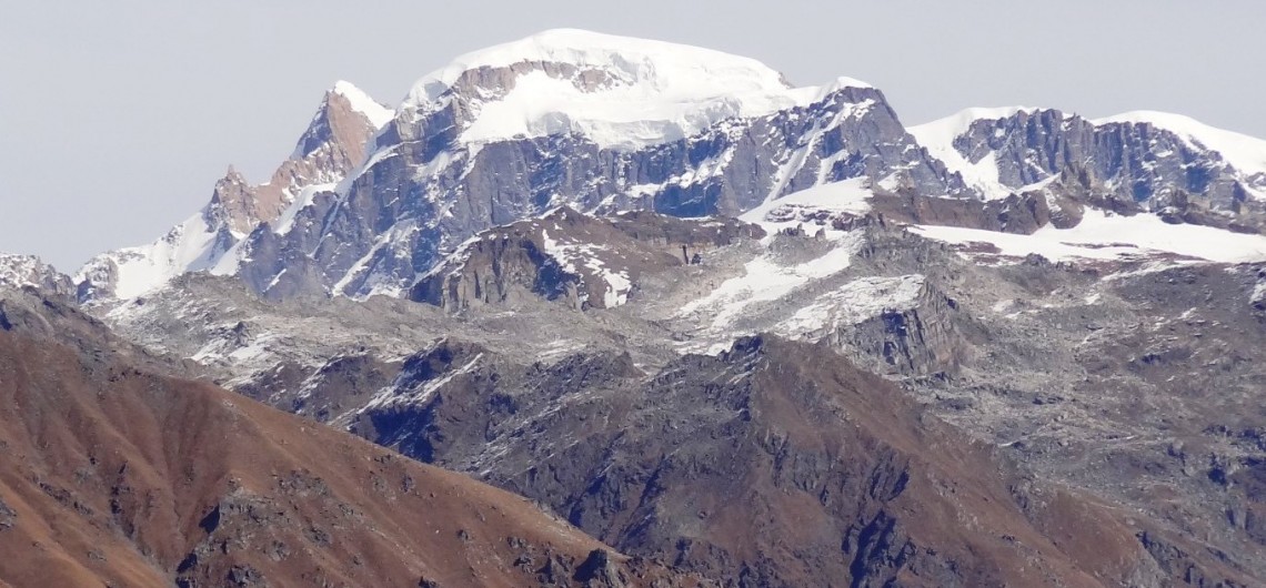
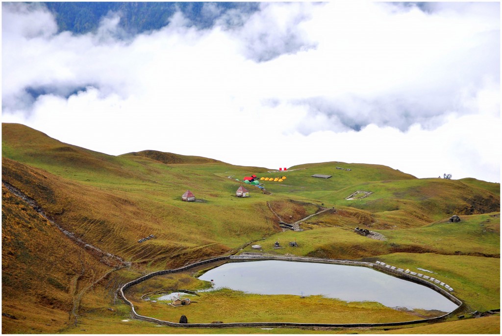
Nestled at the splendid peak of Fateh Parvat and surmounting a height of 3,566 m from the sea level, Har ki Doon is one of the remotest places in the Devbhoomi of Uttarakhand. Its desolation, alpine vegetation and snow-capped peaks make this cradle-shaped valley, a perfect spot for trekking excursion. In addition, it offers several delightful views that leave the trekkers awe-struck, starting from the raw beauty of nature to ice-covered peaks of Swargarohini and Jaundha. The valley which is packed with the alpine meadows, stunning streams, vibrant Himalayan flowers and exotic wildlife species has many hidden gems that add an extra charm to the trekking expedition.

A Dream-like Trek to Har Ki Doon
Believe it or not – walking through the eternal meadow of Har Ki Doon is one of those experiences that remain entrenched in the heart and mind for life. The trail rewards you with fascinating views of mountain ridges, glaciers, ancient temples, alluring caves and rustic hamlets.

It is believed that this valley holds a religious significance for Hindus and shares its past with the age of the Mahabharata. According to the locals, the eldest brother of the Pandavas, Yudhishthira, scaled the Himalayan peak ‘Swargarohini’ on his way to heaven. Also, there is a temple dedicated to eldest brother of the Kauravas, Duryodhana.
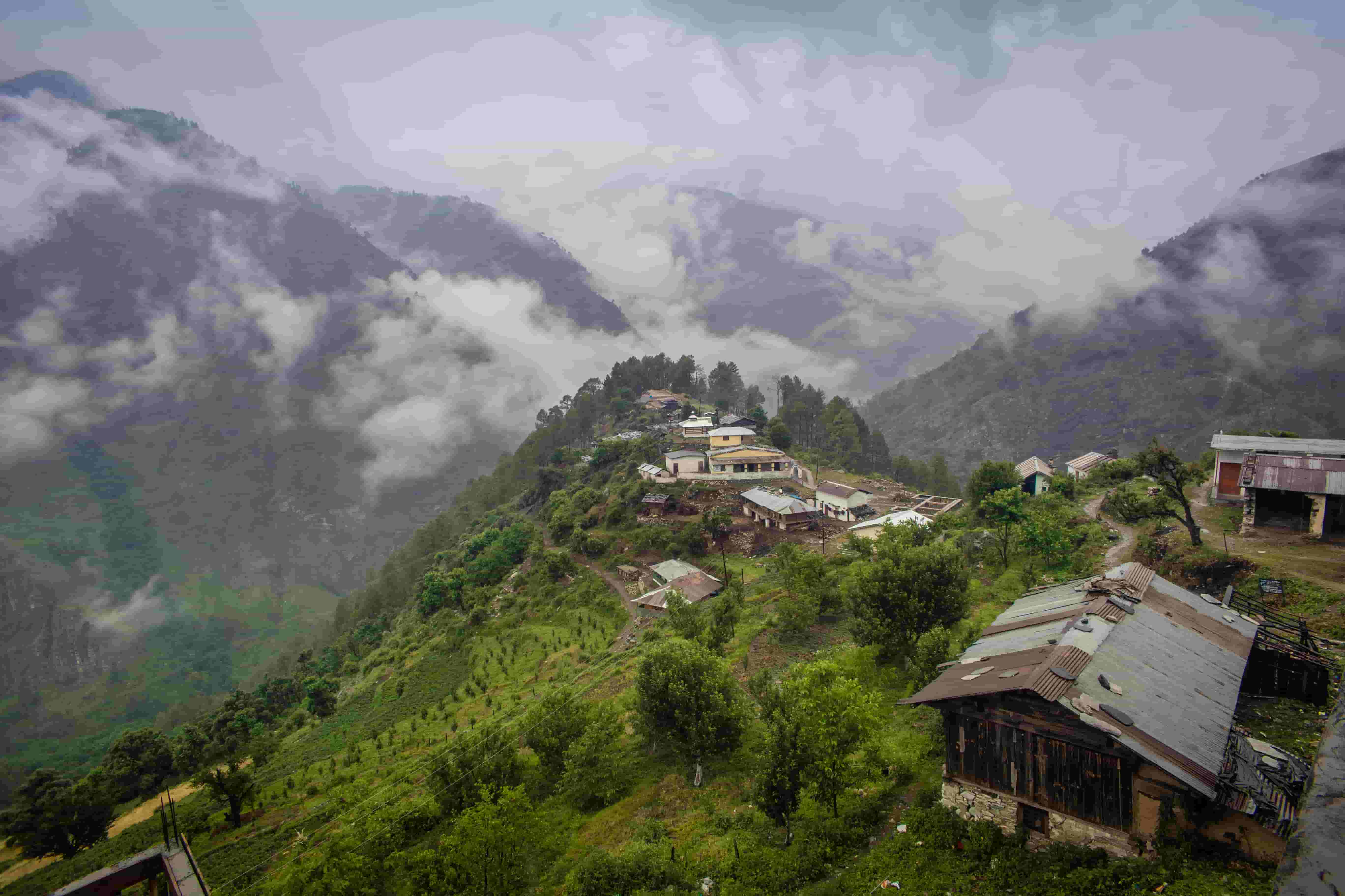
High-angle shot of Sankri village

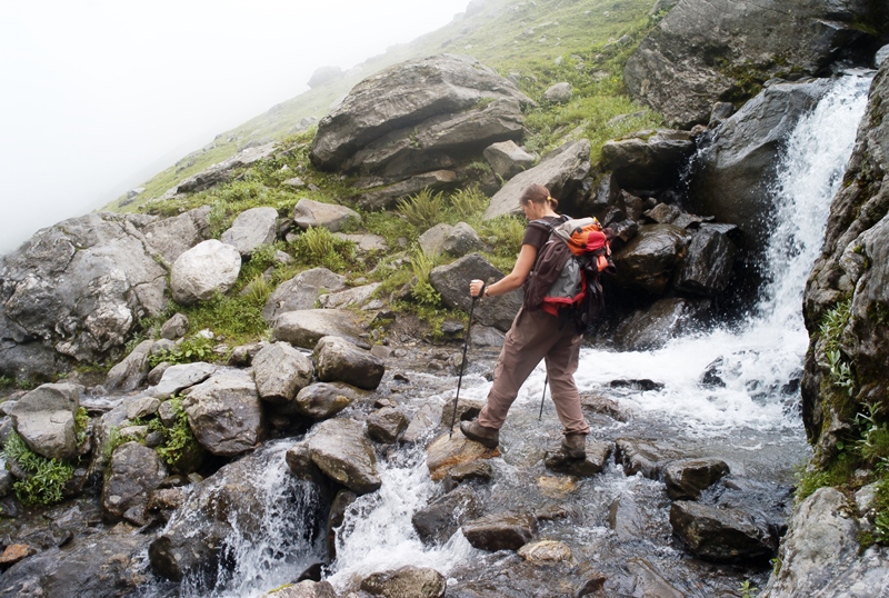
The initial phase of trek begins from Sankri Village to Taluka, which is located at a distance of 12 km from Sankri. Further, the course goes through icy pools, alpine meadows, moraine ridges, and pine and oak forests. On way to the summit, trekkers get an opportunity to capture spectacular views of the valley in camera and learn about the simple yet amazing lifestyle of locals. Also, eyes will be fascinated with a sight of Brahma Kamal flower that blooms in a beautiful alpine lake called Mahinda Taal.

Location: Uttarkashi, Uttarakhand
Duration: 7 Days
Trekking Distance: 54 km
Maximum Altitude: 3566 m
Grade: Easy to moderate
Start Point: Sankri
End Point: Sankri

Best Season to Visit: With pleasant weather conditions, the Har Ki Doon Trek can be undertaken round the year, except the monsoons. From December to March, the region experiences incessant snowfall, thus, adventure enthusiasts need proper physical training and experience to head for the trek during this time. Notably, the average temperature ranges from 11°C to 2°C, although at night temperature dips below freezing point.

Moreover, spring season i.e. from mid-April to June is considered as the best time to engage in this expedition. At this time, the average temperature ranges between 22°C to 10°C.

Several trekkers undertake this trek from September to November due to safe weather condition. The average temperature ranges between 18°C to 9°C.

Warm-hearted locals
Uttarakhand is not only known for its majestic hills and religious significance, but also for its warm-hearted inhabitants. They are the one who makes this place a travel-friendly state. Visit the religious memorials in towns and villages and explore the lifestyle of people and traditional practices followed by them.You will be surprised to see that people of Uttarakhand keep culture and religion very close to their hearts. Their generosity and admiration for the travelers make the expedition one of the most cherished memories.

Quick Overview of Elevation Points: Basically, the Har Ki Doon trekking expedition starts from the capital of Uttarakhand, Dehradun. The drive from Dehradun to Sankri goes through charming villages of Purola, Nainbagh and Naitwar, taking around 7 hours. Situated at an elevation of 1950 meters, Sankri is the base camp of the trek that offers astounding vistas of the quaint Himalayas. Next day, move towards a small village called Taluka at 2560 meters. A major perennial Himalayan river, Tons flows from here. The trek heads to the final destination Har Ki Doon that stands at an altitude of 3566 meters. Leaving the mountains behind, descend to Taluka and then to Sankri.

Itinerary
Day 01: Dehradun – Sankri > Day 02: Sankri – Taluka – Seema > Day 03: Seema – Har Ki Doon > Day 04: Camp near Kalkatti Dhar – Har Ki Doon > Day 05: Har Ki Doon – Seema > Day 06: Seema – Taluka – Sankri > Day 07: Sankri – Dehradun
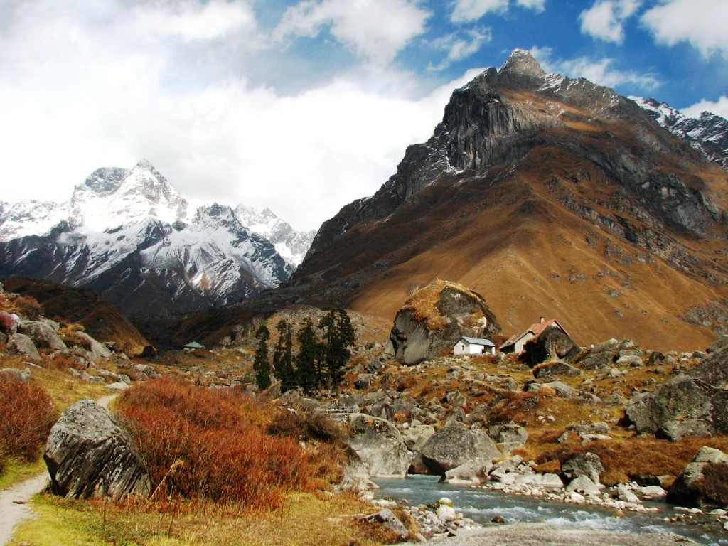
Har ki Doon Trek
Har ki Doon Trek

My Footprints in the Paradise Called Har Ki Doon

Unlike other Himalayan treks, Har Ki Doon trek deserves a special mention because of the splendid views it offers. Without any doubt, this trek is a delight for those who want to witness exotic Himalayan flora and fauna. For city dwellers, this is a perfect escape from the mundane life. A walk on lush green landscape along with snow patches is surely a delightful experience to one’s eyes and soul.

After planning an excursion with my two best friends, I landed at Jolly Grant Airport from Delhi. At the airport, we met our tour representative who welcomed us with a beautiful flower bouquet and a charming smile on his face. He briefed us about Sankri and asked us to wait for sometime as we had to wait there for our other fellow trekkers. Later, we became a group of 10 people with their arrival. We all boarded the taxis arranged by the tour representative and moved toward Sankri. 

The views of snow-covered hills, monasteries and temples were so stunning that they cannot be described in mere words. We had lunch at a roadside Dhaba near Nagthat. After 7 hours, we reached Sankri – a stunning village at Uttarkashi, which is located 13 km inside an exotic Govind Wildlife Sanctuary, where I captured splendid views of mountains animals like black peak, swarg rohini and bandarpunch. Further, the trail passed through River Supin and the dense forests of pine, maple and chestnut trees. The sound of gushing water and birds’ chirping poured into my ears like a melodious song. After reaching Sankri, we had a dinner at GIO camp Sankari.
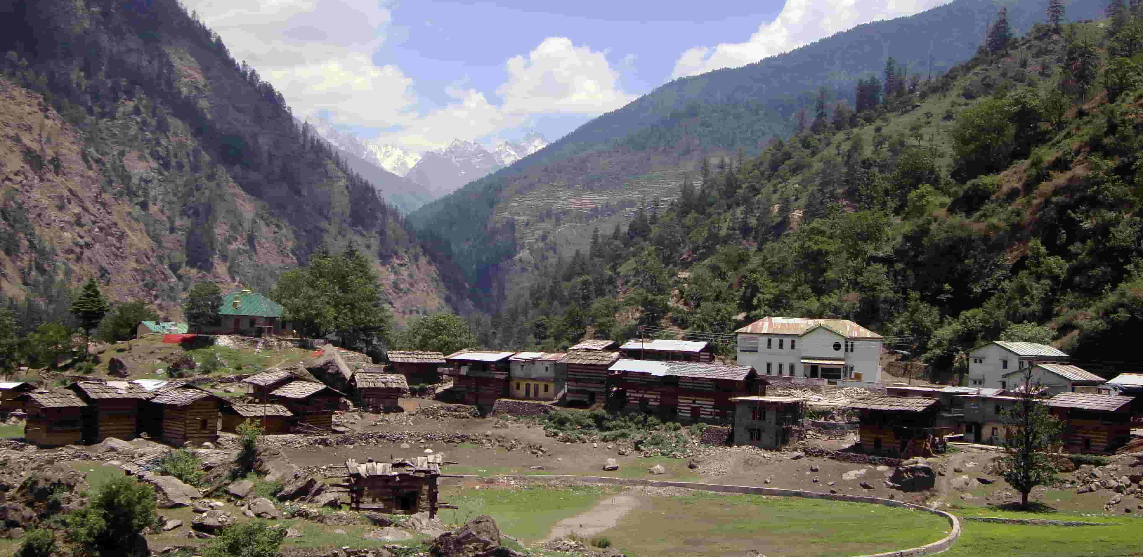
village_in_himalaya__pczwm har ki doon

Next morning, we woke up to a spectacular view of sunrise. After breakfast, our trek began from Sankari to Taluka via Osla and Seema. In the initial phase, the trail was quite easy as it was filled with pastureland and vibrant flowers. Suddenly, it started raining and our guide instructed us to not move further. So, we took out our raincoats and after wearing them we sat in a place covered with trees. Showers made the trekking difficult and the trail turned foggy, however, the vistas became more alluring and mysterious. We crossed Seema Market and reached Taluka gradually. We spent a night in the tents under the glittery sky.

Today, it was the day to make it to the final destination, for which we had been waiting so long! After breakfast, we moved towards Har ki Doon. The trail was pleasingly undulating with a steady gradient, which helped us in maintaining good speed.

The aroma of orchards, Himalayan primroses and the forest kept seeping inside us, just like a magic these flowers create to attract a swarm of bees. The clear-crystal views of Swargarohini and Bandarpoonch peaks were a feast to our naked eyes.

Further, we crossed a cantilever bridge and just after that the path became extremely high and slopes turned rough and perpendicular. Climbing on that giant and the demanding trail took a lot of concentration and efforts. Despite that, it was a remarkable experience as success gave us an immense pleasure. En route, we luckily met local school-going kids aged between 5 and 8, along with their parents. We clicked several pictures with them and it was quite an overwhelming experience. Thankfully, I had a few chocolates in my bag which were distributed among the children.

Our next resting point was Charota waterfalls where we spent around 20 minutes and it gave us immense relief after a long exhausting day. Later, we reached Har Ki dun after a total of 6 hours walk. Sun had already set down in the valley but the enclosing peaks were reflecting the blonde shades of the sun. We captured several group selfies there and spent a wonderful night under the tents.
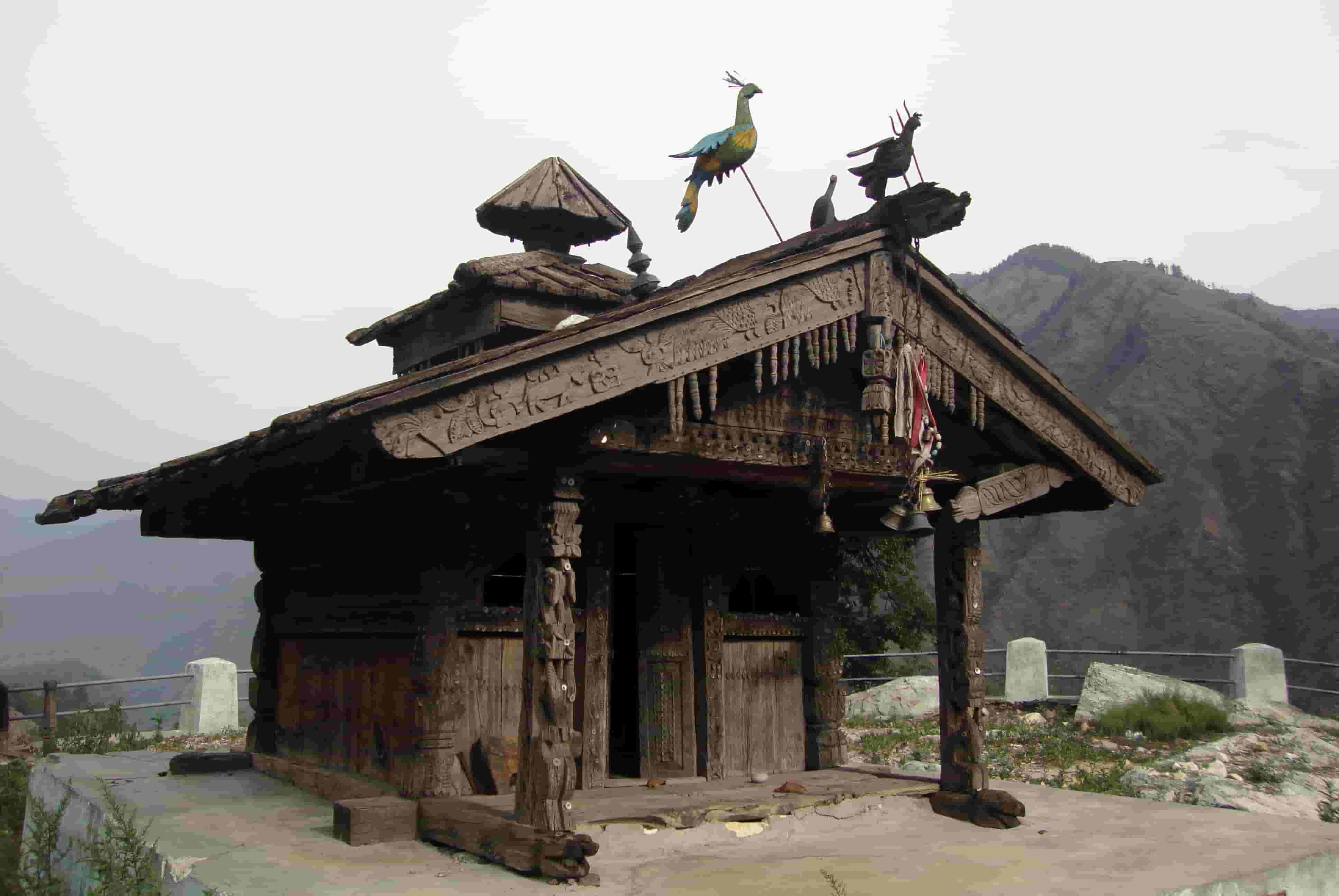
Old wooden temple in Sankri

Way Back to Sankri
On Day 4, we moved to Hata Valley after breakfast. Trekking to Hata Valley was an experience in itself. We encountered with Shepherds came there from far away villages with their herds. In the afternoon, we came to Har Ki Doon.

Next day, we woke up to a beautiful morning in the valley surrounded by lofty trees and mountains. After breakfast, we descended towards Seema Market. We first reached to a temple in the Osla Village, where we interacted with the locals and collected more information about the place. Later, we reached Taluka from Seema and spent a night in the tents. Next morning, on our way back to Sankri, we captured amazing views of flora and fauna in our cameras. We reached Sankri after 5 hours of tiring yet fascinating journey. On last day, I headed to the airport with my two friends, after bidding adieu to our fellow trekkers and tour representative.

Do Not Forget!

  • Respect nature, wildlife and local traditions
  • Travel in a group of 3 to 4 people
  • Respect local culture and be sensitive towards wildlife
  • People with heart disease, diabetes, asthma or high altitude sickness should avoid the trek
  • Work on the fitness levels for the trek
  • Prior research is a must
  • Don’t try to compete with fellow trekkers, just set your own pace

A Handy List of Trekking Essentials

  • Trekking shoes/Trekking pole
  • Warm clothes/Mosquito repellent
  • LED flashlight/Headlamp with extra batteries
  • Extra pair of woollen socks/ Raincoat/Gloves
  • Sunscreen Lotion/ Sunglasses/Lip balm
  • Water Bottles/Energy drink and bars/Emergency Medical Kit

This trekking expedition to Har Ki Doon not only gave me a plethora of wonderful memories to cherish but also help me in conquering my fears. A closer sight at the jewels hidden in the snow capsule mountains is something that one should definitely experience at least once in a lifetime.

If you know a bit of history, then you would be aware of the fact that India has been ruled by numerous dynasties. Many of these were not from the subcontinent, but from Central or West Asia. And back then, there were no proper roads, cars, aircraft or any other contemporary means to travel. Now, look at the geographical map of India for a while. You will realise that all those, coming from the north or northwest of the Indian subcontinent, had a natural barricade in their way in the form of the mountain system of the Himalayas, Karakoram and Hindu Kush. In the absence of modern transportation means, the question arises, how did they cross the mountains?

Have you been spending loads in the gym to get your body in shape, but feel bored by the stereotypical routine and exercises? There is another way you can do it, and it would be a lot better than the gym – Trekking! Yeah, that’s right! Hiking/Trekking is an excellent way to keep yourself up and running. It gives you the chance to exercise in natural conditions, unlike those simulated ones in the gym like on a boring treadmill. Ascending cliffs with the oxygen level decreasing as you go higher will tone up your body like nothing else.

Be glad you are in India as the hilly terrain in the northern part gives you endless opportunities for hiking. There are trails aplenty that you could take through the mountains. Consider the blast of cultures that will take you over as you journey past scenic hamlets, and you have got yourselves a fiesta. The famous children’s author, JRR Tolkien said in the Lord of the Rings, “All those who wander are not lost”, and he was right. Wandering endlessly does not always take you far from everything, but closer to yourself.

There are treks that vary in difficulty and altitude, and you can go in an increasing order to get your body used to it and prepared for the next challenge. In order to prepare for these treks, all you got to do is to start with brisk walks, jogging, climbing stairs and some breathing exercises. This should get you ready for the easy treks, and a few easy treks would set you in motion for the tougher ones. A couple of these every year would guarantee overall fitness. Bunk gym and go trekking for a healthy life. Here is a description of some treks and the sort of workout they will give you, arranged in the increasing order of difficulty.

Twenty years from now you will be more disappointed by the things you didn’t do and the chances you didn’t take! So throw off the bowlines. Trek to that mountain, take an adventure, fly high in the air, go backpacking in some remote place, lose yourself in the forest, just do nothing and gaze at the stars as if they are there just for you and once in your life definitely meet the mighty Himalayas! Explore, Dream, and Discover!

Adventure is not about facing that struggle on the journey, it’s about your willingness to conquer it, and to get yourself at the doorstep of nature and thrill. Nothing is more delightful in life than to live inside the moment of adventure.  It is an outlandish wilderness experience that gives your life expectations and purpose.
There is nothing more exciting than to experience adventures in life without burning a hole in your pocket!
Here is a lowdown on some of the best adventure travel experiences in India that would fulfill your adventure needs.

Bungee Jumping in Rishikesh
Bungee Jumping is on every adventure junkie’s list! Rishikesh is the hub for adventure activities in India. Rishikesh is easily accessible from Jolly Grant Airport in Dehradun, and Delhi – Dehradun is one of the cheapest sectors. You could also choose to take a bus from Delhi, which starts from 350 per head and takes roughly 7 hours or a train journey from Delhi to Haridwar would also be easy on the pocket. Any of these options will take you to the adventure city well within budget. Bungee jumping promises the adrenaline rush like never before. Take this adventure at just 3500 per person!

Explore the vibrant festivals and fairs of India along with different cultures. Each corner has a different story! Find out the story and fall in love with India. Grab the chance to explore the true flavours of every region. Let the travel bug bite you and take you to these fascinating places with interesting fairs and festivals in India.

Hemis Festival, Ladakh
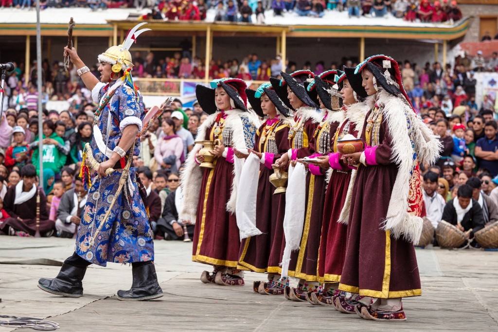
The colourful Hemis Festival is one of the biggest and the most famous religious festivals in Ladakh. The enchanting festival in the land of dreams is celebrated on the birth anniversary of Guru Padmasambhava or commonly known as Guru Rimpoche. The Hemis Monastery is where the festival is celebrated. The monastery is itself a blissful place, surrounded by brown austere hills and bright yellow mustard fields. Its execution through the splendid masked dances by the Lamas is what takes your breath away. To see the celebration of good over evil in a different way, plan your next trip to Ladakh and witness this festival.
When – June or July
Where – Hemis Monastery, Ladakh

Hemis Festival in Ladakh

Winter is usually the time to snuggle up with a good book in front of a fireplace, enjoying a hot cup of tea in bed every morning, or spending lazy afternoons. But winters are also the time to explore the new side of India’s popular destinations. Truly, India is an incredible country, geographically, historically and architecturally. It offers amazing geographical diversity with varied climates and seasons.  Winter season is no doubt the most loved by people of India. If you don’t feel like spending your winter snuggling in a blanket, then trust me you don’t have to!

So if you are planning your next vacation during winters, here is a list of some of the best Winter Destinations in India to choose from.

  1. MADHYA PRADESH- KHAJURAHO AND ORCHHA
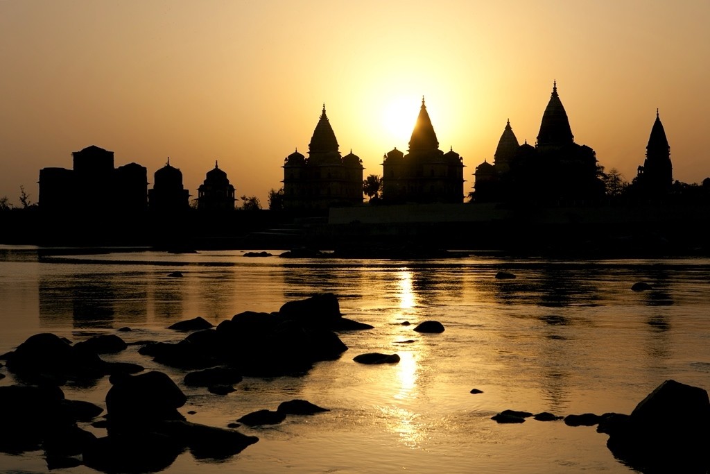
Orccha Cenotaphs
Orchha Cenotaphs

Khajuraho temples are among the finest temple arts in the world. The erotic sculptures, the minute carvings on the temple walls are worth exploring in winters when the weather is at its best.

Lost in the hustle bustle and crowd of the city? Or working like a zombie to fulfil the necessities of life? Well, then you deserve a break. De-stress, forget the troubles, let it all go and make some fresh and beautiful memories. Get lost on the magical roads of India and find yourself. Travel is the best way to rediscover yourself. It is said that “Blessed are the curious, for they shall have adventures”. So take an adventurous road trip and meet yourself somewhere on the journey!

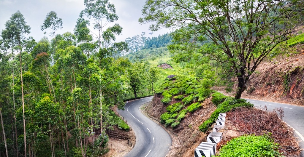
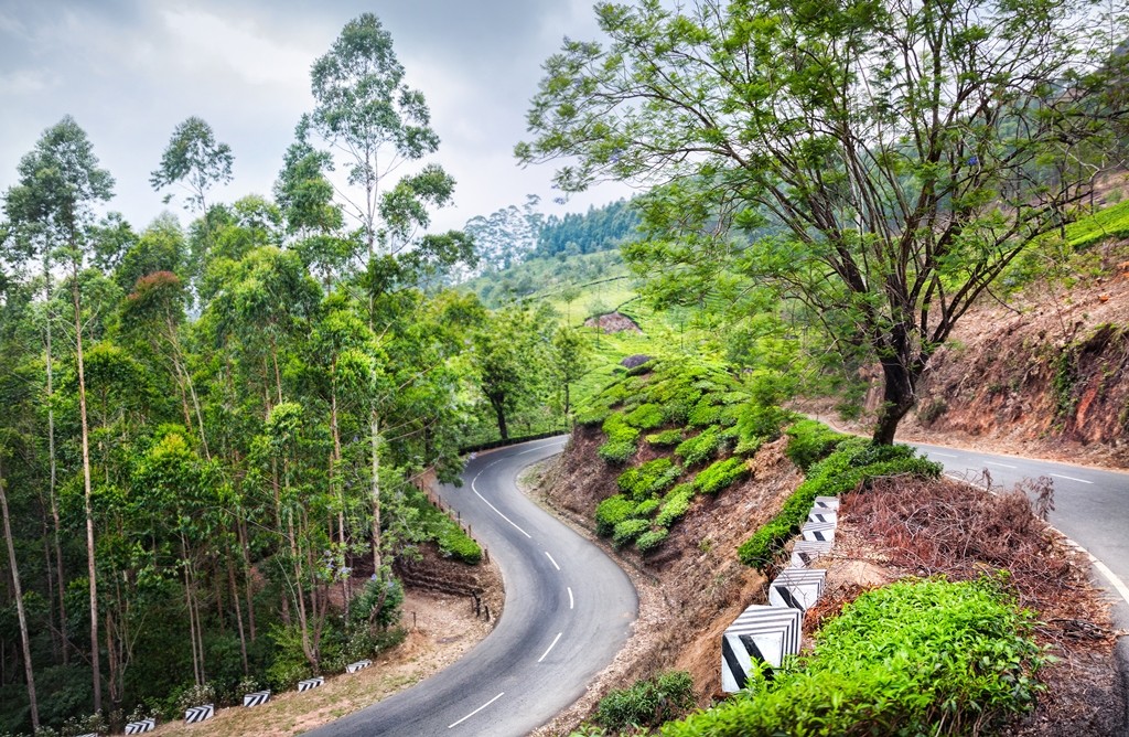
  • Bangalore to Munnar– Let the wheel roll on the smooth roads! Get ready for an adventure trip through Ghat road, forests, hairpin bends, steep climbs and wildlife and misty routes. From the city of filter coffee travel to the city of Tea plantation. The breathtaking views of lush green plantations, the refreshing water of unexpected waterfalls and the amazing views of endless windmills running together will make you stop your car and capture the memories for lifetime. Don’t forget to pamper your taste buds by the local cuisine on the way!
        Distance: 477 KM
        Travel time: 10 hours

Picturesque roads from Bangalore to Munnar
  • Guwahati to Tawang- A paradise for bikers! Explore the picturesque beauty of North-East through this road trip which will take you to some of the most marvelous monasteries of India. You might find it a bit challenging but it’s a beautiful terrain which will make you forget the rough paths. Tawang has the largest monastery in India and the second largest in the world. Situated at a height of 10,000 feet, it is a beautiful offbeat hill town to explore.
    Distance: 521 KM
    Travel time: 10 hours

Himachal Pradesh is beyond doubt one of the most verdant and naturally beautiful states in India. With 3 mountain ranges, namely Pir Panjal, Shivalik, and Dhauladhar, in its vicinity, this state literally is the home of snow. It has so much to offer that no matter how many times you travel here; there will always be something new to witness and experience.

In addition to being home to some of the most popular hill towns, like Shimla, Dharamsala, Dalhousie and Manali, it is also a favorite among adventure seekers, particularly trekkers. There are many treks in the state that originate from Manali and Dharamsala. In addition to trekking, you could also enjoy paragliding in Manali as well as Bir Billing.

Here is a lowdown on some of the best treks in Himachal Pradesh

Hampta Pass Trek

Hampta Pass Trek

This trek begins from Manali and is ideal for beginners. With maximum altitude of 14100 feet, this trek takes 5 days to complete, covering a total distance of 26 kms.  Bookings now open

Skiing is a recreational activity as well as a competitive sport and its history dates back to 600 BC when it is believed to have been practiced in what is now China. Modern skiing has evolved from Scandinavia and the word Ski has originated from Old Norse word Skið meaning split wood or firewood. The sport has grown so popular over the decades that most people have a good understanding of what Skiing is all about. Balance, weight, and edge control are the key skills needed in Skiing.

There are 2 types of skiing widely recognized – Alpine and Nordic. Alpine skiing is a downhill skiing that involves sliding down hills with fixed heel bindings. For Alpine Skiing, one needs mechanical assistance to get to the top of the hill as all the equipment makes walking or hiking almost impossible. Nordic Skiing on the other hand is a cross country skiing with free heel bindings. In Nordic style, skiers can freely climb up and down the hills without any mechanical help.

Popular Skiing destinations across the world –

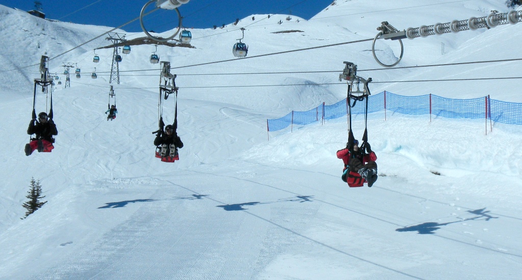
1.       Interlaken, Switzerland – Interlaken is one of the most ideal skiing locations in the world and it has no fewer than four beautiful ski resorts to choose from. The spacious ski slopes, long cross country pistes and snow parks make it perfect for experienced as well as amateur skiers. There are many snow-sports schools here as well, that can make a beginners experience rewarding and fun. All the equipment is available for hire. One of the most popular regions in the Interlaken is the Jungfrau Region. Interlaken is well connected by road and air, with as many as 5 airports within a 2 hour drive. Berne airport is just an hour’s drive away.

Interlaken cable car

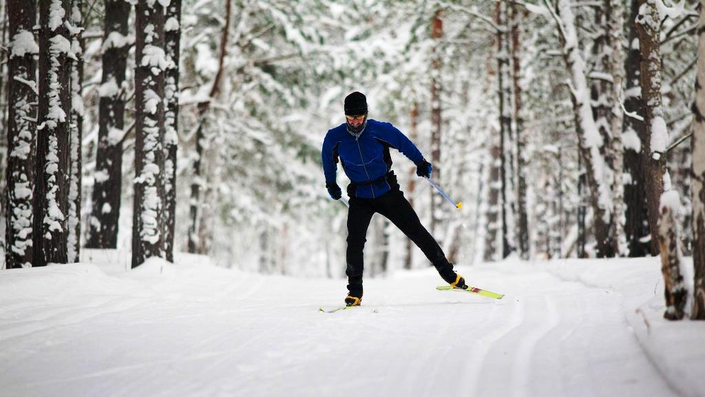
2.       Oslo, Norway – Oslo is a perfect winter and skiing destination with more than 2,000 kms of prepared cross country ski trails that lead one into the beautiful Norwegian forests. These are just 20 minutes away from the main city. Oslo city also has its very own modern alpine ski centre called the Oslo Winter Park, which offers plenty of challenges for downhill skiers as well as snowboarders. With more than 60 cozy cabins available for stay, this makes for a great place to go to with family and friends alike. Here you can also ski after dark as almost 90 kms of the track is well lit till 10 PM.

CrossCountry Skiing Oslo
Cross Country Skiing in Oslo

Waterfalls are beautiful, captivating, inviting and heavenly. There are innumerable waterfalls around the world that arouse our interest and curiosity. While some are geographically significant, others have popular fables attached to them. Here is our list of the 7 most beautiful and fascinating waterfalls in the world:

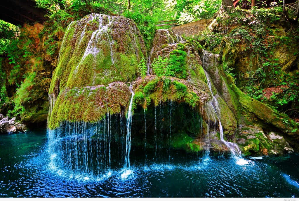
1. Bigar Waterfall, Bozovici, Romania – Located in southwestern Romania in the administrative territory of Bozovici, Bigar Waterfall is a protected area. It is often considered to be one of the most beautiful waterfalls in the world and it is also fascinating that it is located at 45 degrees North, at the halfway mark between Equator and North Pole.

Bigar Waterfall Romania

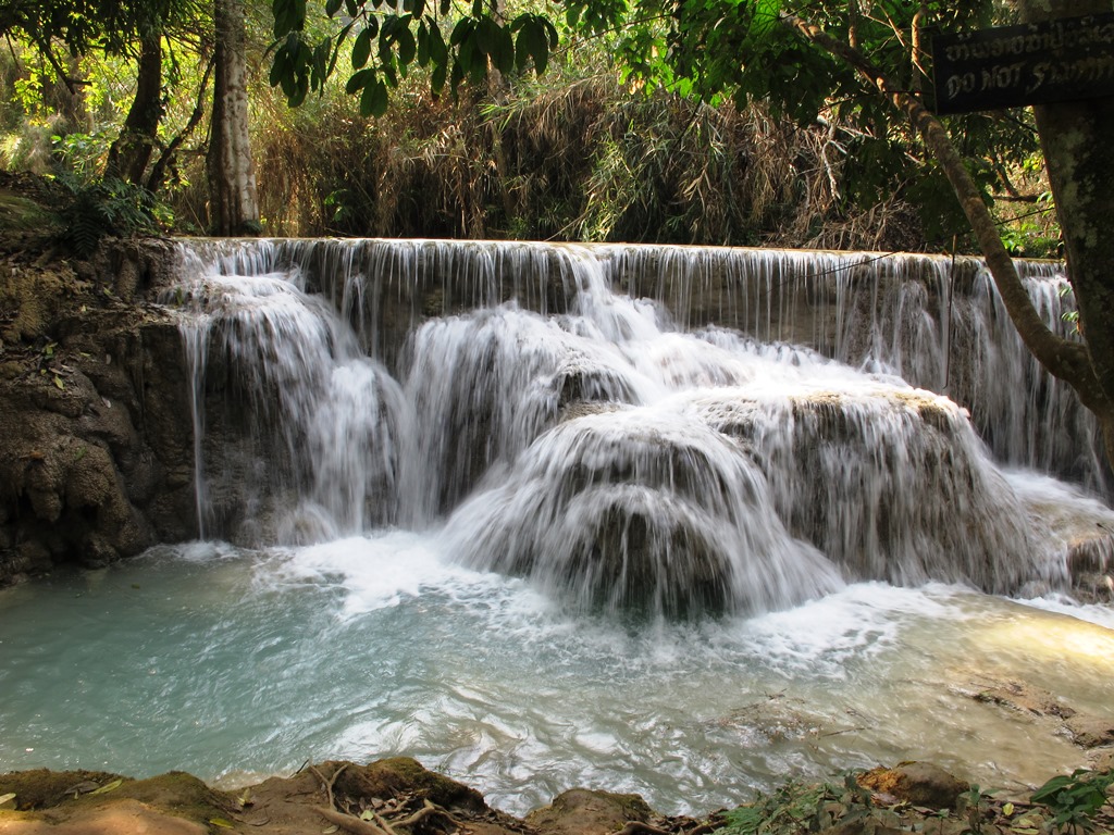
2.      Kuang Si Waterfall, Luang Prabang, Laos – Easily among the most beautiful waterfalls in the world, Kuang Si is located 29 kms from Luang Prabang. One of the most stunning things about it is its 3 tiers and the many blue pools that the cascading water collects into and also that some of the pools are even open to swimming. It is a very well maintained site with bridges and walkways.

Kuangsi Waterfall Laos
Kuang Si Waterfall Laos

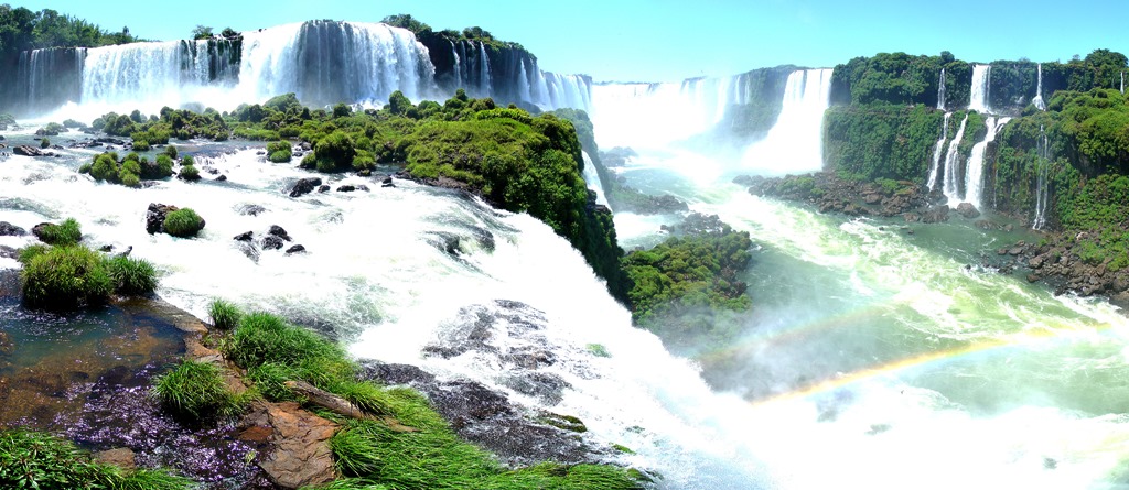
3.      Iguazu Falls, Misiones Province, Argentina – A UNESCO World Heritage Site since 1984, Iguazu Falls forms the border between Brazil and Argentina and is geographically a part of Argentina. It is made up of many cascades and is 80 meters high. Iguazu literally means Great Water and these falls divide the Iguazu River into upper and lower Iguazu. Its existence first came to be known in 1541.

Iguazu Falls Argentina

4.      Dynjandi, Westfjords, Iceland – With a combined height of 100 meters, Dynjandi is a series of waterfalls located in Westfjords in Iceland. Dynjandi means Thunderous and each of the 7 sections of the waterfall has its own name. This place is extremely popular with tourists, with many tourist buses stopping here, and is also considered tourist friendly with regards to the facilities.

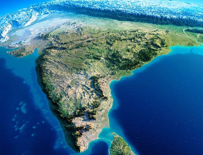
India is a diverse country, not just culturally but geographically too. Here are some interesting facts and figures about the geography of our country:

India
India

Geographical Area – With an area of 3,287,240 sqkm, India is the seventh largest country in the world by area and 2nd largest by population.

Coldest Place – Dras, located in the Kargil district of Jammu & Kashmir, is the coldest place in India. It is situated at a height of approximately 11,000 feet.

Easternmost Point – The tiny town of Kibithu in Arunachal Pradesh is the easternmost point of India. The Lohit River enters India from Kibithu.

Westernmost Point – The westernmost point of India is the small inhabited village of Ghuar Moti, located in the Kutch District of Gujarat.

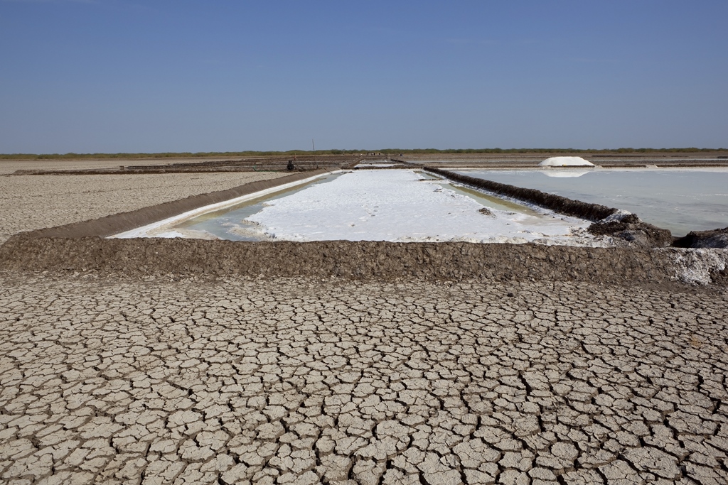
Rann of Kutch in Gujarat

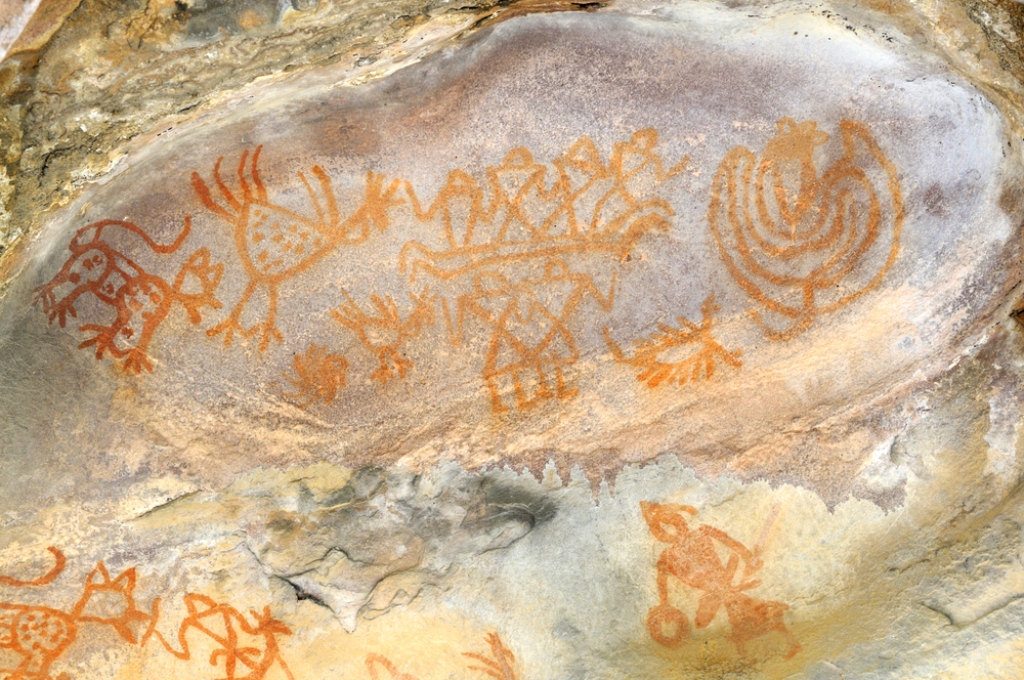
Situated 45 kms south east of Bhopal in the Indian state of Madhya Pradesh, the Rock Shelters of Bhimbetka are a UNESCO World Heritage Site, and lie within the Vindhyan Hills. These enormous rock formations are gathered around the Bhimbetka Hill and the entire area is rich with flora and fauna, recurrent supplies of water and natural shelter. It is due to the presence of all these factors that a sustainable society was able to develop and flourish here.

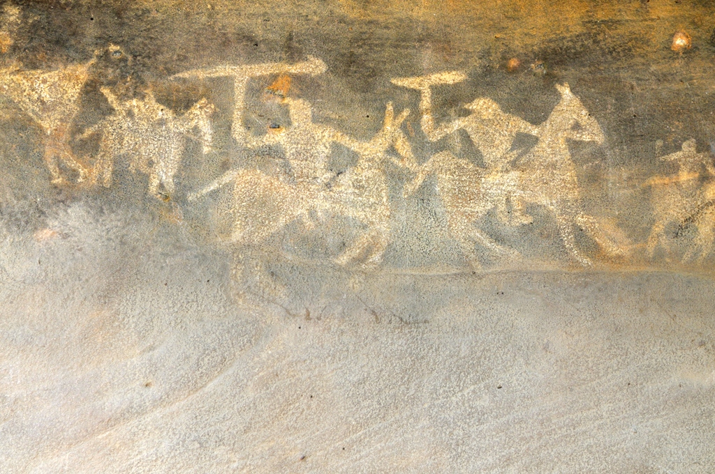
Painting depicting a war scene

With some of its shelters even occupied by the Homo erectus more than 100,000 years ago, the Bhimbetka Rock Shelters are from the Paleolithic era, displaying the oldest traces of human life on the Indian Sub-Continent and marking the beginning of the South Asian Stone Age. The name Bhimbetka itself means the “resting place of Bhīma” and is believed to have come from Bhīma, from the epic Mahabharata. As per the skeletons found, the humans of that time were around 7 feet tall.

This painting depicts the everyday lifestyle of those people

These rock shelters were first cited in the Indian archaeological records in 1888 as a Buddhist site, based on the information obtained from the local tribes. In the 1950s, Indian archaeologist V. S. Wakankar discovered these sites while on a train journey to Bhopal and found some of the rock formations to be alike those he had come across in France and Spain. Further studies by Wakankar and his team in 1957 led to a discovery of various prehistoric rock shelters.

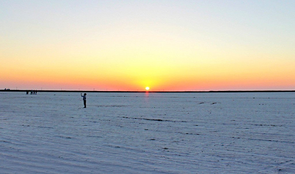
A seasonal salt marsh situated in the Thar Desert, the Great Rann of Kutch covers 7,505 square miles in area. It spans between the Kutch district of Gujarat in India and the Sindh province of Pakistan and its northern boundary forms the International Border between the two countries. It is said to be one of the biggest salt deserts in the world. The Tropic of Cancer passes a few miles from the Rann of Kutch.

The Rann of Kutch
The Rann of Kutch

Due to it being a marshy area, Rann of Kutch makes for a breeding ground for large flocks of flamingos and also provides shelter to wild animals including the Indian wild ass.

Even though the marsh is in a protected area, it is still susceptible to losing its natural resources to grazing and salt extraction. To keep the flora and fauna preserved, various Wildlife Sanctuaries and wildlife conservation areas have been set up. Indian Wild Ass Sanctuary, Kutch Bustard Sanctuary, Narayan Sarovar Sanctuary, Banni Grasslands Reserve, Kutch Desert Wildlife Sanctuary are a few of those and are approachable from the city of Bhuj.

RANN UTSAV

White salt desert speckled with an array of colors, distinctive shades of tradition and culture, a plethora of festivities all around!

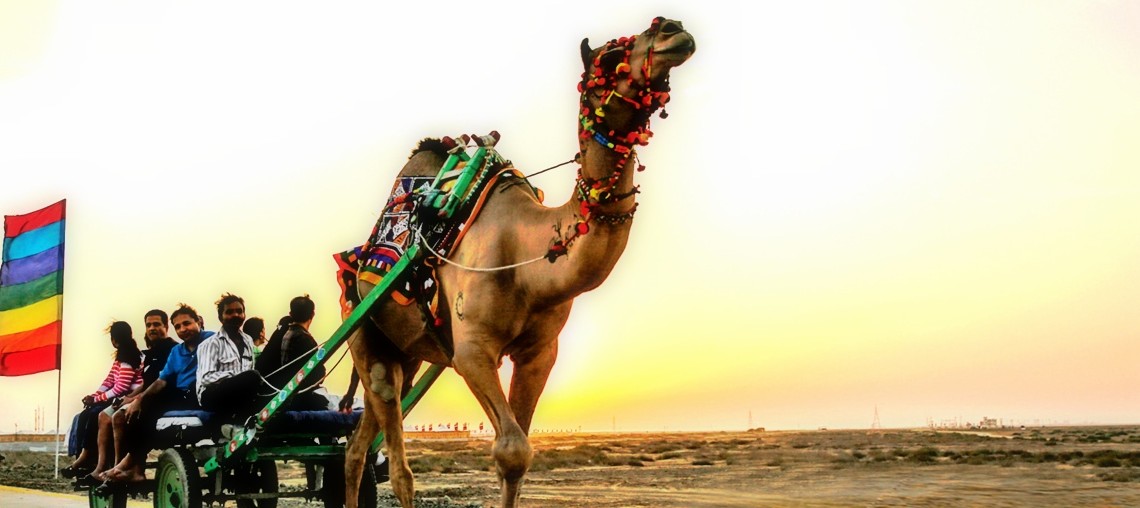
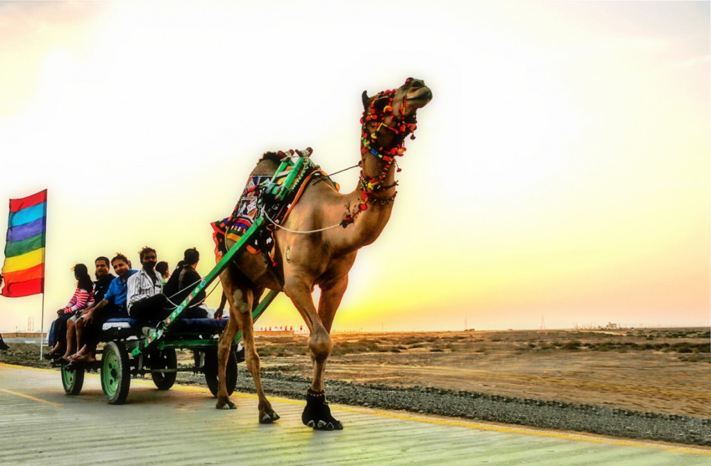
The best ride in the beautiful salt desert.
The best ride in the beautiful salt desert

Days are filled with a display of bright shades and designs in the form of the beautiful costumes the locals wear, from the women dressed in the most gorgeous of lehangas and arms adorned with silver bangles to turbaned men in either loin cloths or short skirts, this is a sight that will find a place in your heart and rest there forever. Evenings bring a multitude of colors as the sun sets followed by a star-lit sky – the stuff that dreams are made of! The heart melting notes of the Surando make the experience mystical.

India is home to some of the most diverse landscapes from mountains, valleys to forests, deserts and beaches. This diversity in topography attracts people from all over the world in every season to experience India in her many colors. India boasts some of the most beautiful valleys like the extremely popular Nubra in Ladakh or the verdant Dibang Valley in the north-eastern state of Arunachal Pradesh. Come explore these with us.

  1. Nubra Valley, Ladakh, Jammu & Kashmir
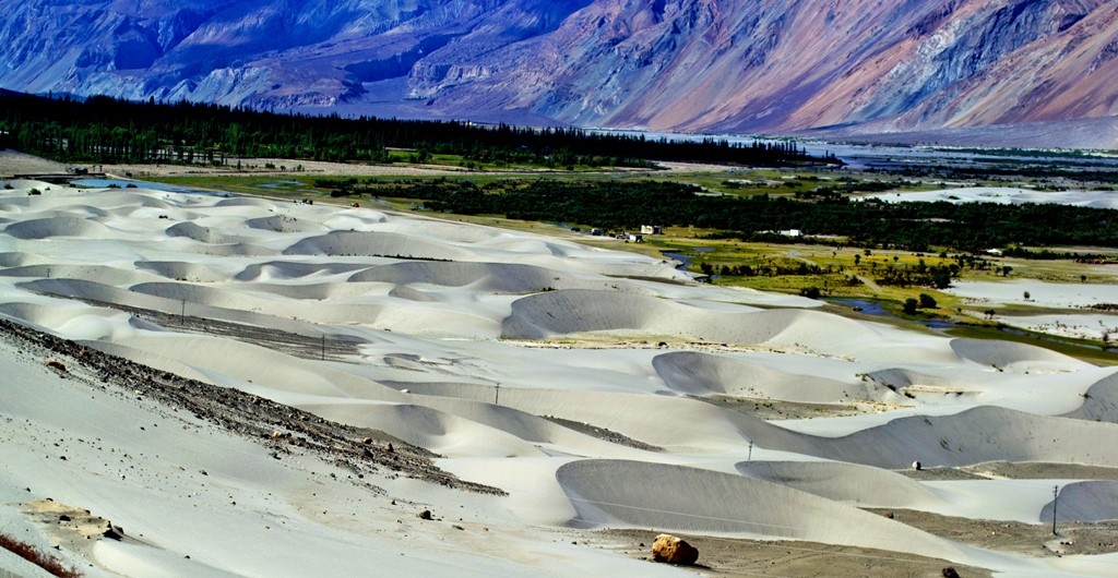
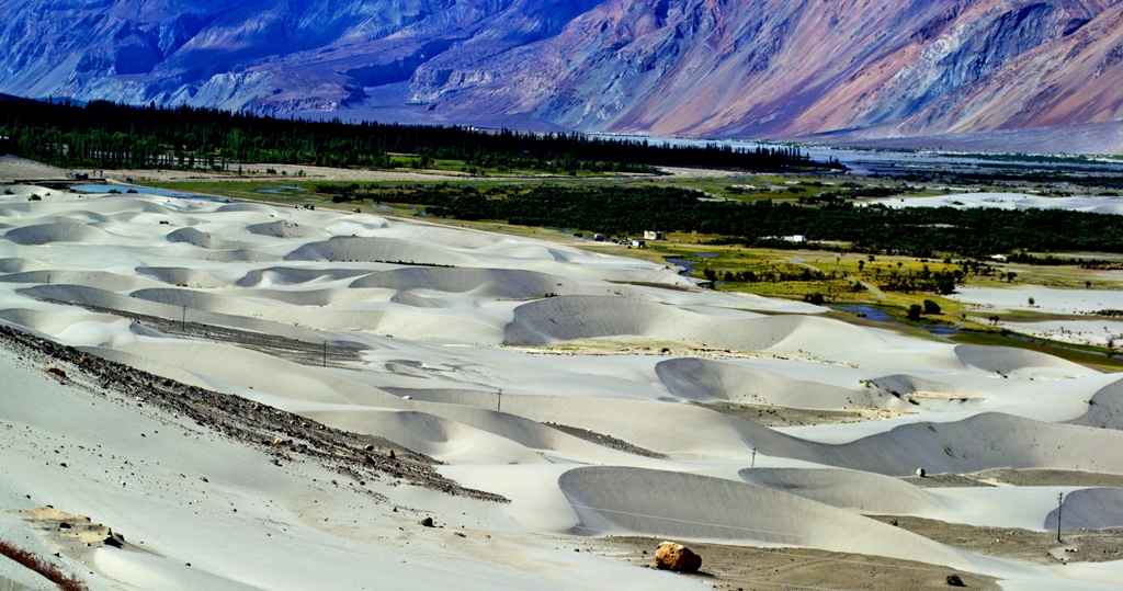
    Believed to be originally called Ldumra meaning the Valley of Flowers, Nubra is located to the north east of Ladakh Valley, approximately 150 kms from Leh. The meeting of Nubra and Shyok (tributary of Indus) Rivers forms a large valley, separating the Karakoram and Ladakh Ranges. This valley can be reached by travelling over the Khardung La from Leh. The average altitude of Nubra is roughly 10,000 feet above sea level.
    An array of colors at Nubra Valley
    An array of colors at Nubra Valley Image Credits: wikipedia.org


  2. Spiti Valley, Himachal Pradesh
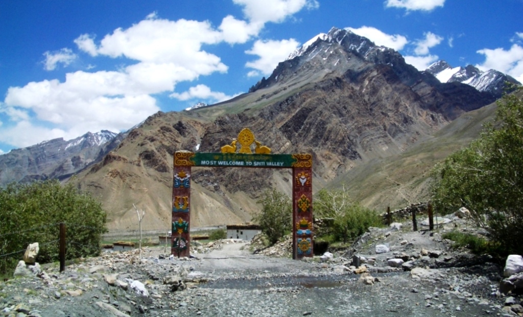
    Located high in the north eastern part of Himachal Pradesh, Spiti Valley is situated between Tibet and India. It is a desert mountain valley and is one of the least populated regions of the country. It is a part of Lahaul and Spiti district and is home to similar Buddhist culture as found in Tibet and Ladakh. Kunzum La at 4,590 meters separates Lahaul from Spiti. The entire valley is surrounded by high mountain ranges. Heavy snowfalls cut off the valley from the rest of the country for almost 2-3 months from November to January every year.
    The ever-welcoming Spiti Valley
    The ever-welcoming Spiti Valley Image Credits: wikipedia.org


  3. Dzukou Valley, Nagaland
    Considered to be one of the most beautiful places in Nagaland, the Dzukou Valley is just ideal for easy to moderate trekking. Dzukou means Cold Water which comes from the cold streams of water that flow through the valley. It is known for its flora and fauna and particularly seasonal flowers like Dzukou Lily found only in this area. It sits at 8339 feet above sea level behind the Japfu Peak at the border between Manipur and Nagaland.

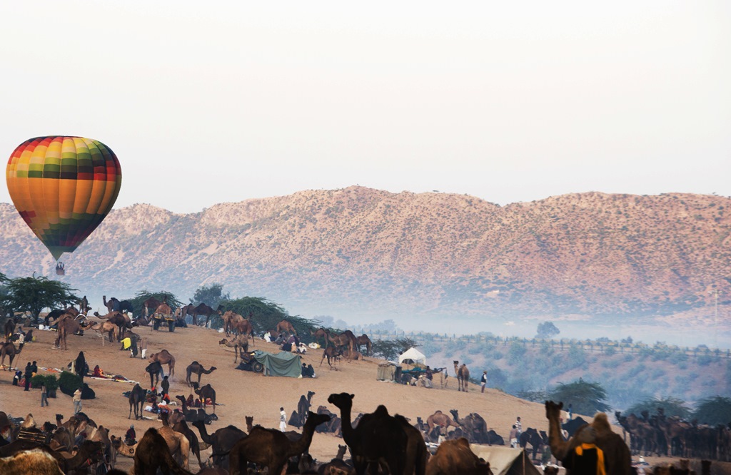
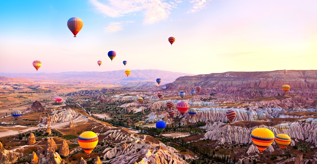
Hot air balloon was the first human carrying flight technology in the world. It is an extremely popular form of soft adventure in many parts of the world and catching up in India too. Places like Jaipur  in Rajasthan and Lonavala  in Maharashtra offer great hot air ballooning opportunities.

Hot Air Ballooning in Rajasthan India

Here are some really interesting facts about this leisure activity:

  1. A Sheep, duck and rooster were the first passengers aboard a Hot Air Balloon flight! It was decided to let animals be the test subjects in order to see the effects of the flight. Sheep was chosen to test the effects of high altitude on a land animal and the birds to act as controls in the experiment, owing to their ability to fly.
  2. In many parts of the world, passengers are served Champagne post a Hot Air Balloon ride. It is a long standing tradition said to have originated in France.
    The first balloonists had apparently carried a bottle of champagne with them to toast after the flight. But upon landing, they were attacked by local farmers for polluting their fields with smoke. To dissuade them, they offered them champagne and even though the smoke problem ended with time, this tradition caught on and has stayed till date!

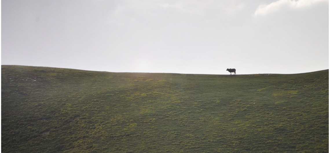
Bugyal, when literally translated, means meadow. A Bugyal is high altitude grassland that makes for an excellent grazing ground. These Bugyals remain covered with snow in the winter months but come to life with colors at the advent of summer season. Here are some of the most beautiful Bugyals in the state of Uttarakhand in India –

1. Bedni Bugyal – Situated at the border of Garhwal and Kumaon in the Chamoli district of Uttarakhand, Bedni Bugyal offers the majestic views of the Trishul Parbat. It is situated at an altitude of 11,000 feet. The trek to Bedni starts from Loharjung and is ranked easy on the difficulty level, since one mostly passes through villages to reach this lush meadow. On route to Bedni, Wan is the last village that you cross; it is also the last point where you could get accommodation.

The Refreshing Bedni Bugyal

Bedni Bugyal is a part of the Roopkund Trek itinerary too. So to witness the verdancy of this meadow, you could either choose the easy trek to Bedni or go further up to Roopkund which is at a height of 15,600 feet.The route to Bedni Bugyal is through exquisitely beautiful forests of rhododendron and oak. It is a perfect campsite and the Bedni Kund offers the most riveting reflection of the Trishul Peak.

2. Dayara Bugyal – Dayara Bugyal is a full-fledged 7 days trek that again is rated easy. At an altitude of 12,000 feet, Dayara is easily among the top 2 most beautiful high altitude meadows in the Himalayas. It is breathtakingly serene and looks like the most ideal setting for a fairytale. It can be reached from Haridwar via Barsu, and Barnala meadows are where Dayara begins. It is a moderate 5 kms trek from Barnala to Dayara through dense forests.

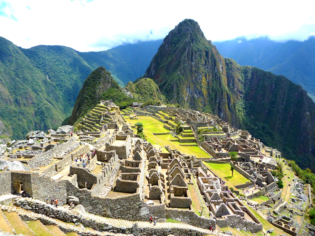
Machu Picchu, a name the whole world is familiar with today, was not known to mankind a century ago. Spirit of adventure, curiosity and the quest for the unknown led to its discovery in 1911, when a party of three chanced upon it while looking for the legendary lost city of Vilcabamba. The leader of this party was Hiram Bingham.

Machu Picchu
Machu Picchu

Bingham was born in Honolulu, Hawaii on 19th November, 1875 to a family of missionaries. However, he found his true calling in history and archaeology, especially Latin American History and that motivated him to pursue his doctorate in the same field and take many trips to South America. His 1911 expedition, as mentioned above, was to seek out the Incas’ last capital, Vilcabamba, which was believed to have been the last refuge of the defeated king Manco Inca II in 1536, when he had fled after being defeated by the Spanish conquistador Francisco Pizarro. There was a lot of speculation about the location of this city to be somewhere in the valleys of the Vilcabamba and Urubamba River.

Hiram Bingham
Hiram Bingham
Image Credits: wikipedia.org

On the morning of 23rd July, 1911, along with his companion Sergeant Carrasco, a Peruvian soldier, Bingham left Cuzco to explore the Urubamba valley. They spent the night camping near the river and while there, they were approached by a local farmer named Melchor Arteaga who informed them of the presence of some ancient ruins high up in the mountains. The next morning, 24th July, the 3 set out to explore and find out what these ruins were. They all advanced slowly, making their way across a wobbly bridge that traversed just above the rapids. Fighting the rain, they scrambled up the path, sometimes on all fours owing to its steepness. After about an hour or so, they were above the tree line and the view below took their breath away. Little did they know that something even more spectacular awaited them above.

As they moved further up, they found that the Native Americans farmed on an ancient terrace cleared of the jungle. They discovered more terraces and mazes of sorts, consisting of stone houses made of white granite blocks fitted together with clean, mortar-less joints, sitting 4000 feet above the Urubamba River. Accidentally, they had found an abandoned citadel/fortress that was to become the most celebrated ruin in South America and one of the most visited sites in the world.

Click here to book your trek with us.

Nestled between Nepal, Tibet, Bhutan and West Bengal, the landlocked state of Sikkim is the least populated in India. This quaint destination was once an independent Buddhist Kingdom and Buddhist Saint Padmasambhva is said to have passed through this region in the 8th century AD. Sikkim became the 22nd state of Indian Union in 1975.

Owing to its location in the Himalayas, Sikkim is one of the most geographically diverse states in the country, with climate ranging from high alpine to subtropical. Its culture, diverse flora and fauna and picturesque locations make it an extremely popular tourist destination.

The Eastern Himalayas situated between Central Nepal in the West to Myanmar in the East pass through Sikkim, making it home to the world’s 3rd highest mountain peak, Kanchenjunga, which is worshipped by the locals as their deity. The presence of this majestic mountain has made Sikkim a favorite among adventure seekers, especially mountaineering, trekking and photography enthusiasts.

William Blake, the great 18th century poet, said that great things happen when men and mountains meet. Almost two centuries later, the world saw that come to life!

World’s highest mountain range, Himalayas, is home to 14 peaks higher than 8,000 meters or eight-thousanders as these are commonly called, and till the first half of the 20th century, all of these were unscaled! While the geographical conditions were a major deterrent, political unrest in India, Pakistan, Nepal and Tibet also proved to be one big hurdle!

Explore: Mount Annapurna Base Camp Trek

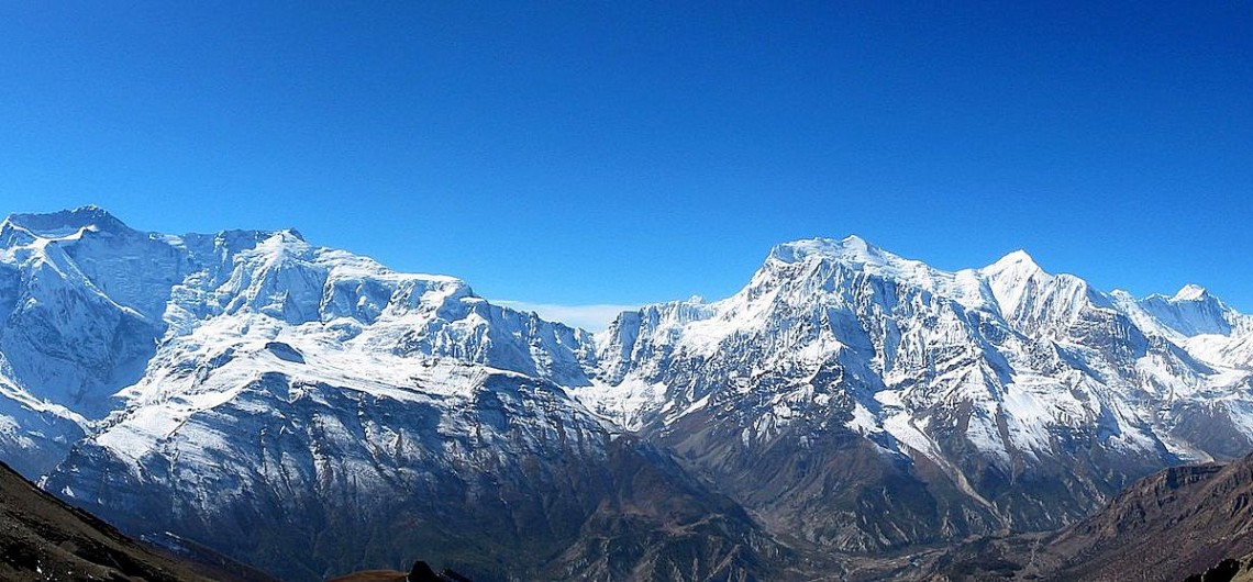
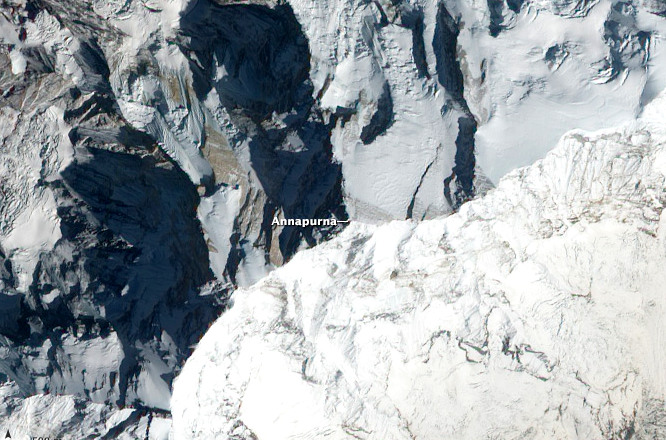
Aerial view of the Annapurna Image credits: Wikipedia.org
Aerial view of the Annapurna
Image credits: Wikipedia.org

But all that was about to change! In 1949, the Maharajah of Nepal gave his consent to a climbing party of nine from France to attempt an assault on one (or more than one) of these peaks. The party, led by experienced French Alpinist Maurice Herzog, arrived in Nepal in the spring of 1950 with plans to attempt either the Annapurna (8091 m) or the slightly higher Dhawalgiri (8167 m).

This was a time when not even the local inhabitants had any knowledge of reaching higher up in those mountains through the thick forests and tough terrain speckled with gorges and ridges. Having spent some time probing for routes and backtracking, in April of 1950, Herzog, his climbing partner Louis Lachenal and the rest of the team realized that they needed to make haste if they wished to climb any of those peaks, since the ideal weather conditions would only last till June. So they zeroed in on Annapurna by the north-western glacier, which seemed like the perfect approach at the time. The next difficult step was the setting up of a chain of 3 camps in higher altitudes. The last and highest camp was pitched at 7407 m. It was already June and the threat of monsoon fast approaching was looming over their heads.
Explore: Annapurna Circuit Trek

Lachenal and Herzog Image credits: Wikipedia.org
Lachenal and Herzog
Image credits: Wikipedia.org 

Every action when looked at from different perspectives could mean different things! Same can be said for this historical adventure in which a 37 year old Navy Captain and his crew of 116 became the first people ever to complete the first successful submerged voyage around the North Pole.
Let’s start at the beginning! It was the period of Polar Exploration. Many countries and governments had sent their expert teams to the far off lands both North and South of the equator. While there were political agendas, scientific aspirations, and exploration possibilities, there were also the dreams of experiencing the ultimate adventure – being there where no man has set foot before!

On 4th October, 1957 the Soviet Union launched Sputnik – the first artificial Earth Satellite and as expected it brought in new military, scientific and political developments and aspirations. One part of those developments was the Operation Sunshine – a submarine transit of the North Pole, ordered by President Eisenhower in 1958.

Nautilus in the open waters Image credits: Wikipedia.org
Nautilus in the open waters
Image credits: Wikipedia.org

The mission started on 25th April, 1958, when USS Nautilus (SSN – 571), world’s first operational nuclear-powered submarine, commanded by Commander William R. Anderson headed towards the West Coast starting from New London, Connecticut. After stopping at San Diego, San Francisco and Seattle it left Seattle port on 9th June, 1958. An attempt to enter the open waters was made on 19th June, 1958 but it had to be pulled back due to drift ice in the shallow waters. Special Gyrocompass built by Sperry Rand was installed just before the journey began.