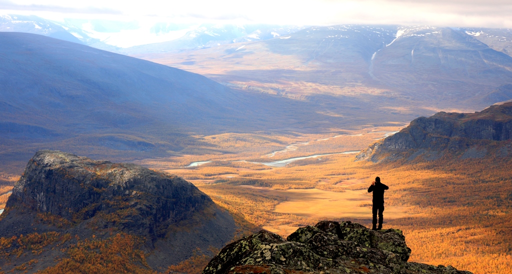
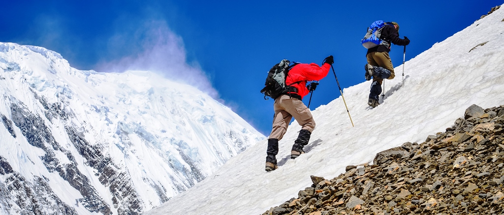
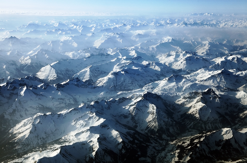
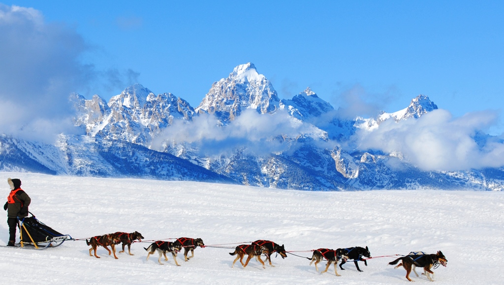
Most adventurers would tell you that hiking is the weak sibling of other hardcore outdoor adventure activities. But those who have really experienced some dangerous treks would tell you that sometimes the most serious adventure in the world simply involves putting one foot in front of the other. Here is Adventure Nation’s pick of some of the most treacherous treks in the world:

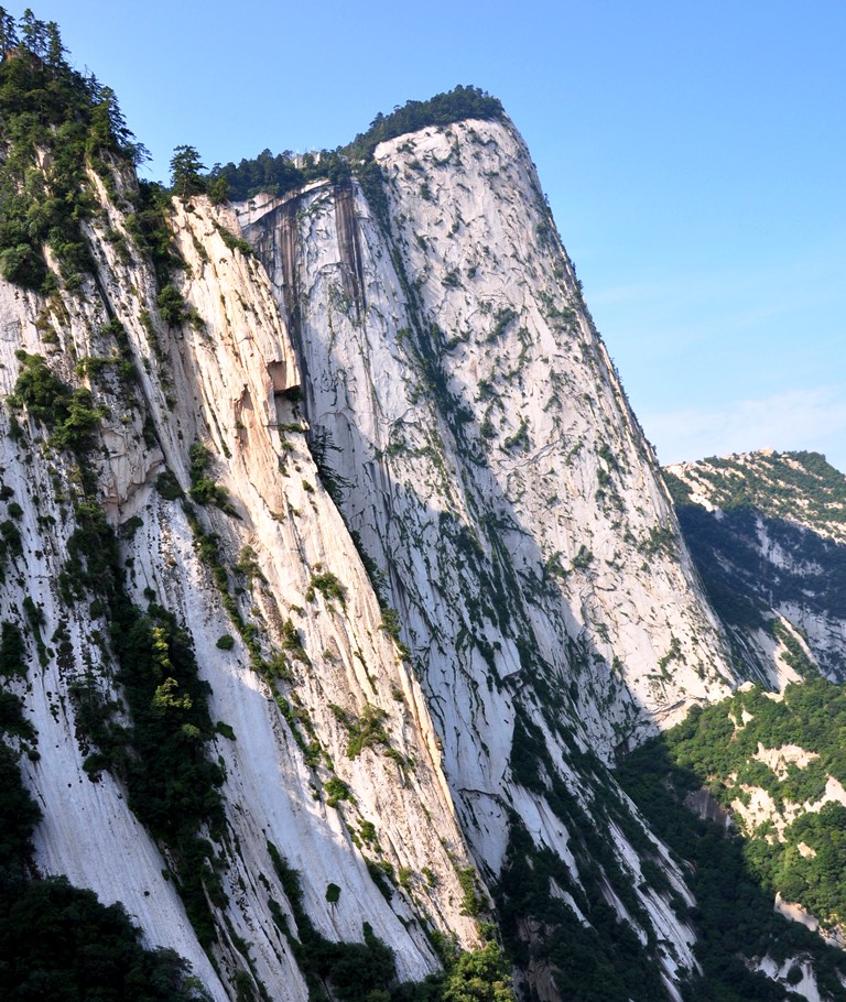
1.       Hua Shan (Mount Hua), China – Even though all the climbs here are treacherous (with nearly vertical stairways) the plank trail to the South Mountain is called the most dangerous hike in the world. It has wooden platforms secured onto the mountainside. Even getting to the trail is tough and consists of a climb up a vertical rebar staircase. At one point, the planks altogether vanish and hikers have to use small cavities carved into the rock.

Hua Shan
Hua Shan

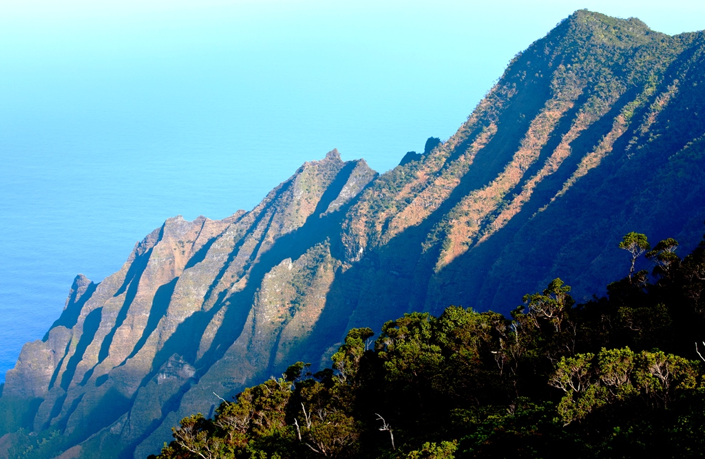
2.       Kalalau Trail, Kauai, Hawaii – At its best, the Kalalau Trail along the Na Pali Coast in Hawaii is an remote jungle with steep volcanic slopes and a pristine undeveloped beach at the end. But the 22-mile round-trip hike can turn treacherous quickly. The path’s three major stream crossings can flood during monsoon, and falling rocks, especially around waterfalls, are always a concern. More than 100 people have lost their lives while swimming on the trail’s isolated beaches, and the transient community living on the shore can be hostile.

Kalalau Valley Trail
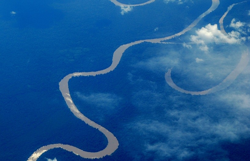
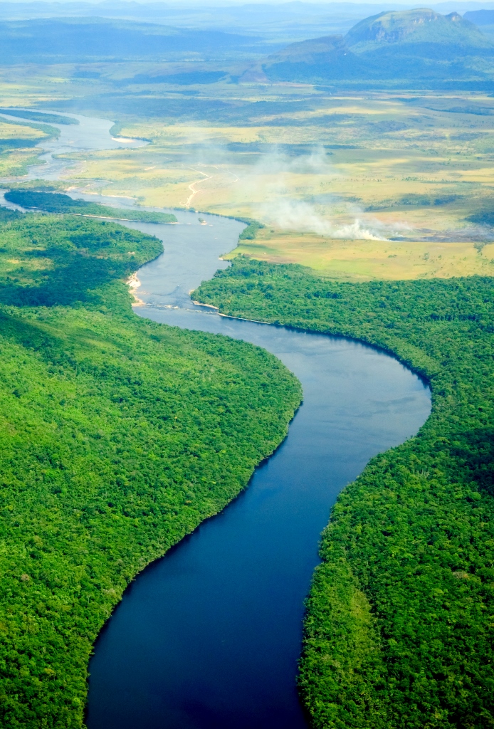
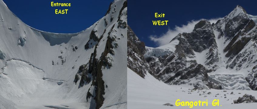
  • 3.       The Maze, Utah – About 2,000 people visit the most remote section of Canyonlands National Park per year, and not because it is not worth visiting. Known as the Maze, this red rock labyrinth is difficult to reach and almost impossible to navigate. To make it even more difficult it is full of dead-ends and always presents the danger of rock-falls or deadly flash floods.
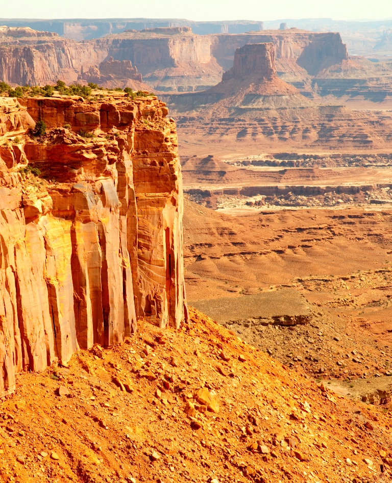
    The Maze
    The Maze

India is known worldwide for its rich history, culture and traditions. People from many countries visit India to experience a different kind of life, a life that is racy in a relaxed sort of way. It has also become a hub for many adventure sports, especially white water rafting, wildlife safaris, trekking and mountaineering in the Himalayas, amongst others. While these adventures are done for the thrill and adrenaline rush, there are a few that one does only for the experience.
Adventure Nation picks five such off beat Indian adventures for you that are not to be missed.

1.       Snorkeling with Elephant Rajan in the Andaman – There was a time when swimming and snorkeling elephants were a regular sight in the Andaman Islands but now 63 year old Rajan is the only elephant left there that swims and snorkels in the sea. He is popular all over the world and has also featured in a Hollywood film called The Fall. People arrive at Havelock Island from world over to be a part of this enriching and unique experience. Rajan, like most other elephants, loves water and swimming with him is described as a magical experience by many.  He is also a favorite subject for underwater photography.
Watch this video of Rajan swimming.

Rajan - The snorkeling elephant!
Rajan – The snorkeling elephant!
Image Credits: phototoartguy.com

2.       Road Trip to the Magnetic Hill in Ladakh – Located 27 kms from the city of Leh on the Leh-Srinagar highway, ‘Magnetic Hill’ has become a major tourist attraction. There is a signage on the roadside that asks people to park their vehicles in the box marked on the road. Once parked (engine off and in neutral), vehicles start to move uphill defying gravity. The hill is believed to have magnetic properties, so much so that it is said that aircrafts increase their altitude while flying above it. Even though scientists call it an optical illusion, it doesn’t stop the curious adventurous souls from wanting to experience it firsthand.

Magnetic Hill, Ladakh

Known as a soft adventure today, hiking is as old as humanity itself. In the past, people hiked miles and miles in search of food, shelter and new settlements. In this process many new lands were discovered and popular hiking trails established. Now we go hiking for leisure and thrill and the world is full of some wonderful hiking trails. Adventure Nation  has prepared a list of some of the most amazing ones:

  1. Inca Trail, PeruCrossed by 1000s every year, this ancient trail was laid out by the Incas. It leads up to Machu Picchu winding up and down the mountains.

    Machu Picchu in the Inca Trail
    Machu Picchu in the Inca Trail

  2. Kungsleden, Sweden – Kungsleden (the “The King’s Trail”) is a 100 miles inside the Arctic Circle. It’s a 275 – mile trail and one of the greatest wildernesses in Western Europe.

    The King’s trail, Sweden

  3. Grand Canyon Hike, Arizona– This hike offers the best natural architecture one could ever come across along with billions of years’ worth of geology.

    Grand Canyon, Arizona
    Grand Canyon, Arizona

  4. The Hot Spring Route, Iceland– From Landmannalaugar to Thorsmork in the South of Iceland, this 4 day hike has rivers, lakes, mountains and glaciers in its scope.

    Iceland
    Hot Springs, Iceland

  5. Fitz Roy Trek, Patagonia, Argentina – Fitz Roy Massif is an iconic ridge that makes for an amazing hike taking one from glaciers to forests to waterfalls!

Located in the Chitwan District in south-central Nepal, Chitwan National Park was established in 1973 and granted the status of World Heritage Site in 1984. Covering an area of 932 sq km, its altitude ranges from 330 feet to 2,674 feet.

Chitwan National Park Image Credits: johntyman.com
Chitwan National Park
Image Credits: johntyman.com

Literally translated, Chitwan means Heart of the Jungle. It was a favorite hunting ground for the royals of Nepal since the end of the 19th century. During the winter seasons, comfortable camps were set up in the area for the hunters and their entourage and hundreds of tigers, rhinos, leopards and sloth bears were hunted.

Chitwan’s forest extended beyond 2,600 sq km in the 1950s and was home to more than 800 rhinos. But the area was gradually opened for settlement and unrestrained poaching of the wildlife started. Edward Pritchard Gee surveyed the area and recommended that a protected area and wildlife sanctuary be created north and south of the Rapti River respectively.
By the end of the 1960s only 95 rhinos were left and thousands of people had settled in the area. This striking decline in the wildlife propelled the government to form the Gaida Gasti – a rhino recon patrol of 130 armed men and a network of guard posts all over the area. Following this the National Park was gazetted in 1970 with an area of 544 sq km. and enlarged to its present area in 1977.

Being a part of the central climatic zone of the Himalayas, Chitwan has a tropical monsoon climate with high humidity throughout the year.

Uttarakhand literally translates to the abode of the Gods. It is considered a paradise for trekkers, adventure buffs and nature lovers. Whether one is an experienced trekker or a first timer, there is a trek for everyone.

For all those who love the beauty and tranquility of the mountains and crave to reach new heights of adventure, here is Adventure Nation’s pick of the best Himalayan treks in Uttarakhand:

Valley of Flowers and Hemkund Sahib Trek – Duration – 06 days
The base camp for this trek is at the small village of Ghangariya which is located by the river Lakshman Ganga. The Valley of Flowers is approximately 5 kms from this village. There is also the famous Govind Ghat that got its name from the time Sikh Guru Guru Gobind Singh meditated here. A steep trek from Ghangariya leads one to the heavenly Hemkund Lake that stays frozen for almost 8 months in a year. Hemkund Sahib Gurudwara and Lakshman Temple are built on the banks of this lake. This trek is particularly popular for the variety of flowers one gets to witness in the valley.

Valley of Flowers

Valley of Flowers
Image Credits: bharatrawat641.blogspot.in

Har Ki Doon Trek  – Duration – 08 days
Considered a haven for bird watchers and nature lovers, Har Ki Doon trek gives one a great opportunity to explore the remotest parts of the Garhwal Himalayas. The base camp for this trek is Sankri which is about 37 kms from the highest camp on this trek. Har Ki Doon literally means the Valley of Lord Krishna and is surrounded by dense forests of pine, deodar and conifer. It is believed that the Pandavas camped here on their final journey.

Situated in the Western Himalayas, Kedarnath Sanctuary is located in the Chamoli and Rudraprayag districts of Uttarakhand. A part of the Himalayan Highlands, it has an elevation ranging from 3,810 ft to the Chaukhamba peak at 23,189 ft. It gets its name from the famous Kedarnath Temple that was built in the 8th century AD. It is just outside the northern border of the sanctuary.

Kedarnath Temple Image Credits: photos.wikimapia.org
Kedarnath Temple
Image Credits: photos.wikimapia.org

Covering an area as 975 sq km, it is the largest protected area in the Western Himalayas. It was formally established in 1972, primarily to protect the Himalayan musk deer and because of that it is also called the Kedarnath Musk Deer Sanctuary. It has been designated a “Habitat/Species Management Area” by the IUCN.

It is popular for its great biodiversity, picturesque snow-covered mountains, lakes, glaciers, valleys and the glistening Mandakini and Alaknanda Rivers. It’s often called one of the most beautiful sanctuaries in India. The density of the flora changes with the elevation – from sub-alpine forests to alpine shrubs, Himalayan flowers to permanent snow lines with little or no vegetation.

When the continents were joined as western Gondwana, Amazon flowed west from the interior of the present day Africa. 15 million years ago, the rise of the Andes Mountain range blocked the river and caused the Amazon to become a vast inland sea. Gradually it became a massive freshwater lake.

Amazon River
Amazon River

The Amazon River is said to have come into being as a transcontinental river approximately 11 million years ago, when the waters worked through the sandstone from the west and the Amazon began to flow eastward. It led to the emergence of Amazon rainforest. During the Ice Ages, sea levels dropped and the Amazon Lake speedily drained and became a river.

During the wet season (December – June), the Amazon River reaches over 190 kilometers in width. It is the second longest river in the World at approximately 6400 kilometers (only the Nile, in Africa, is longer). Because of its vastness, it is sometimes referred to as The River Sea. It has over 1,100 tributaries, 17 of which are over 1,500 kilometers long.

Clockwise (L-R) - Black Caiman, Giant Otter, Poison Dart Frog and Green Anaconda
Clockwise (L-R) – Black Caiman, Giant Otter, Poison Dart Frog and Green Anaconda
The mighty Himalayas

For eons India has been the home of spirituality, yoga, tradition, history and cultural diversification. People from all over the world have visited this great land for trade, knowledge, and spiritual freedom. A multitude of cultures have found their way right to the country’s heart over many centuries.

Camping at Rishikesh

In addition to being rich in history and culture, India is also a land of varied landscapes. From mountains to beaches to valleys and rivers, you can find it all here. Himalayas along with the many rivers that flow from it, dominate the topography of the north. There are also many National Parks all across the country teeming with tigers and other animals, which make for great wildlife safaris.

Himalayas attract mountaineers and adventure buffs from all over the world. It offers plenty of scope for trekking, paragliding and skiing and some serious mountaineering. River Ganges is one of the most popular rafting destinations in India. Rishikesh in the foothills of the Himalayas is the ultimate destination for rafting, kayaking, bungee jumping and zip lining.

Bungee jumping in Rishikesh

Rivers Kundalika and Kali in the west and south respectively are also popular spots for rafting. Maharashtra in the west is another adventure hub that offers rafting, rock climbing and rappelling, trekking, paragliding and hot air ballooning.

Rafting in India
Rafting in India

In addition to all this, the Thar Desert in the west is the perfect place for a desert safari  where one can experience life amidst the vast expanses of sand.

Satish Gopalkrishnan and his navigator Savera D’Souza celebrated yet another victory together when they won the 12th Maruti Suzuki Desert Storm, in a race that upended the formbook, with pre-event favourites Gaurav Gill and Suresh Rana dogged by mechanical problems and unable to complete the race. Meanwhile, India’s top biker, the formidable CS Santosh, maintained his dominance on two wheels.

Driving a Grand Vitara for Team Maruti Suzuki, the Bangalore duo topped the ‘Rally Ndure’ category. Satish, incidentally, is the software guru who is responsible for the ‘TSD Meter’, a development that has changed the face of time-speed-distance rallying in India. Trailing the champs in second place were Pratap Thakur and Dhiraj Arora, and completing the top three were Ashish Budhia and Arindam Ghosh.

The Desert Storm, an annual motorsport marathon that sees four- and two-wheelers tackle the sands of the That Desert, finished in Jaipur after negotiating some 2200km over six days. And it was dominated by the sponsor, with seven out of the nine prizes on offer going to Maruti vehicles.

In the ‘Rally Xtreme’ category, the honours went to Chandigarh’s Sunny Sidhu and his navigator PVS Murthy. Sandeep Sharma (Delhi) and Varun Davessar (Chandigarh) finished runners-up, and occupying third place was the team of Amartej Pal Buwal (Delhi) and Nakul Mendiratta. In the ‘Rally Xplore’ category, Rajesh Chalana and navigator Yogesh Gupta, driving an SX4 for Team Maruti Suzuki, finished ahead of the pack, seeing off Nitin Yadav and Ravi Bansal, driving a Mahindra Scorpio, and Sanjay Takale and Mustafa, driving an SX4 for Team Maruti Suzuki.

On two wheels, there was no stopping CS Santosh of Bangalore, who retained his title in a Suzuki RMX 450. Ranked second in the ‘Rally Moto’ category was Austrian stalwart Helmut Frauwallner, driving a Yamaha WR450F, while third place went to Suresh Babu, who was driving a Suzuki RMS 450Z.

For centuries Rishikesh  has been the undisputed Yoga capital of the world and people from all over the world seeking spirituality have found their way to this ancient and holy town. It is located in the northern part of the Indian State of Uttrakhand, on the banks of the Ganges River and is surrounded by hills on 3 sides. People flock here for practicing meditation, learning the techniques of Yoga and sometimes just for the peace of mind that it offers.

Rishikesh - Where Gods reside!
Rishikesh – Where Gods reside!

The Beatles made it even more popular in the 1960s when they stayed at the ashram of Maharishi Mahesh Yogi. It is also home to the 120 year old Kailash Ashram Brahmavidyapeetha, an institution that has been dedicated to promoting and conserving the traditional Vedic studies and had the likes of Swami Vivekananda has one of the students. There are many more Ashrams in Rishikesh where the traditional “Guru-Shishya Parampara ” is being followed.

Students of one of the Ashrams praying at the banks of the Ganges

In the last 10-15 years, Rishikesh has also earned another name, that of being the Rafting Capital! The shores are lined with camps that make for a great retreat and offer a host of activities for the adventure seekers. It has become an extremely popular spot for white water rafting and on a must visit list of most adventure buffs. Ganges River offers medium to rough rapids, rated class 3 and class 4.

One of our adventure enthusiasts, Jagdish Kumar Lohar, working as a Teacher in Central School in Jodhpur (Air Force area), Rajasthan, took an extraordinary trip – one that spells grit and passion.

He completed an 1800 km “Inspiriting Tour” from Jodhpur to Srinagar via Sonamarg Zojila Pass. He organized it all on his own and did it solely for the motivation of “People with Special Needs”, residing in northern India. The trip started on June 8, 2013 and concluded on June 19, 2013. This journey was completed on a single tri-scooter (RJ24 M 5147) and Mr. Lohar was accompanied by Mr. Laxman Kumar who was an assistant as well as a pillion rider (Mr. Kumar is differently abled).

They made their way through Bikaner, Shri Ganga Nagar, Amritsar and Udhampur. Between Udhampur and Srinagar, he continuously drove for 14 hours (4 AM to 8 PM), only taking 2 hours’ break in between for food!

There is a special driving license number issued for him, which is RJ-19/DLC/2002/99256 Dt. 6-8-2002.

Adventure Nation salutes this spirit of true adventure and compassion.
See the images below:

On the way to Sonamarg
Touching new heights!
Passionate riders!

What it means – A Via Ferrata or Iron Way or Iron Roads is a fixed protection climbing path or route found primarily in the Alps. The term originates from the Dolomites mountain range in Northern Italy.  Its core is a steel cable that runs along the path and is sporadically fixed to the rock. Climbers secure themselves to the cable and also use the cable as a climbing aid. Other climbing aids include pegs, carved steps, iron rungs and sometimes bridges and ladders. It makes an otherwise unsafe route relatively easy. Even those with very less or no climbing experience get the chance to reach places otherwise only accessible to avid mountaineers. All you need is some basic equipment and technique coupled with the will to do it!

Climbing with the help of iron rungs.

Origin and History – Simple paths with basic protection aids and ladders have been there in the Alps for centuries. These paths helped the natives connect to the high pastures. These constructions date back to the early nineteenth century, during the time of the early Alpine exploration, and can be considered as a harbinger to the modern day Via Ferrata. Via Ferratas are also strongly linked to the First World War when, to assist the movements of the troops, many of them were constructed by the Italian Army on the Dolomite Mountain range in northern Italy. This was primarily to access difficult peaks and to also carry heavy equipment.

Development – Via Ferrata is a new adventure activity and is often tried by people looking for something slightly more challenging than the routine alpine hiking and climbing. Many new paths have been developed over the years, especially recently and their tourism benefits recognized. They have gained popularity amongst serious climbers and amateurs alike. Traditionally associated with the limestone mountain regions in Italy, Via Ferratas have found their way to other mountain ranges outside Europe too. There are more than 1000 Via Ferratas in the world today, majority in the Alps.

Via Ferrata - Dolomites
Via Ferrata – Dolomites

Safety and Equipment – Via Ferratas were primarily climbed using basic equipment like carabiners or slings attached to a rope or harness. However it was soon realized that these did not provide much safety or prevent serious injury. To resolve this, many devices have been developed that act as shock absorbers. These are aimed at dispelling energy of the fall efficaciously, keeping the climber safe. A Via Ferrata set contains a lanyard and two carabiners. The lanyard comprises of an energy absorbing system, two arms that connect to the cable and a way of connecting to the harness, forming a “Y”. It’s called a Y tape configuration and is the only type to be approved by the UIAA. It is safe and simple.

One of our Adventure Nation Gurus, Amit Chowdhury is an esteemed member of the UIAA.

Adventure Nation Guru Amit Chowdhury with the other UIAA members at Chamonix, France
Adventure Nation Guru Amit Chowdhury (Sitting – extreme left) with the other UIAA members at Chamonix, France

Grading and Types – Via Ferratas vary in length and difficulty levels, from under one hour short tours to long and demanding alpine routes at high altitudes that can take 8-10 hours to finish! These routes can sometimes be just simple paths in spectacular surroundings to very steep and dangerous treks. These definitely require the strength, if not the technique, of serious rock climbing. There are numerous grading systems that exist today and most focus on the difficulty level of the toughest passage, using a 5 or 6 point scale. The Kurt Schall guides use an A to E 5 point scale.

Alps Mountain range is one of the most popular in the world. It attracts millions of tourists every year from all over the world. Here are some interesting facts about the Alps:

  1. The formation of the Alps  started some 300 million years ago. It was a process spread between various episodes from the Paleozoic Era to the Mesozoic Era to the Jurassic Period. From a single tectonic plate, the Pangaean supercontinent broke into many plates, thus forming the Tethys Sea between Laurasia and Gondwana. Mountain ranges called the Alpide belt were formed when the Tethys was squeezed between the colliding plates – a process that continues till now. This orogenic process led to the formation of the Alps, caused by the collision between the Eurasian and the African plates.

    Aerial View of the Swiss Alps
    Aerial View of the Swiss Alps

  2. Covering eight counties, the Alps are located in Middle-Southern Europe and cover a distance of 1,200 km. This crescent shaped mountain range is majorly divided into Western Alps and Eastern Alps. The division is along the line from Lake Constance through the Rhine to Lake Como. The Western Alps are located in Italy, France, Monaco and Switzerland, the Eastern Alps in Austria, Germany, Italy, Liechtenstein, Slovenia and Switzerland.
  3. Alps have been extremely important from a historical point of view. Even before antiquity, countless numbers of armies crossed the Alps, including Caesar and other Roman leaders during the expansion of the Roman Empire. In the Middle Ages, post the fall of the Roman Empire, barbarian hordes looking for a new settlement migrated through the Alps.

    Famous Mount Jungfrau in the Swiss Alps
    Famous Mount Jungfrau in the Swiss Alps

  4. In 1991, a mummified man nick-named Otzi the Iceman was found at the Austrian/Italian border in the Alps. It is said to be 5,000 years old. In the Drachloch cave above the village of Vattis in the canton of St. Gallen, radiocarbon dated charcoal placed around 50,000 years ago was found. It proved that the high peaks in the Alps were visited by prehistoric people.

“I have no fear of losing my life – if I have to save a koala or a crocodile or a kangaroo or a snake, mate, I will save it.” – Steve Irwin

Steve Irwin
Steve Irwin

Born on 22nd February, 1962 to nature lovers and animal naturalists, Lyn and Bob Irwin, Steve Irwin spent his entire life living and working for and with animals. While growing up on the Queensland Reptile and Fauna Park, his father taught him about reptiles, and also guided him on caring for animals, feeding them and getting to understand them better. So it wasn’t really a surprise when at the age of 9, Steve began handling crocodiles.

Watch this video to see how Steve worked with the crocs!

He soon became an expert on reptiles and associated himself with the Queensland government in the country’s Crocodile Relocation Program. Steve became established as one of the most successful participants in this government -sponsored program, safely catching and relocating dozens of crocs in the most humane (and non-tranquilizing) manner.

Crikey! What a beauty! Image Credits: en.wikipedia.org
Crikey! What a beauty!
Image Credits: en.wikipedia.org
  1. Experts state that around 50 million years ago, a head-on collision between two tectonic plates led to the formation of the Andes. These were the Nazca and the Antarctic plates that were undergoing subduction beneath the South American plate. This process has continued to this date and causes earthquakes and volcanic activity in the region.

    Aerial View of the Andes
    Aerial View of the Andes

  2. The Andes Mountains have been inhabited for centuries. One of the most recognizable civilizations from the past is the ancient Inca Empire. Inca engineers built massive and impressive sites, including Machu Picchu and the capital city of Cuzco. They also constructed roads and conduits throughout the mountain. Inca Empire, also known as Tawantinsuyu in the Quechua language, covered the entire length of the Andean range from Colombia to central Chile to northwestern Argentina.

    The ancient city of Machu Picchu
    The ancient city of Machu Picchu

  3. The name “Andes” is believed to have come from the Quechua word “Anta”, meaning copper or “Anti”, which means “East Cardinal Point”.
  4. The Andes Mountain range at 4,500 miles is the longest mountain range on the Earth. It is located around the entire western coast of South America  and covers a surface of 800,000 square miles. It is divided into three sections – Southern (Argentina and Chile), Central (Chilean and Peruvian cordilleras and parts of Bolivia) and Northern (Venezuela, Colombia and Northern Ecuador).
    Snow Mountain, Peru
    Snow Mountain, Peru

Born on February 14th, 1898, Major Harold William “Bill” Tilman was an English explorer, mountaineer and one of the finest travel writers of the last century. He is known for his many climbing and sailing expeditions.

Tilman fought in both the World Wars and was awarded the Military Cross for bravery twice and Distinguished Service Order in World War I and II respectively. The latter was awarded for having fought behind the enemy lines in the Balkans.

Bill Tilman Image Credits: www.grin.com
Bill Tilman
Image Credits: www.grin.com

He was the true embodiment of the spirit of adventure. As he grew older, his zest for adventures became stronger. He has often been referred to as the conceiver of the stylish lightweight approach to mountaineering. It is said that Tilman was ahead of his time, he pioneered ecologically sound principles of adventure and exploration. He was one of those rare people who considered the journey itself as the adventure!

Even though he suffered from altitude sickness all his life, he either summited or attempted to summit the highest peaks known to man. He was a part of the two of the Mount Everest  expeditions in the 30s. He participated in the Reconnaissance Expedition (to Everest) as the expedition leader, and reached 27,000 feet without oxygen. Along with his team that included Peter Lloyd, H. Adams Carter and Eric Shipton, he successfully made the ascent to Nanda Devi Sanctuary  in 1936 and that remained to be the highest summit climbed by man until 1950. It was during this ascent that they discovered a new passage to this summit. More information about this can be found here .

1. Ogden, Utah

Ogden lies only 40 miles north of Salt Lake City’s International airport and its two primary mountains – Snowbasin and Powder Mountain. Spread across the lower flanks of the popular Wasatch Range, Ogden has recently become a key Mountain hub for the outdoor industry. Head 30 minutes into the Wasatch for your choice of skiing styles on two sprawling mountains. Snowbasin underwent major renovation for the 2002 Winter Olympics and has elegant base lodges with state of the art lifts, including a tram and two gondolas. It boasts expert terrain rivaling anything in Utah. Powder Mountain is a throwback hill with simple lodges and non-high-speed chairlifts. Both areas are shockingly very less crowded.

Winter morning on Mount Ogden in the Wasatch Mountains

2. Reno, Nevada

Before its reinvention as an outdoorsy city filled with university students and skiers, Reno was a gambling mecca in the 20th century. Reno sits at the northern end of Lake Tahoe that has the thickest concentration of ski resorts in North America. Within 100 miles of Reno’s international airport, 18 resorts are located. At a 20-minute drive from the downtown there is Mount Rose. While it might not be the biggest ski area around, it is definitely economical and offers an excellent beginner program. In addition to that, it has the highest base elevation in the Tahoe region (8,260 ft.) that helps escape the rains that can spoil the area’s snow pack. Hundreds of millions of dollars have been put in to revamp the city and that has resulted in the sprouting of many cafes and galleries.

Nevada mountains near Reno, Nevada
Nevada mountains near Reno, Nevada 

Adventure Nation is thrilled to share with you all that our Mountaineering Guru Debabrata Mukherjee along with his team, has recently been chosen to be awarded with the prestigious Himalayan Club Award for excellence in Mountaineering for the best Indian Himalayan Expedition – 2013. This is for opening a new route to the Himalayas during the historical exploration from Badrinath to Gangotri over Chaukhamba col.

Read all about this great adventure here.

Here are some glimpses from this historic expedition (All image credits – https://www.facebook.com/indiaguide):

1

2

3

4

  1. Land of the Bear – The name Arctic comes from the word ‘Arktikos’, which is Greek for ‘bear’. This is because the Great Bear constellation (Ursa Major) is seen in the northern sky. It is a polar region located in the northernmost part of the Earth.
    Recommended reading by Adventure Nation.

    Fish-eye lens view of sea ice off the coast of Spitsbergen (Svalbard Islands)
    Fish-eye lens view of sea ice off the coast of Spitsbergen (Svalbard Islands)      

  2. Midnight Sun – Most of the Arctic and the North Pole has almost six months of light each year, beginning around April. In the summer there is almost 24 hours of sunlight and it is exactly the opposite in the winter. The phenomenon is called Midnight Sun and occurs around the solstice (June 20-22). The number of days with a likely Midnight Sun increase the farther you go towards the pole. Similarly there are Polar nights in winters.
    Watch this fascinating short time lapse film shot in the month of June to give you an idea about how days look like in the Arctic in peak summers.

    Sun atop icebergs in Iceland

  3. Freezing Cold – Arctic’s climate is marked by cold summers and even colder winters. Eight countries extend into the Arctic: Greenland, Iceland, Norway, Sweden, Finland, Russia, Canada and the USA (Alaska). The coldest temperature recorded in the Arctic is around -68°C in Siberia. Norilsk, Russia (located in the Arctic) is the most northern city in the world with an average temperature of 20 degrees below 0.
    Siberian Huskies
    Siberian Huskies

Born on February 9, 1865, in Königsberg, Kingdom of PrussiaErich Von Drygalski was a German geophysicist, geographer and polar scientist and an Arctic veteran.

Erich Von Drygalski Image Credits: en.wikipedia.org
Erich Von Drygalski
Image Credits: en.wikipedia.org

At the end of the 19th century, when many countries and avid explorers in Western Europe were resolute to head south to the Antarctic, the German South Polar Commission also suggested a national expedition to Antarctica. For his experience in the field of geophysics and geography at the University of Berlin, Drygalski was chosen to be a part of the expedition along with 31 others (22 crew members, 5 naval officers, 5 scientists).

This was the first German expedition to the Antarctic, led by Drygalski in the ship Gauss.

The entire team aborad Gauss Image Credits: coolantarctica.com
The entire team aboard Gauss
Image Credits: coolantarctica.com

The Gauss Expedition started from Kiel (Northern Germany) on August 11, 1901 and reached Kerguelen Islands in the Southern Indian Ocean on January 2, 1902. After some very difficult navigation through the Ocean, the crew first sighted land on February 21 1902. But as luck would have it, later that day their ship was trapped while trying to enter a gap between two ice ridges.